Labels

Aberdeenshire (21) Angus (4) antiquities (87) Argyll and Bute (35) Arran (7) art (37) birds (231) bridge (9) Caithness (12) Carmarthenshire (5) castle (165) Ceredigion (9) Channel Islands (13) Cheshire West and Cheshire (1) City and County of Swansea (1) City of Bristol (2) City of Edinburgh (4) Conwy (8) Cornwall (74) County Antrim (19) County Down (23) County Durham (3) County Londonderry (4) Cumbria (19) Denbighshire (2) Devon (48) diving (7) Dorset (18) Dumfries and Galloway (22) Dundee City (2) East Lothian (6) East Sussex (16) East Yorkshire (6) English Riviera (3) Essex (17) Fife (19) Flintshire (1) food (13) fossils (14) gardens (28) Ghosts (35) Glamorgan (1) Gower (7) Guernsey (4) Gwent (1) Gwynedd (19) Hampshire (13) Highland (72) Inner Hebrides (42) Inverclyde (5) Islay (8) Isle of Anglesey (14) Isle Of Man (7) Isle Of Wight (10) Isles of Scilly (3) Jersey (7) Kent (22) Lancashire (8) Lewis and Harris (7) lighthouse (62) Lincolnshire (8) Merseyside (8) Mid Glamorgan (1) mining (23) Moray (10) Mull (8) Norfolk (21) North Ayrshire (13) North Yorkshire (12) Northern Ireland (45) Northumberland (17) Orkney (10) Outer Hebrides (14) Pembrokeshire (27) pubs (47) Ross and Cromarty (20) Scotland (300) Scottish Borders (3) Shetland (14) shipwrecks (42) Skye (12) smuggling (48) Somerset (9) South Ayrshire (6) South Glamorgan (5) South Gloucestershire (1) Suffolk (18) surfing (83) Sutherland (16) Tyne and Wear (10) Wales (93) wartime (75) webcams (232) West Dunbartonshire (3) West Glamorgan (9) West Sussex (9)

Monday 31 October 2011

ABERLADY

Moving along the south shore of the Firth of Forth from North Berwick, we pass the village of Dirleton; nearby is the Yellowcraig nature trail which offers views across to Fidra, an island with a puffin colony. A few miles further on, the village of Gullane has no less than five golf courses, one of which, Muirfield, has hosted several Open championships.

Aberlady once served as the seaport for the nearby inland town of Haddington. One reminder of this time is the 17th-century custom house. The parish church has a stone outside known as a “loupin’-on” stone”, which allowed riders to mount their horses more easily. Aberlady Bay is a nature reserve visited by opsreys and Montagu’s harriers among other birds. Between Aberlady and Longniddry is the impressive 19th century Gosford House, completed in 1891, which is used for events and has its own golf course.

Map of the area.

Aberlady Beach 2019 02 (48379348471). Photo by Ian Robertson, via Wikimedia Commons.


Sunday 30 October 2011

GHOSTS OF THE COAST

The British coast has been the scene of so many dramatic events over the centuries, many involving murder and mayhem, that it is not surprising that there are many ghost stories associated with our coast. On the occasion of Halloween, here is a selection of the best coastal ghost stories.

Old inns on the coast are a particularly rich source of ghost sightings. The Dolphin Inn in Penzance is frequented by an old salty seadog called George. George has been heard tramping around the inn, his heavy footsteps quite out of keeping with the present-day carpeted surfaces. Another story describes a fair-haired figure appearing at the foot of a bed in the inn.

The smuggling activities which took place around the British coast in the past are another source of hauntings. In Weybourne, Norfolk, there is a mysterious whistling sound which can be heard at dusk on nights when the full moon is due. One person who witnessed this phenomenon thought they could make out the outline of a man standing on the shore. Legend has it that this was the ghost of John Smythe, a smuggler who operated many years earlier.

The erosion which is a feature of huge swathes of our coast has led to whole communities being swallowed up by the sea. One of the most famous of these is Dunwich, a former major seaport which was washed away by the sea in the 14th century. Submerged church bells are still heard to this day, warning of coming storms, while shadowy figures, thought to be the ghosts of former inhabitants, are sometimes seen on the clilff tops.

Many apparitions stem from people who have been put to death for a misdemeanour. For example, on stormy winter nights in Gosport, clanking sounds can be made out on Blockhouse Point. These are thought to come from the chains of Jack the Painter who was hanged for starting a fire in the harbour ropehouse in 1776. In Meeting House Lane in Brighton, the ghost of a monk who was walled up alive for running away with a local girl is often seen disappearing through a bricked-up doorway next to the Friends’ Meeting House.

Other supernatural phenomena have come about as a result of the dark arts which were practised in the past. In Reculver on stormy nights babies’ cries can be heard. In the 1960s a number of babies’ skeletons were unearthed by archaeologists, the theory being that they were buried alive during sacrifices.

Castles are always a reliable source of ghostly activity given the often violent history associated with them. At Skipness Castle at the mouth of Loch Fyne the ghost of a “gruach” – a small long-haired spirit – also known as the Green Lady – is said to have defended inhabitants of the castle when danger loomed. At Flamborough, the ghost of a headless woman known as the “White Lady” haunts Danes’ Dyke earthwork west of the village. At Margam Castle, near Port Talbot, the very angry ghost of a gamekeeper called Robert Scott is seen climbing the steps of the house, or on the Gothic staircase inside. Doors are slammed and objects are thrown. Scott is said to have died at the hands of a poacher. There have also been reports of laughing children and the sound of footsteps in the building.

These are just some of the many ghost stories associated with the British coast and its fascinating past. So on this Halloween, mind your backs, but don’t shy away from discovering our incredible coastline!

'Halloween' photo (c) 2005, Miala - license: http://creativecommons.org/licenses/by-sa/2.0/

Saturday 29 October 2011

NORTH BERWICK

On the shore opposite Bass Rock lie the clifftop ruins of the 14th century Tantallon Castle, once the seat of the Douglas Earls of Angus, which offers views down to the sea below which would cause those with a fear of heights to run screaming, as well as a magnificent view of Bass Rock. Anyone planning to visit on Halloween should beware: a couple of years ago it was reported that a photograph was taken at the castle which was deemed to be the world’s most convincing ghost snap. The photograph of a group of family members revealed another figure in the background dressed in Tudor garb.

Further round the coast, at the entrance to the Firth of Forth, is the town of North Berwick. The tiny harbour here is reached through narrow streets and adjacent to the harbour wall is the 12-century Auld Kirk. The Auld Kirk is believed to have had a Christian settlement in the 7th century, and in 1999 archaeological investigations revealed a burnt circle and Roman coins. In 1590 the Auld Kirk was the scene of the North Berwick Witch Trials in which a number of people from East Lothian were accused of witchcraft, including Francis Stewart, 5th Earl of Bothwell. The confessions of the accused were extracted by torture. Auld Kirk Green was the scene of covens held by the “witches”. Nowadays, North Berwick is the Headquarters of the Scottish Seabird Centre, which offers a range of activities, including boat trips out to Bass Rock (see previous post). The Center was the recipient of the Queen’s Award for Enterprise in 2009. The John Muir Way (see Dunbar post) passes through the town.  In an area known as Lodge Grounds is a Holy Well known as St Andrew's Well.

Live streaming webcam view of North Berwick East Beach.

Map of the area.

North Berwick Bay - Looking east towards the harbour - geograph.org.uk - 1897917. Photo by Richard West, via Wikimedia Commons.


BASS ROCK

When I started this blog I made a conscious decision not to include any uninhabited islands - I had enough to be going on with with the inhabited ones! However, I have decided to make an exception in the case of Bass Rock, because it is of such significance for its amazing bird population that it would be a crime to leave it out. In actual fact, Bass Rock has not always been uninhabited. A Lindisfarne monk called Baldred who was sent to convert the heathen Lothians to Christianity in the 8th century used the island as a retreat for prayer and meditation. There is a chapel on the Rock dedicated to him. Later, in the 15th century, a castle was built which was where James, later to become James I, was sent to wait for a vessel to transport him to France. James later used the rock as a place of incarceration for his political enemies. Later still, Mary Queen of Scots had a garrison of 100 men stationed on the rock.

The people who occupied this rock at various times in history would have needed earplugs during the nesting season. There are 80,000 occupied nest sites on the island. The island is best known for its gannet population, in fact the ornithologists who came to study the birds in the 19th century bestowed the gannets with the scientific name Sula Bassana, the Latin version of the rock’s name. Another statistic to conjure with: Bass Rock holds 10% of the population of North Atlantic Gannets. Such is the significance of the Rock that David Attenborough, no less, described it as “one of the wildlife wonders of the world”. You would think that with all these gannets there would be no room for any other birds on this little island, but the gannets share their space with a number of other species, including puffins, guillemots and eider ducks. The Scottish Sea Bird Centre in North Berwick offers boat trips out to the Rock, including some with the possiblity of landing there. The Seabird Centre also has some webcams on its website for those wanting to get up close and personal with the birds from the comfort of their living room.

BassRockNB. Photo by Honge, via Wikimedia Commons.


Thursday 27 October 2011

DUNBAR

Heading north from St Abbs, a group of skeletal remains on a mound of rock are all that remain of Fast Castle, which dates back at least to the 14th century. The castle is believed to have been the inspiration for Sir Walter Scott’s “Wolf’s Crag”, from his novel “The Bride of Lammermoor”. A bit further along the coast are the red cliffs of Pease Bay and the neighbouring fishing village of Cove, where a tunnel was cut through the cliffs to give local fishermen access to a now-disused curing house.

One would like to think that it was a childhood spent surrounded by the natural splendour of Scotland which led to John Muir becoming a champion of wilderness preservation in America. Muir was born in Dunbar but his family emigrated to the United States in 1849. Muir became a nature writer and activist, playing a big part in efforts to save such iconic American wilderness areas as Yosemite and Sequoia National Parks. Today, his connection to this South-East corner of Scotland lives on in the John Muir Way, a 45-mile path from Musselburgh near Edinburgh to Dunglass. There is also the John Muir Country Park which includes 8 miles of beaches and other varied habitats frequented by a variety of birdlife. Muir’s birthplace in Dunbar is now a museum.

Dunbar is a former Royal Burgh – a Scottish town granted a royal charter. Its relative proximity to Edinburgh makes it a popular dormitory town for people working in the Scottish capital. It was inhabited as far back as the Iron Age, and there are exhibits dating from this time on display in the 17th century Town House. Dunbar’s Victoria Harbour was built in the 1840s, but the castle which forms part of it was built in the 13th century. The castle was once occupied by Mary Queen of Scots, who fled here when heavily pregnant with the future James VI of Scotland following a murder instigated by her husband. The following year, she was brought back here by the Earl of Bothwell when he abducted her on her way back from visiting her son at Stirling.

For a list of events in Dunbar see here.

Live streaming webcam view from Dunbar Golf Club.

Map of the area.

Looking Along The Massive Harbour Wall at Victoria Harbour, Dunbar - geograph.org.uk - 1957431. Photo by Richard West, via Wikimedia Commons.


Wednesday 26 October 2011

ST ABBS

During our last holiday in Northumberland, on a glorious sunny June day, we nipped over the border to St Abbs, where we parked at the Visitor Centre just outside the village and set off over the clifftops on a short but exhilarating walk to St Abbs Head. The nature reserve here is exceptionally well-endowed with nesting seabirds such as kittiwakes, guillemots and puffins as well as a variety of flora and fauna. The reserve contains a loch called Mire Loch, formed from a geological fault, which is frequented by swans, tufted ducks and grebes. There is a voluntary marine reserve here which runs educational activities and rock-pool rambles. Last month there were reports of a basking shark off St Abbs Head, and another sighting at the entrance to St Abbs harbour.

Back in the village, which is named after a Northumbrian princess called Ebba, a busy fishing port awaits, with the promise of fresh crab rolls. The village is used as a base for divers wanting to explore the voluntary marine reserve, while just around the corner is the sandy beach at Coldingham Bay, which is popular with surfers. There is a surf shop here with a webcam which can be viewed from its website for those wanting to check out the conditions.

Map of the area.

St Abbs Head from St Abbs. Photo by Mick Knapton, via Wikimedia Commons.


Tuesday 25 October 2011

EYEMOUTH

In my last post about Burnmouth, I described the tragic events of 1881 when large numbers of fishermen were lost to a sudden, furious storm. Eyemouth lost a large proportion of the 189 men and boys who died on that October day, which has come to be known as Black Friday. To this day the fleet refrains from sailing on a Friday as a mark of respect for the victims. The local museum, which tells the port’s history since the 13th century, displays a tapestry commemorating the tragedy. Today, Eyemouth celebrates its still thriving fishing trade every July with the Herring Queen ceremony, in which the newly crowned queen is escorted by the fleet from St Abbs to Eyemouth.

Another ‘industry’ for which Eyemouth was renowned in the past was the smuggling trade. As the closest Scottish port to the continent, Eyemouth was particularly prized by smugglers. There were secret passages and concealed storage areas all over town, but the Headquarters of the illicit activities was the 18th century Gunsgreen House, which still dominates the harbour. Smugglers made use of the roof of the house to hide their ill-gotten gains as well as spaces hidden behind the walls, and even a space behind a fireplace that swung open. Nowadays, the house, which was designed by James, younger brother of the architect Robert Adam, and built by a local merchant and smuggler called John Nisbet, is open to visitors wanting to discover more about the town’s smuggling past. It also has a holiday rental apartment sleeping up to eleven guests. On the other side of Eye Water, from where the town gets its name, is the Eyemouth Golf Club.

Map of the area.

Yachts Eyemouth Harbour. Photo by Peter Nisbet, via Wikimedia Commons.


Monday 24 October 2011

BURNMOUTH

Burnmouth seems to have had more than its share of calamities brought about by extreme weather over the years. A quick glance at the news archives for this little community just inside the Scottish side of the border reveals a range of weather-related dramas. In 1958 a landslide on the coast road of the village caused by heavy rains loosening the soil caused several families to be cut off from the rest of the village. In 2003 days of pouring rain resulted in a boulder being dislodged from the top of a hill, bringing it crashing down on a retired sea captain’s car. In 2005 a lorry was blown over on the A1 near Burnmouth, killing the driver of a car which was crushed by the vehicle. But the most heartbreaking story of tragedy brought about by the elements occurred back in 1881, when Burnmouth was one of several coastal settlements in the area which lost large numbers of their fishermen at the hands of a ferocious storm which blew up too rapidly for the men to get back to safety. 24 men from Burnmouth were killed in the storm, including three from one family.

The name of the village comes from the “burn” or brook which cuts through the cliffs here. There are two main parts to the village, Upper Burnmouth at the top of the cliffs, where the East Coast Main Line runs along the clifftop, and Lower Burnmouth at the bottom of the cliffs. The two communities are linked by the “Brae”, a road which climbs the cliff from the lower to the upper village, and every year in May a cycle race is held called the “Brae Race”, the course of the race consisting of this steep road.

Map of the area.

Burnmouth Bay - geograph.org.uk - 1002111. Photo by Walter Baxter, via Wikimedia Commons.


Sunday 23 October 2011

BERWICK-UPON-TWEED

It poured with rain the day we visited Berwick-Upon-Tweed, but it didn’t stop us from walking the walls around this border town with its Georgian streets and Elizabethan fortifications, said to be the most complete to be found anywhere. The walk offers some great views over the surrounding area.  The Bell Tower, alongside the wall, was built in Elizabethan times, and is octagonal in shape set over 4 storeys.  Any town which has exchanged hands between Scotland and England no less than thirteen times is bound to have a turbulent history. It was during medieval times that most of this “pass the parcel” activity took place. The Tweed seems to form a natural border between the two countries, but most of modern-day Berwick actually lies north of the river. There are three bridges spanning the Tweed: the pink stone Jacobean Bridge dating from 1611, the Royal Border Bridge dating from 1847 and the Royal Tweed Bridge from 1925.

One man who was no stranger to the charms of the town was L. S. Lowry, who visited many times during the mid-20th century. There is a Lowry Trail which guides the visitor around the parts of the town which came to the artist’s attention, which include the south bank locations of Tweedmouth and Spittal. Berwick Barracks, dating from the 18th century, include the regimental museum of the King’s Own Scottish Borderers as well as the town’s museum and art gallery. One of the mainstays of the local economy used to be shipbuilding, but the shipyard closed in 1979. However, the memory of the shipbuilding days is kept alive in a website devoted to the industry.

Map of the area.

Berwick-Upon-Tweed. Photo by Shermozle, via Wikimedia Commons.


Friday 21 October 2011

HOLY ISLAND

Visitors heading in a northerly direction up the coast of Northumberland from Seahouses and Bamburgh, via the nature reserves of Budle Bay and Ross Back Sands, part of the Lindisfarne National Nature Reserve, will be treated to the beguiling sight of Holy Island topped with Lindisfarne Castle growing ever larger in their field of vision. Visits to the island have to be carefully timed, as it is accessible only by a causeway and only at low tide. The castle, a Tudor fort built in 1550, sits so naturally on its cone of rock that it almost seems an extension of the rock itself. The famous architect Edwin Lutyens restored the original ruined castle in 1902, converting it into a private house. The property is now run by the National Trust.

Down below lie the red sandstone ruins of Lindisfarne Priory, run by English Heritage. There was originally a monastery founded by the monk Aidan, but this was destroyed by the Danes in the 9th century. The British Library houses a relic from this time: the Lindisfarne Gospels, a magnificent example of English Celtic art. Work on the Priory began in 1093. There is a little village on the island with a cluster of cottages, a handful of shops and a couple of pubs. So all in all it is worth braving the causeway to come over here as there is plenty to see and it makes a fascinating day out.

Live streaming webcam view of the castle.   

Map of the area.

Hrad Lindisfarne - panoramio. Photo by Martin Cigler, via Wikimedia Commons.


Thursday 20 October 2011

BAMBURGH

On a wild, stormy night in 1838 a paddle steamer called SS Forfarshire was making its way from Hull to Dundee when it struck rocks off the Farne Islands, killing all but a handful of survivors who were forced to spend the night clinging desperately to rocks. As dawn broke, a local lighthouse keeper went to their aid using just a rowing boat and succeeded in getting all of them on board. But it was his 23-year-old daughter who really saved the day by steadying the boat and keeping it from dashing onto the rocks in the awful weather while her father tended to the survivors. Her name was Grace Darling, and she became a heroine as a result of her part in the rescue. Tragically, she died just three years later from tuberculosis, but her memory lives on thanks to her elaborate shrine-like tomb which can be found in the churchyard of St Aidan’s in Bamburgh. Opposite the church is the Grace Darling Museum, which includes the original rescue craft used by Grace and her father.

Walking around the village of Bamburgh, with its old stone cottages and pubs flanked by an expanse of green, it seems strangely detached from the nearby sea. The reason for this is the mighty Bamburgh Castle, which towers over everything, separating the village from its lovely sandy beach. The castle can be seen from miles around, in fact the first time I saw it, years ago, was when we were hurtling along the A1 towards Edinburgh. We were in a hurry to get to our destination, but I vowed that one day I would come back to see this amazing sight close up. The castle keep dates from the 12th century and was built by the Normans, but much of the present castle is relatively modern, having been renovated from the late 19th century by Lord Armstrong the inventor. Much further back in time, King Oswald of Northumbria made Bamburgh his capital. The village church is dedicated to St Aidan, who died at Bamburgh in AD651.

Map of the area.

Bamburgh MMB 39 Bamburgh Castle. Photo by mattbuck, via Wikimedia Commons.


Wednesday 19 October 2011

THE FARNE ISLANDS

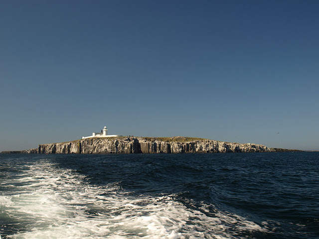
I have visited the Farne Islands twice: once in April and once in June. Early summer is an exciting time to visit the Farne Islands, a short distance offshore from Seahouses. What makes it so exciting? Pods of dolphins leaping out of the sea? Whales rearing up and spouting so close to the shore that you can feel their droplets on your face? Well no, although dolphins have been seen here, and on one occasion a humpback whale was spotted to great excitement. What makes June so exciting is the arctic tern. What, I hear you cry, the arctic tern? Yes, that’s right. You see, this is the time of year when these feisty little birds are guarding their nests, and they do not take kindly to visitors. Some birds limit themselves to a bit of a hiss or flapping of wings when confronted by unwanted intruders. Not so the arctic tern, whose modus operandi is to lurk by the pathways waiting for the approach of an unsuspecting tourist, then to suddenly rise up and swoop down, trying to peck the hapless visitor on the head with its sharp little beak. This is why some sort of headgear – a Bob The Builder hard hat would be ideal – is essential for a visit to the islands at this time of year. However, any trauma incurred by an encounter with these little terrorists will quickly be softened by the sight of their most endearing neighbours, the clownlike puffins, who are abundant here at this time, not to mention the equally charming seals who pop up out of the water to check out the passengers on arriving pleasure boats. These creatures share the islands with huge numbers of other sea birds, making this a must-do destination for twitchers.

The islands can be visited by boat from Seahouses, with a number of operators vying for visitors’ custom from their kiosks by the harbour. There are different options available, one of the most popular being the trip to Inner Farne, with the chance to spend an hour on the island. As well as the wildlife, there is a lighthouse on the island and some monastic remains dating from the time when there were monks living there. St Cuthbert spent some time on the island prior to becoming the Bishop of Lindisfarne. Another island which can be visited is Longstone Island with its lighthouse, made famous by Grace Darling and her father (of which more in my next post).

Map of the area.

Inner Farne Wide View. Photo by Pontificalibus, via Wikimedia Commons.


Tuesday 18 October 2011

SEAHOUSES

I have spent two very pleasant holidays in Seahouses over the last few years, both times staying in the fishermen’s quarter adjacent to the harbour, with the excellent Swallow fishmongers tantalisingly close at hand. This small resort is probably best known as a departure point for the Farne Islands, with boat-owners competing for business from their kiosks by the harbourside – of which more in the next post. The harbour is always bustling, with the human activity interspersed with a large presence of jaunty eider ducks bobbing on the surface of the water. I love old harbourside inns with lots of nautical decor and memorabilia, and The Olde Ship Inn in Seahouses ticks all the boxes. Unfortunately, a lot of other people feel the same way, and the small front bar can get very crowded on Friday and Saturday nights.

One of the best things about Seahouses is the wonderful view up the coast. As you cast your gaze over the seemingly never-ending expanse of sandy beach heading northwards, your eye cannot help but be drawn to the magnificent sight of Bamburgh Castle, which dominates this stretch of coast. On a clear day, it is also possible to make out the romantic outline of the more petite Lindisfarne in the distance. The beach just begs to be walked along, and with Bamburgh just two miles away it makes a nice day out to make the walk to Bamburgh, have lunch in one of its excellent pubs and walk back again. For golfers, there is a Golf Club at the southern edge of the resort.

Map of the area.

Seahouses Harbour - geograph.org.uk - 1930247. Photo by Alexander P Kapp, via Wikimedia Commons.


Monday 17 October 2011

BEADNELL

At first glance, the small harbour at Beadnell looks as if it has had some sort of fortification added to it at some point in the past. However, the large tower-like structures are actually lime kilns, the earliest of which was built in 1789. The kilns were used for heating up limestone to make lime, which was used as a soil improver. After this practice died out, a new use was found for them: curing herrings. Nowadays they act as a handy storage area for the local fishermen’s lobster pots. Another historic building in the village which was a type of tower called a ‘pele tower’, dating from the 16th century, is now part of the Craster Arms Hotel. An even earlier structure lies at Ebb’s Neuk Point to the east of the harbour: the remains of a 13th century chapel. The original chapel was reputedly built in the 7th century by Oswald, King of Northumbria, for his sister St Ebba. The parish church, originating from the 18th century, is also named after St Ebba.

Beadnell Bay is a lovely horseshoe-shaped expanse of sand backed by dunes with crabs on hand for the kids to toy with and a colony of terns. A couple of years ago, the beauty of this stretch of coastline came to the attention of the promoters of Canadian tourism who decided to use an image of it in an advertisement for Alberta, all the more bizarre given the fact that Alberta is a landlocked province!

Map of the area.


Beached boats at Beadnell - geograph.org.uk - 1929647. Photo by Oliver Dixon, via Wikimedia Commons.

Sunday 16 October 2011

LOW NEWTON BY THE SEA

Low Newton By The Sea, one of the best preserved 19th century fishing villages in Britain, offers a wonderful walk for wildlife watchers. The walk, starting from the village car park, offers the chance to observe migrant birds, waders and geese to name but a few, plus the opportunity to view grey seals hauling themselves onto rocks just offshore. The bird reseve includes hides for viewing the shore birds such as oystercatchers. Meanwhile, the beach includes a number of rock pools where creatures such as sea anenomes, limpets, crabs and starfish can be observed. The village itself, much of which is owned by the National Trust, has a square with whitewashed cottages and a historic pub arranged around a pretty village green. The pub, the Ship Inn, tucked into a corner of the square, is a cosy retreat for sampling the local fish delicacies, while the sandy beach is popular with windsurfers.

Map of the area.

Low Newton by the Sea - geograph.org.uk - 1363280. Photo by Andrea Hope, via Wikimedia Commons.


EMBLETON

The distinctive ruins of Dunstanburgh Castle are still clearly visible from the lovely bay at Embleton. Embleton has had a turbulent history, especially during the Wars Of The Roses which took place largely during the latter part of the 15th century, during which the village was attacked by Scottish invaders. A bit later in 1511, the Scottish High Admiral Andrew Barton was cruising this part of the British coast chasing after the Portuguese when his vessel was captured, and he was subsequently beheaded according to some reports, other claiming that he was killed in battle. There is a lump of sandstone in Embleton Bay known as the “Vanishing Rock”, so called because it disappears and reappears according to the vagaries of the tides. The rock has the name “Andra Barton” chiselled into it, along with others.

Embleton has a wonderful sandy beach backed by dunes, all set within an Area of Outstanding Natural Beauty. A walk along the coastal path towards the south takes you past forty-odd wooden huts or beach bungalows. These were built in the 1930s by golfers so intent on getting the maximum amount of play in during their visit that they could not bear to be parted from the golfcourse. It is easy to see why they were so attached to this place. There can be few golfcourses enjoying a more stunning geographical position or more beautiful coastal views than the Dunstanburgh Castle Golf Club.

Map of the area.

Embleton Beach - geograph.org.uk - 36579. Photo by Christine Westerback, via Wikimedia Commons.


Friday 14 October 2011

HOWICK AND CRASTER

On the way from Boulmer to Craster, Howick makes a worthwhile detour, with its 18th century mansion Howick Hall boasting wonderful terraced gardens, woods full of rhododendrons and wildlife which includes the increasingly elusive red squirrel. The Hall was the home of former Prime Minister Earl Grey, whose family history stretches back to the 14th century. It was also the birthplace of Earl Grey tea, blended by a Chinese mandarin for Charles, 2nd Earl Grey. The history of Howick goes back much further than the Grey family. It is here that archaeologists have unearthed the earliest Mesolithic round-house ever found in Britain.

Craster is a traditional fishing village which is famous for its smoked fish delicacies such as smoked kippers and smoked salmon, which are prepared on the premises of L. Robson and Sons. The local kipper pate can be sampled in the harbourside pub, The Jolly Fisherman, which is also known for its crab sandwiches. A short walk from the village, following a grassy shore dotted with sheep, will take you to the impossibly romantic ruins of Dunstanburgh Castle, run jointly by the National Trust and English Heritage. Begun by Thomas, Earl of Lancaster in 1313, the castle’s gatehouse was converted into the keep in 1380 by John of Gaunt, once the most powerful man in England. The castle was the scene of ferocious battles during the Wars of the Roses, and it was after this period that it went into a decline. Of all the castles in Northumberland this is my personal favourite. There’s just something incredibly haunting about this place. The first time we went there, we picked our way through groups of lambs running excitedly down to the shore, their worried mums following on behind. After visiting the castle, on the way back down, a sudden and unexpected sea mist rolled in, and looking back up towards the castle it made an incredible sight as it swirled around the ruins.

Map of the area.

Craster Cottages - geograph.org.uk - 1363253. Photo by Andrea Hope, via Wikimedia Commons.


Thursday 13 October 2011

BOULMER

Boulmer is blessed with a natural harbour formed from a gap in the offshore rocks between Longhoughton Steel and Seaton Point, although there is no actual manmade harbour, so the boats, which include the traditional ‘cobles’ of the area, have to be hauled ashore or moored in the water. At one time the village was known as the smuggling capital of Northumberland. It was particularly popular with Scottish smugglers, and was best known for its illicit trade in alcohol such as gin, possibly because of a verse describing how one of the Scots, Wull Faa, got into a scrap with a custom’s man on one of his smuggling trips: "There is a canny Will Faa o' Kirk Yetholm, He lives at the sign o' the Queen; He got a great slash i' the hand. When comin' frae Boulmer wi' gin'". Another verse has a go at one Jimmy Turner: "Jimmy Turner of Ford did not think it a sin, to saddle his horse on a Sunday and ride to Boulmer for gin". A large proportion of the villagers were complicit in the trade, and there is one story of a woman sitting on a barrel of liquor wearing a full skirt with the aim of hiding it from the customs men. Salt was another commodity popular with the smugglers, and anyone caught carrying a sack of it would find their bundle on the receiving end of the customs man’s knife, their cargo spilling all over the place. As is usually the case, the village pub, the Fishing Boat Inn, was the local HQ of the smugglers.

Apart from being a delightful place for a quiet coastal break, the main thing Boulmer is known for nowadays is RAF Boulmer, which carries out search and rescue operations and homeland defence. There was great consternation in 2003 when the base was earmarked for closure, threatening local jobs and livelihoods, but in 2008 there were sighs of relief all round as it was announced that the base would stay after all. In 1977 there was a UFO sighting at Boulmer consisting of two bright objects out to sea at a height of about 5,000 feet. The sighting was afforded credibility by the fact that it was RAF personnel who observed it and that it was confirmed by local radar facilities, but it was considered so sensitive that the information was only released more than 30 years later.

Map of the area.

Beach at Boulmer village - geograph.org.uk - 1898721. Photo by Oliver Dixon, via Wikimedia Commons.


Wednesday 12 October 2011

ALNMOUTH

Regulars of The Schooner Hotel in Alnmouth must be quaking in their boots at the approach of Halloween. The hotel has twice been voted Britain’s most haunted hotel, with some 3,000 sightings recorded of over 60 individual spirits. These sightings have included a young boy on a tricycle, a uniformed man, and even a chicken! Naturally a hotel with so many ghosts has a distinguished history. It is a 17th century listed coaching inn which has been frequented by a number of notable people including Charles Dickens, Basil Rathbone, Douglas Bader and King George III. The hotel’s dark side, which no doubt led to many of the hauntings, was manifested in an array of murders, suicides and massacres.

But there is no sign of such horrors today. The Schooner lies in the village’s main street, which leads down to the mouth of the River Aln, whose sheltered estuary has facilities for yachts and small boats, although there is a shallow bar which makes entry difficult and there are dangerously fast currents. For landlubbers there are two golf courses and, of course, walks along the beach. The port here used to be an important trading centre mainly for the export of grain, and it was also a haven for smugglers. The town of Alnwick with its famous castle and gardens is just a short distance away, and last year it was reported that there are plans to reopen the railway line linking Alnwick with Alnmouth. The line was one of the casualties of Dr Beeching’s hatchet job when it closed in 1968, but the Aln Valley Railway Trust has received grants to reopen it.

Map of the area.

Colourful houses in Alnmouth village - geograph.org.uk - 1860663. Photo by Joan Sykes, via Wikimedia Commons.


Tuesday 11 October 2011

WARKWORTH

A short distance from Amble on a loop of the River Coquet, its imposing castle high up on a grassy mound and clearly visible from the coast, Warkworth is a fortified village with a history going back centuries. The picturesque main street of the village, with several pubs, shops and galleries and restaurants, rises up towards the 15th century castle, run by English Heritage. The castle once belonged to the powerful Northumberland family the Percys, one of whose offspring, nicknamed Harry Hotspur for his impulsive nature, was the nemesis of two of England’s oldest enemies: the Scots and the French. He also led a rebellion against Henry IV in 1403, allying himself with the Welsh rebel Owain Glyndwr, but he was killed in the Battle of Shrewsbury.

Across the river from the castle is a hermitage consisting of a tiny 14th century chapel carved out of the rock. The story of how the Hermitage came about was told in a ballad called “The Hermit of Warkworth”, written by Bishop Percy in 1771 in three “fits”, the first of which sets a forbidding scene:

“Dark was the night and wild the storm,
And loud the torrent’s roar;
And loud the sea was heard to dash
Against the distant shore”.

The ballad goes on to tell of the tragic events in which the knight Sir Bertram unwittingly killed both his brother and the lady he was betrothed to in a tragic chain of events. It was this which led the knight to build the Hermitage and retreat from life there.

Warkworth also has an impressive church, St Lawrence, which is almost completely Norman. The earliest record of the church is from 737 AD when the church and village were given to the monks of Lindisfarne by King Ceolwulf of Northumbria.

Map of the area.

Warkworth Castle, River view. Photo by Mark J. Pearce, via Wikimedia Commons.


Monday 10 October 2011

AMBLE

On the way from Newbiggin-By-The-Sea to Amble we come to the magnificent sandy sweep of Druridge Bay, home to a Country Park where, as well as the seven miles of beach there is a lake for boating and nature reserves with a variety of birds. Anti-tank blocks and pill boxes act as a reminder that during World War II this area was thought of as a possible location for a German invasion.

The town of Amble lies at the mouth of the River Coquet. There was once a Roman presence here, and after the Romans left the area was subjected to attacks by Germanic tribes and Vikings who had got wind of the fertile land in the area and the rich stocks of fish in the sea off this coast. Later on in the 19th century, Amble became an important centre for coal distribution until the decline of the mining industry. Today it is a popular centre for tourists visiting Northumberland, with attractions including a Marina and a Yacht Club. Just offshore is Coquet Island run by the RSPB, less well known than its more famous rivals up the coast, the Farne Islands, but with a similar range of inhabitants such as puffins and other nesting seabirds as well as eiders and seals. Unlike the Farnes, visitors are not allowed to set foot on the island, but boat trips are normally available which take visitors around the island. The island also has the base of a lighthouse tower which was built by monks.


Map
of the area.

Amble Harbour Panorama - Northumberland (31135351171). Photo by alsimages1, via Wikimedia Commons.


Sunday 9 October 2011

NEWBIGGIN-BY-THE-SEA

The settlement of Newbiggin-By-The-Sea was originally called South Wallerick until the Danes came along and changed everything. They christened the town Newbegining and variations thereof, until the present-day name stuck. In the 14th century, the town had an important role in supporting Edward III’s campaign against the Scots. The town’s popularity as a beach resort began in Victorian times, when it was Northumberland’s premier resort. Newbiggin had its own colliery, but it closed in 1967. The church of St Bartholomew stands on a promontory at the north end of the main street. Newbiggin used to have a massive summer fair which included live music as well as stalls selling food and other produce. Sadly this event no longer takes place, but a local pub called The Old Ship is doing its best to revive it by holding an annual festival with a full programme of live music.  Other attractions include the Newbiggin Maritime Centre and a Golf Club.

Just inland from Newbiggin-By-The-Sea, Woodhorn is the site of a former colliery, now turned into a Country Park including a leisure lake. Woodhorn also has a Colliery Museum which covers over 800 years of Northumberland history. Woodhorn's Saxon church is believed to be the oldest on the Northumberland coasrt, and houses the Church Museum.

Webcam view of the beach from Newbiggin by the Sea Sailing Club.    

Map of the area.

Newbiggin-by-the-sea (Northumberland, England). Photo by Amyviolet, via Wikimedia Commons.


Saturday 8 October 2011

BLYTH

Blyth is the largest port in Northumberland. Its economy grew up around coal, salt, shipbuilding and fishing, much of which is now a thing of the past. Nowadays, new activity in the port has arisen courtesy of Scandinavia and the British Press, as large quantities of Scandinavian paper and pulp are handled by the port destined for the printing presses. Parts of the seafront are also given over to leisure, with South Beach being popular with watersports enthusiasts as well as walkers and sea anglers.  Back in the town, entertainment of various kinds is on offer at the Phoenix Theatre.

One of the oldest structures in Blyth is a lighthouse built in 1788 known as the High Light. The original height of 35 feet was extended by another 14 feet a century later, with another twelve and a half feet added in 1900. It no longer operates but is now a Grade II listed building. One interesting feature of the regenerated quayside in Blyth is a series of eleven “solar sound posts”, made of Douglas Fir and powered by solar power, which when approached play recordings of stories told by the local people about the area. All ages were involved in the project, from the very young talking about their senses and making sounds with props to the older generation sharing their memories of the war, of mining and other stories about the town.


Map
of the area.

Blyth Pier (8502618749). Photo by michael marston, via Wikimedia Commons.


SEATON SLUICE AND SEATON DELAVAL

Passing up the coast to Seaton Sluice we come to Northumberland and one of my favourite stretches of the British coast. The Northumberland coast is wonderfully wild and varied, with impressive castles at intervals along its shore and the uplands of the county's interior as a backdrop.

The harbour at Seaton Sluice dates from 1660 when a port was built here for the export of coal and salt, consisting of a line of massive stones erected at the mouth of Seaton Burn. There used to be a sluice gate between the harbour and the burn, which is how this place got its name. The salt was made as far back as the 13th century in a place called Hartley Pans. In 1100 the nephew of William The Conqueror, Hubert De Laval, acquired land around here, and his family, the Delavals, settled a short distance inland at Seaton Delaval.

The stately pile of the present-day Seaton Delaval was designed by Sir John Vanbrugh and built by Admiral George Delaval in the 18th century, and is a masterpiece of English architecture. Sadly, both Sir John and Admiral George died before the building work was completed. The house grabs the attention of the passer-by, due to its postition on rising ground, and is imbued with romanticism, with its ionic columns and balustraded towers. The National Trust was given the task of looking after the future of this impressive architectural wonder and the doors were open to the public in May 2010.

Map of the area.

Seaton Sluice (8647544777). Photo by Timo Newton-Syms, via Wikimedia Commons.


Thursday 6 October 2011

WHITLEY BAY

Here’s a brain-teaser for those old enough to remember chart-topping songs from the early 80s. Which band wrote these lyrics: “And girl it looks so pretty to me just like it always did//Like the Spanish City to me when we were kids.” (** Answer at the bottom.) You may wonder why I am banging on about a Spanish City when I’m supposed to be blogging about the Tyne and Wear coast. Well, during the 20th century Spanish City was Whitley Bay’s answer to Blackpool Pleasure Beach. Suitably whitewashed, with a huge dome on top, giving it the appearance of a Brighton Pavilion gone wrong, the Spanish City was a permanent funfair which was first opened in 1910, initially as a concert hall and roof garden with refreshment facilities. A ballroom was added later, then later still the funfair. The complex was closed in the early 2000s, having seen better days. However, there is now a plan to regenerate the site. Earlier this year, it was predicted that the regeneration would “pump millions of pounds into the economy”. Let’s hope this prediction proves true, because this economically troubled part of the country could do with a helping hand.

Whitley Bay’s history goes way back beyond the creation of Spanish City, with its first mention around 1100 during the time of King Henry I. Along with Cullercoats, it developed into a seaside resort around 200 years ago, with many day-trippers making the short journey from Newcastle to enjoy a relaxing spell on Whitley Bay’s seafront with its golden sandy beach. More recently, the town’s nightlife has made it a magnet for Stag and Hen parties, no doubt to the consternation of local residents. As well as the beach, the town's attractions include the Playhouse Theatre.

**Answer: Dire Straits (Tunnel of Love).

Map of the area.

Whitley Bay (2373170). Photo by Lisa M Moskwa, via Wikimedia Commons.


Wednesday 5 October 2011

CULLERCOATS

The seaside village of Cullercoats, which has latterly become absorbed into the conurbations of neighbouring Tynemouth and Whitley Bay, was deemed by the American artist Wilson Homer to be picturesque enough to warrant a two-year stay. While there he captured the traditional life of the local fishing folk in paintings such as "Mending The Nets". Another charming painting of the village was by John Davison Liddell, born in North Shields, who named the work simply “Cullercoats”.  Another architectural relic from the old days of fishing is a row of fishermen’s cottages which were preserved during the redevelopment of the village in the 1970s. As well as fishing, the harbour here owed its existence to coal, which was extracted in a primitive type of mine called a “bell pit”, the coal being extracted with a bucket, similar to the way water is drawn from a well. As early as the 17th century, Lady Elizabeth Percy, daughter of the last Earl of Northumberland, had a quay built for the export of the coal produced by her own and neighbouring collieries. The present-day Cullercoats has a small but perfectly formed sandy beach popular with families.

Map of the area.


Baie Cullercoats North Tyneside 15. Photo by Chabe01, via Wikimedia Commons.

Tuesday 4 October 2011

TYNEMOUTH

One thing that makes the north-east coast of England special is the large number of monastic ruins and romantic castles to be found at intervals along the shore. Just two examples are the equally famous Whitby Abbey in North Yorkshire, and Lindisfarne in Northumberland. Midway between these two are the impressive ruins of Tynemouth Priory and Castle, run by English Heritage. The Priory was built in 1090 on the site of a 7th century monastery and was used by the military until after the Second World War. There is still a gun battery and magazine on view. Nelson’s second-in-command at Trafalgar, Admiral Collingwood, was born in Newcastle and there is a statue of him below the Priory.  Nearby is the Life Brigade Watch House, which includes a museum dedicated to shipwrecks and lifesaving activities in the area.

The huge stone breakwater of Tynemouth Pier stretches out to sea from the foot of the Priory with a lighthouse at the end. There is also a promenade stretching to the north, backing onto Long Sands beach. The Blue Reef aquarium is on the promenade.  Meanwhile, one unlikely attraction of Tynemouth is its Metro station, which  has undergone an award-winning restoration and is one of Britain's finest examples of Victorian railway architecture.  At weekends the station hosts markets selling books, antiques and collectables.

Charles Dickens visited Tynemouth in 1867 and while there was evidently caught out by inclement weather, as he wrote a letter describing heavy seas and high winds, which he seemed to rather enjoy, even though he was knocked over and soaked by a wave crashing over him. Another famous visitor to the port was Giuseppe Garibaldi, who sailed in in 1854 and stayed a short while. The house where he stayed, in Huntingdon Place, bears a commemorative plaque.


Webcam views.

Map of the area.

Tynemouth Castle1. Photo by Dposte46, via Wikimedia Commons.


Monday 3 October 2011

NORTH SHIELDS

North Shields on the north bank of the Tyne used to have three collieries but like the other collieries in the area they are a thing of the past. There were also a number of shipyards, also gone. However, there is still some fishing activity, with trawlers selling their catches each morning on Fish Quay. The fishing port was set up in the 13th century by the Prior of Tynemouth to provide fish for the Priory at the mouth of the River Tyne. Another activity with which the area is associated is the railways, and railway fans can relive the glorious days of steam at the Stephenson Railway Museum. The museum houses many engines from the steam age including one christened “Billy”, which was a forerunner of the Rocket. North Shields also acts as an international ferry port for sailings to Amsterdam. Last month, a young woman travelling on the ferry with friends heading for a break in Amsterdam had a lucky escape when she was rescued from the North Sea after falling from the ferry.

North Shields played a defensive role during the Anglo-Dutch Wars in the 17th century, when Clifford's Fort was erected at Fish Quay.  The fort had a later role in submarine mining during the First World War, and its walls with their cannons are still there today.  Another feature of Fish Quay is a pair of lighthouses, High Lighthouse and Low Lighthouse, both of them whitewashed and square in shape unlike the usual rounded shape of lighthouses.  The Old Low Light Heritage Centre covers 900 years of the area's maritime heritage.


Map
of the area.

Arrival of the Market Place Ferry at North Shields (geograph 2367422). Photo by Stanley Howe, via Wikimedia Commons.


Sunday 2 October 2011

JARROW

The name Jarrow is synonymous with unemployment and hardship brought on by global depression. Sound familiar? In 1936, a band of protesters 207 strong took part in the Jarrow March, making their way on foot all the way to Westminster, accompanied by their local Member of Parliament Ellen Wilkinson, otherwise known as “Red Ellen”. Sadly, although there was much public sympathy, the marchers did not get much out of the Government, apart from receiving £1 each to pay for their journey back up north. However, in the years that followed a ship-breaking yard and engineering works was established, and a steelworks was opened in 1939. As if to underline the parallels between those grim times and what we are facing today, just yesterday it was reported that a new Jarrow March had begun involving hundreds of people protesting at the cost of education and the lack of jobs. Best of luck to them, I hope they get more attention from the Government than their 1936 forerunners.

This town on the south bank of the River Tyne has historic remains dating back to Saxon times, when the Venerable Bede lived and worked in a monastery here. There is a Saxon dedication stone dating from 685 AD above the chancel arch of St Paul’s Church. Nearby, the Bede Museum at Jarrow Hall tells the story of medieval Northumbria, and includes a reconstruction of an Anglo-Saxon farm from those times.

Map of the area.

Jarrow Hall, Jarrow, Tyne and Wear (4535471011). Photo by Orangeaurochs, via Wikimedia Commons.