Labels

Aberdeenshire (21) Angus (4) antiquities (87) Argyll and Bute (35) Arran (7) art (37) birds (231) bridge (9) Caithness (12) Carmarthenshire (5) castle (165) Ceredigion (9) Channel Islands (13) Cheshire West and Cheshire (1) City and County of Swansea (1) City of Bristol (2) City of Edinburgh (4) Conwy (8) Cornwall (74) County Antrim (19) County Down (23) County Durham (3) County Londonderry (4) Cumbria (19) Denbighshire (2) Devon (48) diving (7) Dorset (18) Dumfries and Galloway (22) Dundee City (2) East Lothian (6) East Sussex (16) East Yorkshire (6) English Riviera (3) Essex (17) Fife (19) Flintshire (1) food (13) fossils (14) gardens (28) Ghosts (35) Glamorgan (1) Gower (7) Guernsey (4) Gwent (1) Gwynedd (19) Hampshire (13) Highland (72) Inner Hebrides (42) Inverclyde (5) Islay (8) Isle of Anglesey (14) Isle Of Man (7) Isle Of Wight (10) Isles of Scilly (3) Jersey (7) Kent (22) Lancashire (8) Lewis and Harris (7) lighthouse (62) Lincolnshire (8) Merseyside (8) Mid Glamorgan (1) mining (23) Moray (10) Mull (8) Norfolk (21) North Ayrshire (13) North Yorkshire (12) Northern Ireland (45) Northumberland (17) Orkney (10) Outer Hebrides (14) Pembrokeshire (27) pubs (47) Ross and Cromarty (20) Scotland (300) Scottish Borders (3) Shetland (14) shipwrecks (42) Skye (12) smuggling (48) Somerset (9) South Ayrshire (6) South Glamorgan (5) South Gloucestershire (1) Suffolk (18) surfing (83) Sutherland (16) Tyne and Wear (10) Wales (93) wartime (75) webcams (232) West Dunbartonshire (3) West Glamorgan (9) West Sussex (9)

Sunday 24 June 2018

JOURNEY'S END


In January 2011 I set off on a virtual blogging journey around the British coast, and this month I finally ran out of coast to blog about.  “Why?” I hear you cry.  Well, I have always had a fascination for the idea of travelling around the entire coast of Britain, preferably on foot, but for various reasons I have never had the time, money or energy to do it.  I also enjoy writing, however, and one dark winter’s morning as I was lying in bed I suddenly had an idea: “I know, I’ll blog my way around the coast”.  Added to which, the British coast has given me a huge amount of pleasure over the years, and I just wanted to give something back.


So what have I discovered about the British coast?


-          There’s always something going on!  Music festivals, food and drink festivals, sea shanty festivals, literary festivals, sailing events, surfing events, marathons and half marathons – the list is endless.  Although I have stopped blogging, I will continue to list selected events for each week, so if you want to find out what’s going on, check in from time to time.


-          Every single place, no matter how small, has a story to tell, and there is so much history everywhere.  When I came to Charmouth on the Dorset coast, I wondered how much I would find to say about such a small place, and then I discovered that it was the scene of a succession of bloody battles against the Danes in the 9th century.  Moreover, that Catherine of Aragon had once stayed there in a building later to become a pub, after which Charles II turned up in disguise after his defeat at the Battle of Worcester in 1651.


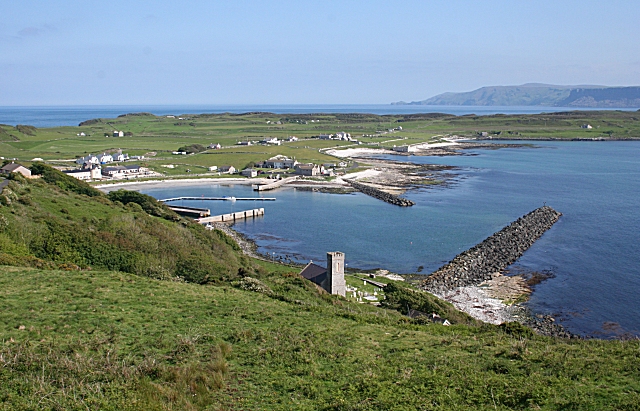
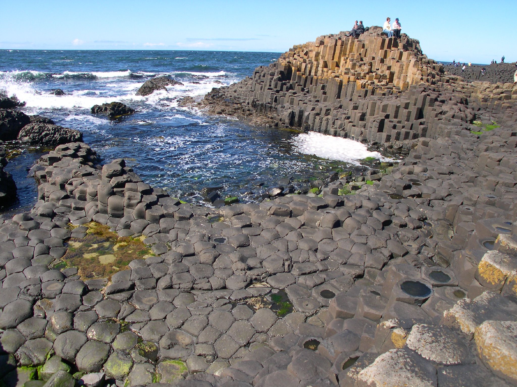
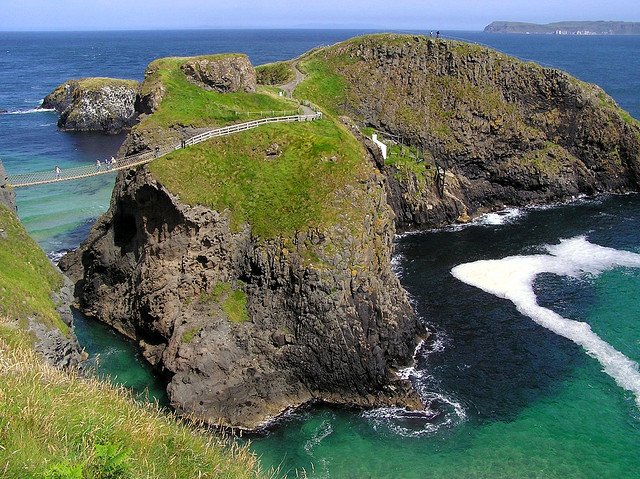
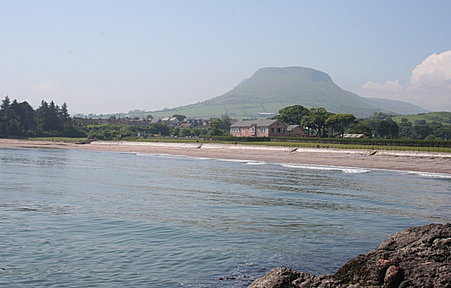
-          Our coastline is one of the most varied of any country in the world.  From the towering cliffs and pounding seas of Cornwall or Pembrokeshire, the islands of the Hebrides, some doing an imitation of the Caribbean with their pristine white sand beaches, interesting rock formations and sea stacks, dunes such as those at Camber, the marshes of North Norfolk, the rias of the South Cornwall and South Devon coasts, the risky mudflats of Morecambe Bay.


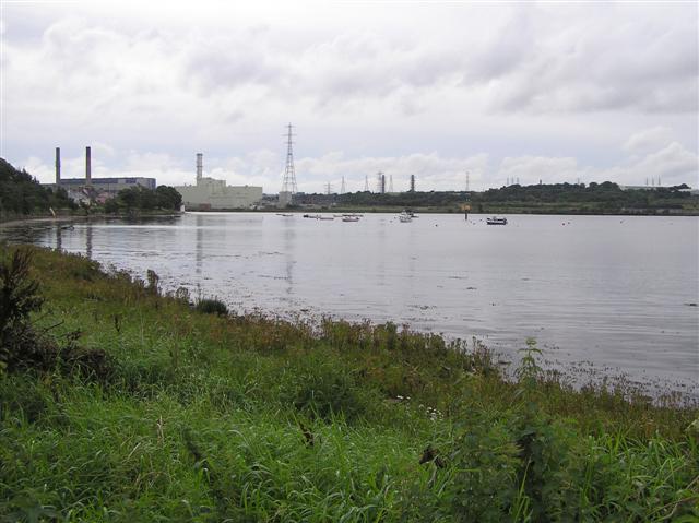
-          There is one recurring theme which strikes me as particularly sad, and that is the amount of industry that has disappeared from our coasts.  The most visible example of this is in Poldark country, my home county of Cornwall, where everywhere you go there are reminders of a long-lost tin and copper mining industry.  In Combe Martin, Devon, it is lead and silver mining which have bitten the dust.  Other places have lost their coal mines, and in North Yorkshire it was ironstone which ceased to be mined.  Strontian in West Scotland lost its lead, zinc, tin and silver mines.  Another disappearing industry in many places is shipbuilding, and numerous ports have become shadows of their former selves due to the decline in export activity.  As for fishing, although it continues in many places, there are countless places where the fishing has given way to more leisurely pursuits.


-          The amazing people who selflessly give of their time for the benefit of the coast and the people who enjoy it.  First and foremost, the brave people of the RNLI who risk their lives to save others, and the folk who work for the Coastguard, doing their best in the face of brutal cuts.  The people who give up their weekends for beach cleans, wildlife surveys and other activities.  The people who organise the aforementioned events and festivals and who raise money for charity.


And finally, I would like to dedicate my blog to its biggest fan, my lovely mother Barbara, who will be 90 in a few weeks’ time.  You can see some of her paintings in the Cornwall section of my blog.

Friday 15 June 2018

RATHLIN ISLAND


And so to the last island on my coastal blogging journey.  With its distinctive boomerang shape, Rathlin Island has the distinction of being the only inhabited island within the jurisdiction of Northern Ireland.  The island is easily accessible from the mainland, being linked to Ballycastle by means of a ferry service for passengers and vehicles, the maximum crossing time being 40 minutes.  Most of the signs of civilisation, including a bar, accommodation and shops, are to be found next to a small west-facing harbour, the departure point for the ferries.  Among the historic sites on the island are a Kelp House, where kelp used to be stored prior to being sent to Scotland, a standing stone and the site of a Neolithic settlement, a reminder of the earliest human presence on the island between 4000 and 2500 BC. 


There is a well-known story about the Scottish king Robert the Bruce, in which he is taking refuge in a cave after being driven from Scotland by Edward I of England.  He observes a spider persevering in repeated attempts to bridge a gap with its web, and the spider’s efforts inspire him to return to Scotland to regain his crown.  As is often the case with such stories, there are a number of places where this event is claimed to have taken place, but a few years ago one of Robert’s descendents claimed that it happened on Rathlin Island.


Another notable event from history was the Rathlin Island Massacre in 1575.  At that time there was a castle on the island, and the MacDonnells of Antrim took refuge there and used it as a base for their resistance to the Enterprise of Ulster.  Their leader, Sorley Boy MacDonnell, also decided to send a host of women, children, elderly and sick to the island for safety.  However, this proved to be a bad move when Sir Francis Drake and Sir John Norreys, acting for the 1st Earl of Essex in his campaign to subdue Ulster, attacked the castle, and even went as far as seeking out the more vulnerable folk who were hiding in caves.  The result was 600 dead, including over 400 civilians.  The dead included the entire family of Sorley Boy MacDonnell, who was forced to watch helplessly from the mainland.


Rathlin Island had a mention on the last episode of this year’s Springwatch, when it was announced that the corncrake has returned to the island, making it the only place in Northern Ireland where the bird has been heard in recent years.  According to the island’s RSPB page, as well as the corncrake, the island is home to Northern Ireland’s only breeding pair of chough, while other birds to be found there include puffin, guillemot, kittiwake, razorbill and fulmar.


For a list of events on the island follow this link.

Map of the area.

File:Church Bay - geograph.org.uk - 469318.jpg
Church Bay - geograph.org.uk - 469318. Photo by Anne Burgess, via Wikimedia Commons.


Monday 4 June 2018

CULMORE


Culmore is at the mouth of the River Foyle, a short distance downstream from the city of Londonderry, or Derry, slightly further inland.  This geographical location proved to be of strategic importance in May 1600 when Sir Henry Docwra, 1st Baron Docwra of Culmore, landed here with his army prior to taking Derry in an attempt to quash a war against the crown in Ulster.  The 17th century Fort Culmore on Culmore Point played a part in another event a few years later when Sir Cahir O’Doherty captured a supply of arms from there before launching what came to be known as O’Doherty’s Rebellion.  A more recent claim to fame for the village is that Amelia Earhart completed her solo translatlantic flight in 1932 by coming down on Culmore. 


Just beyond Culmore is the border with the Republic of Ireland, making it the last mainland coastal settlement on my blogging odyssey around the British coast.  However, there is one last place to blog about: Rathlin Island.  Watch this space.


File:Culmore point - geograph.org.uk - 953319.jpg
Culmore Point - geograph.org.uk - 953319. Photo by Kenneth Allen, via Wikimedia Commons.


Thursday 24 May 2018

MAGILLIGAN POINT


Well, I am nearing the end of my blogging journey around the British coast, and this is the last headland before the border with the Republic of Ireland.  Poking out into the mouth of Lough Foyle, Magilligan Point is a short distance from the Republic and there is a year-round ferry to Greencastle on the other side.  A short distance from the ferry crossing point is a Martello tower built during the Napoleonic Wars to protect the lough from those pesky French, but also as a defence against American privateers.  Group tours of the tower can be undertaken by arrangement.  The tower stands within the Magilligan Point Nature Reserve, distinguished by its extensive system of sand dunes, the largest in Northern Ireland.  The flora growing among the dunes attract a variety of insects such as bees and moths, including the rare Scarce Crimson and Gold Moth, a variety of moth only found along this coast.


File:Martello Tower, Magilligan Point - geograph.org.uk - 583940.jpg
Martello Tower, Magilligan Point - geograph.org.uk - 583940. Photo by Ross, via Wikimedia Commons.


Friday 18 May 2018

CASTLEROCK


The kilometre-long stretch of sandy beach stretching to the west of the mouth of the River Bann belongs to the small resort of Castlerock.  The beach is adjacent to the Castlerock Golf Club and its dunes continue upstream to a National Trust bird sanctuary.  Wildlife enthusiasts should keep their eyes peeled when eyeing the estuary as harbour porpoises and seals can sometimes be seen feeding there.  Castlerock’s celebrity claim to fame is that the actor James Nesbitt called the resort home when a teenager. 


Another famous name associated with Castlerock is the author C. S. Lewis, who used to holiday there when growing up in Belfast.  Lewis used to visit the nearby Downhill Demesne, and was so captivated by the site that it provided inspiration for some of his work, including The Lion, the Witch and the Wardrobe.  The Demesne is run by the National Trust and includes the ruined 18th century mansion Downhill House, a Mausoleum, a Dovecote and an Icehouse among its points of interest.  For nature lovers there are The Bog Garden, The Black Glen, and there is a Walled Garden which nowadays is home to sheep and apple trees.  Another attraction within the Demesne is the clifftop Mussenden Temple, which is based on the Temple of Vesta in Italy, and which, along with the beautiful beach it overlooks, featured in Game of Thrones as Dragonstone.  By the way, the word 'demesne' is used in Ireland to mean a piece of land attached to a manor.


File:Mussenden Temple overlooking Downhill beach. Northern Ireland.jpg
Mussenden Temple overlooking Downhill beach. Northern Ireland. Photo by D LN, via Wikimedia Commons.


Thursday 10 May 2018

PORTSTEWART


In a dramatic scene from series 5 of Game of Thrones, Jaime Lannister and Bronn are seen duelling with the Dornish guards on a stunning beach.  The beach in question was the Strand of Portstewart, just across the county border from Portrush, in County Londonderry.  The timing of the filming, which took place in 2014, was unfortunate, being in August, the busiest time of the year, as the beach had to be completely closed for it.  However, there was significant payback for the resort, which gained valuable exposure as a result of its starring role in the series.


The Portstewart Strand, which holds Blue Flag status, stretches out from the mouth of the River Bann, with the Portstewart Golf Club at one end.  The beach is popular with surfers, and in the town there is a Dive Centre for divers at Aquaholics, where boat trips can also be booked.  On the opposite bank of the river and inland a bit is a bird hide run by the National Trust (as is the Strand itself).  The hide offers the opportunity to observe waterfowl, waders and nesting birds.  The built up part of Portstewart lies to the other side of the golf course, occupying an area surrounding a small rocky peninsula, and it has a range of cafes, restaurants, pubs and shops for visitors to choose from.  There is a promenade leading to the Strand, taking in a small harbour. 


File:The Promenade at Portstewart - geograph.org.uk - 1322701.jpg
The Promenade at Portstewart - geograph.org.uk - 1322701. Photo by Des Colhoun, via Wikimedia Commons.


Thursday 3 May 2018

PORTRUSH


Portrush, which has signs of human habitation going back to around 4000 BC, started out as a fishing town, but the arrival of the Ballymena, Ballymoney, Coleraine and Portrush Junction Railway in 1855 paved the way for its development into a resort.  


The big attractions at Portrush are its wonderful beaches, the windswept location making them popular with surfers.  Horse riders and dog walkers are also attracted to the golden sands, though these should be aware that restrictions apply from May to September.  Whiterocks Beach, so named because of the limestone cliffs and rocks dotted about the beach, which were formed around 150 million years ago during the Cretaceous Period, lies to the east of the town, bordered by the Royal Portrush Golf Course.  The East Strand, meanwhile, is managed by the National Trust, so parking is free for members.  


For offshore activities, the town has a Yacht Club.  The town itself is built on a peninsula called Ramore Head (the name Portrush comes from the Irish Port Rois, meaning “promontory port”.  On the east side of the peninsula is the Blue Pool, which is popular with divers.  Golfers are well catered for, with a second golf course, Ballyreagh Golf Course, to the west of the town.  The Coastal Zone is a visitor centre with an exhibition space covering aspects of the area’s history and natural attributes.  A group of small offshore islands called The Skerries are home to seabirds such as kittiwake and eider duck as well as more exotic marine species such as the cotton spinner sea cucumber.


Portrush  hosts a number of prominent events every year, including an Air Show in September, the North West 200 motorcycle race in May and an RNLI Raft Race.  

Webcam view of Whiterocks Beach.


File:The White Rocks near Portrush (3) - geograph.org.uk - 785946.jpg
The White Rocks near Portrush (3) - geograph.org.uk - 785946. Photo by Albert Bridge, via Wikimedia Commons.

Thursday 19 April 2018

DUNLUCE CASTLE


Such is the appeal of the now-ruined Dunluce Castle that it, and its magnificent surroundings, have been the inspiration for both poetry and music.  The 4-part poem published in 1814 by Edward Quillinan sets the scene at length, describing the castle itself, the roar of the Atlantic “in wildest fury frantic” and the dramatic coastline around it.  A tone poem called Dunluce was written in 1921 by Irish composer Norman Hay, while a more recent musical work called Dunluce Castle was performed by the Irish Rovers in the 1990s.  The castle made an appearance on the sleeves of two albums: Led Zeppelin’s Houses of the Holy in 1973 and American musician Jandek’s Glasgow Friday in 2008.  The castle is believed to have been the inspiration for Cair Paravel in Chronicles of Narnia by C. S. Lewis.  Finally, not surprisingly, the castle was one of the many Northern Irish locations used in Game of Thrones as the castle of Pyke, seat of House Greyjoy.


Dunluce Castle was the first stop on our wonderful drive along the Causeway Coast a few years ago, and it set the scene magnificently for the rest of it.  The castle was built by the MacQuillan family around the year 1500, but 50 years later it was seized by the MacDonnell clan.  There was once a small town called Dunluce, founded by the Earls of Antrim in the 17th century.  The town was abandoned long ago, but visitors can view the remains uncovered by an archaeological dig.  The castle’s precarious position perched over the foaming sea was allegedly the cause of a catastrophe in 1639, when the castle’s kitchen fell into the sea along with the unfortunate kitchen staff while the 2nd Earl of Antrim and his wife were waiting for their dinner.  However, the veracity of this story is in some doubt, since the kitchen is still in situ among the present-day ruins.  What is for sure is that in the 18th century the north wall of the residence building did fall into the sea.  The remaining walls are still standing. 


File:Awesome Dunluce Castle.jpg
Awesome Dunluce Castle. Photo by Osioni, via Wikimedia Commons.


Thursday 5 April 2018

PORTBALLINTRAE


Looking at Portballintrae on the map, the eye is drawn to a small but perfectly formed horseshoe-shaped bay.  At one end of this is a small harbour, formerly the haunt of the local fishermen, but nowadays used mostly by leisure craft, and at the eastern end is Salmon Rock Beach which, while popular with families, is risky for swimmers.  The Bush River wends its way down to the coast to the northeast of the village, enclosing the Bushfoot Golf Course.  Back in 2007 it was reported that Donald Trump was considering the village as the site of a £1 billion golf complex, but it never came to pass. 


On the outskirts of the village are two strange mounds of earth forming concentric rings.  Known as the Lissanduff Earthworks, it is not clear what their original purpose might have been.  Some archaeologists, however, think they may have been linked to ancient worship rituals.  Fast forwarding to the 16th century, in 1588 a Spanish galleass called the Girona, part of the Spanish Armada, sank off Lacada Point, further back along the coast from Portballintrae.  In the 1960s a treasure trove from the ship was recovered by a team of Belgian divers, and was hauled ashore at Portballintrae.  It was the greatest find ever recovered from a Spanish Armada vessel and the gold jewellery from the hoard is displayed in the Ulster Museum in Belfast.


File:The bay of Port Ballintrae. - geograph.org.uk - 435121.jpg
The bay of Portballintrae. - geograph.org.uk - 435121. Photo by Des Colhoun, via Wikimedia Commons.


Monday 26 March 2018

THE GIANT'S CAUSEWAY


In December 2012 I blogged about Fingal’s Cave on the island of Staffa.  The geology that is the cause of the cave’s distinctive appearance is the same as that on view at the Giant’s Causeway, namely the strangely uniform interlocking hexagonal basalt columns formed from cooling lava. The unique nature of this coastal wonder has earned it the status of World Heritage Site, and it is run by the National Trust, with all the associated trappings such as shop and tea room.  From the car park there are buses on hand for anyone who does not fancy the hike down to the causeway. 


When the causeway was discovered by the Bishop of Derry in 1692, no-one was sure whether the feature was man-made or created by nature.  There was even a school of thought that a giant was responsible for it, hence the name given to it.  The favourite candidate was one Finn McCool.  The story goes that there was a battle between Finn and a Scottish giant who was threatening Ireland.  Finn started throwing chunks of rock into the sea to form a pathway towards his Scottish enemy.  In reality, as indicated above, it is ancient volcanic activity that was responsible for this most unusual of coastal features, as explained in the Visitor Centre.  The Causeway is a must-see for anyone visiting Northern Ireland, and is probably the best known and most visited site in this corner of the British Isles.  When we visited we stayed in a nearby roadside pub; alternatively the nearby village of Bushmills makes a good base.


File:Causeway-code poet-4.jpg
Causeway-code poet-4. Photo by code poet, via Wikimedia Commons.

Thursday 8 March 2018

DUNSEVERICK


The hamlet of Dunseverick, on the way from the Carrick-A-Rede Rope Bridge to the Giant’s Causeway, is tiny but with several points of interest.  Dunseverick Castle and earthworks, on a peninsula managed by the National Trust, date from at least the 5th Century AD when St Patrick visited and baptized Olcán, a local man who later became Bishop of Ireland.  The Gate Lodge of the castle can still be seen standing proud, although ruined, on the grassy clifftop.  There is a well on the headland named after St Patrick.  Walkers can take the North Antrim Cliff Path from the castle to the Giant’s Causeway, a distance of 5 miles. 

The harbour, sheltered by basalt islets, was where many local people emigrated from during the19th century.  They were rowed out from here to schooners headed for Glasgow or Londonderry before continuing with their onward journeys.  Between the harbour and the castle, Dunseverick Falls, although not the most dramatic of waterfalls, make a picturesque sight as they tumble down to the sea.

Map of the area.


File:Dunseverick Castle - geograph.org.uk - 475761.jpg
Dunseverick Castle - geograph.org.uk - 475761. Photo by Anne Burgess, via Wikimedia Commons.


Wednesday 28 February 2018

KINBANE CASTLE AND THE CARRICK-A-REDE ROPE BRIDGE


Heading north from Ballycastle on the way to Ballintoy we come to Kinbane Castle, reachable by a minor road off the Whitepark Road.  The castle is in ruins and there are many steps leading down to the main castle area, but those fit enough to tackle the approach will be rewarded with some of the best views on the Antrim coast.  The castle was built in 1547 by Colla MacDonnell, brother of Sorley Boy MacDonnell, and was laid siege to more than once by English forces.


As a member of the National Trust, I have visited many of their properties over the years, but possibly the most unusual site I have been to is the Carrick-a-Rede Rope Bridge.  The bridge was originally built in 1755 by fishermen to provide access to the small offshore island called Carrick, from where they were able to fish for salmon.  Now, under the auspices of the Trust the bridge is solely a novel tourist attraction, providing a frisson for visitors as they wobble their way across while daring themselves to look down at the foaming sea below.  The bridge is a popular attraction, so be prepared to wait to make the crossing, which is only 20 metres.  The island itself is very small, but offers wonderful coastal views and birdlife.  Back at the entrance to the site there is a cafe for visitors to warm up in.  The nearby village of Ballintoy has a number of facilities for visitors in the area, and the harbour is worth a visit for Game of Thrones fans, as it was used for the Iron Islands scenes.


File:Carrick a Rede.jpg
Carrick a Rede. Photo by Qole Pejorian, via Wikimedia Commons.


Friday 23 February 2018

BALLYCASTLE


This small resort is located in the far northeast of the Irish mainland and at the most northerly point of the Antrim coast.  Ballycastle’s main attraction is its wild and windswept beach, with lovely views along the coast to Fair Head.  At one end is an area known as Pans Rock, the remains of an iron salt pan used by fishermen, and just beyond that is the Devil’s Churn, with steps leading down to an underwater tunnel.  Ballycastle’s big event of the year is the Ould Lammas Fair, which originated in the 17th century, and which is the subject of a ballad by John Henry MacAuley, a sculptor by craft.  The first line of the ballad tells how “At the Ould Lammas Fair in Ballycastle long ago I met a pretty colleen who set me heart a-glow”.  The Fair is held on the last Monday and Tuesday of August.  The Ballycastle Museum has displays relating to the local area.


On the way in to Ballycastle by the road from Cushendall lie the ruins of Bonamargy Friary built by Rory MacQuillan in 1500.  88 years later the friary was seized by the rival MacDonnell clan.  Many of the features, including a cloister, altar and burial vault, are still relatively unscathed, although the roof is missing.  The friary is the last resting place of several Earls of Ulster and of Sorley Boy MacDonnell.  The friary is easily accessible from the road, free to enter, and there are information boards for visitors, who can also enjoy the lovely surroundings, including a golf course. 

Live streaming webcam view courtesy of Marine Hotel.

Map of the area.


File:Pans Rock - geograph.org.uk - 470238.jpg
Pan's Rock - geograph.org.uk - 470238.  Photo by Anne Burgess, via Wikimedia Commons.


Thursday 15 February 2018

TORR HEAD AND FAIR HEAD


Heading north out of Cushendun the Causeway Coastal Route takes on the name Torr Road, and after a few miles there is a turnoff from this to Torr Head.  This headland, with its spectacular views of the Mull of Kintyre, was used in the 1800s to record the passage of Transatlantic ships for Lloyds of London, and the remains of the old lookout station are still visible.  This was also one of the first places where Marconi’s wireless telegraphy system was installed.  Nestled against the headland on Portaleen Bay is a small harbour, a reminder of a former salmon fishery. 


Further north is Murlough Bay, known for its flora, fauna and geology, with birdlife including eider ducks and peregrine falcons.  Beyond the bay is Fair Head, which has been described as Northern Ireland’s tallest cliff face, rising to 600 feet above sea level.  As well as fantastic views along the coast and across to Scotland, there are goods views of Rathlin Island, which lies just across the way.  The headland is popular with rock climbers.  Running around the headland is a path called The Grey Man’s Path.  The Grey Man in question is said to derive from a local legend about a “devil-horse” living in nearby Lough Dhu who wandered along the path disguised as a human and frightened the living daylights out of a local woman called Mary McAnulty. 


File:Ballycastle beach, September 2010 (01).JPG
Ballycastle beach, September 2010 (01).  Photo by Ardfern, via Wikimedia Commons.


Friday 9 February 2018

CUSHENDUN


Like Cushendall, Cushendun, at the foot of Glendun, one of the nine Glens of Antrim, is classed as a “conservation village”, and as such is protected by the National Trust.  The name comes from the Irish Cois Abhann Duinne, which means “beside the River Dun”, the river that tumbles down from the valley of Glendun.  The village was planned in 1912 by Clough Williams-Ellis at the request of Baron Cushendun, and the Cornish appearance of the village is no accident, as Williams-Ellis designed it in this way to please the Baron’s wife Maud, who was from my home town of Penzance.  There is even a row of whitewashed cottages named after her. The village passed to the care of the National Trust in 1954.


Just to the north of the village is Castle Carra, thought to have been built in the 14th century and now a ruin.  The castle was the scene of a series of shenanigans involving Shane O’Neill and the McDonnells, culminating in O’Neill being stabbed to death as revenge for his earlier defeat of the McDonnells.  Not content with this act of violence, they cut his head off and sent it to representatives of Queen Elizabeth in Dublin. 


Last, and by no means least, fans of the hit series Game of Thrones will want to include a visit to Cushendun Caves on a visit to the village.  The caves, formed from over 400 million years of weathering, appeared in the series as the background for the Stormlands, one of the nine constituent regions of the Seven Kingdoms.  They can be reached by following the walk suggested via this link.  


File:Cushendun Caves - geograph.org.uk - 467791.jpg
Cushendun Caves - geograph.org.uk - 467791. Photo by Anne Burgess, via Wikimedia Commons.

Thursday 1 February 2018

CUSHENDALL


Formerly known as Newtown Glens, Cushendall and the surrounding area is classed as a “conservation area”.  The ‘dall’ part of the name comes from the River Dall which tumbles down to the beach via the Cushendall Golf Club course.  One of the main historic landmarks in the village is the Curfew Tower, also known as Turnly’s Tower, after Francis Turnly of the East India Company, who erected the tower as “a place of confinement for idlers and rioters”.  However, the history of the area goes back much further; there are the remains of Bronze Age forts in the mountains overlooking the village.  In 1924 the village became one of the first places in Ireland to have street lighting installed. 


On the outskirts of the village is Cottage Wood, with footpaths, viewpoints and picnic facilities.  Lovers of wildlife should keep their eyes peeled for the Red Squirrel, which are regularly seen here.  About a mile outside the village lie the evocative ruins of the Layd Old Church, dating from the early 1600s, although records suggest a church existed here as long ago as 1288.  Cushendall’s big event of the year is the Heart of the Glens Festival, which takes place in August and is a throwback to the days when there were eight fair days held throughout the year.


File:Cushendall Beach - geograph.org.uk - 467693.jpg
Cushendall Beach - geograph.org.uk - 467693. Photo by Anne Burgess, via Wikimedia Commons.


Wednesday 24 January 2018

RED BAY


To the north of Carnlough the shore-hugging Causeway Coastal Route veers to the west, where it reaches Red Bay.  Glenariff, one of the nine “Glens of Antrim” and known as the “Queen of the Glens”, drops down to the sea here, and there is a small village by the same name.  Glenariff Forest Park speads over 1,000 acres, with woodlands, lakes, waterfalls and recreational areas.  Just beyond the neighbouring village of Waterfoot lie the ruins of Red Bay Castle, built in the 13th century by the Bissett family, self-styled Lords of the Glens of Antrim.  The family’s descendents, the MacDonells of Antrim, rebuilt the castle in the 16th century, only for it to be burned to the ground in 1565 by Shane O’Neill of Tyrone.  The MacDonnells rebuilt it again, but it fell into disrepair and after a further restoration was subsequently destroyed by Oliver Cromwell during his conquest of Ireland, hence the scant ruins on view today.  So not much to see here now, but worth swinging by anyway for the wonderful views across to the Mull of Kintyre.


File:Waterfoot, Co. Antrim, 1990 (6981329372).jpg
Waterfoot, Co. Antrim, 1990 (6981329372). Via Wikimedia Commons.


Tuesday 16 January 2018

CARNLOUGH


Continuing north from Glenarm along the glorious coast road which hugs the Antrim shore, we come to Carnlough (‘cairn of the lake’), a village on the bay of the same name and lying at the mouth of Glencloy.  The villagers must be made of stern stuff, the harbour here being one of a number of locations on the Northern Ireland coast known for its New Years Day swims.  The limestone cliffs in the vicinity have played an important role in the area’s history right from Neolithic times, when the flint deposits in the cliffs served as tools for these ancient inhabitants.  Much later quarries were set up to extract the limestone, and the harbour, originally a stone pier built in the 1700s, was redeveloped in the mid-19th century by the Marchioness of Londonderry.  The limestone was used for the construction of the harbour, as well as many of the houses in the village, and a 1.5 km mineral tramway was built for transporting the stone.  

Another spinoff from this activity was the Londonderry Arms Hotel, built in 1848 as a coaching house.  Between 1921 and 1924 the hotel was owned by Sir Winston Churchill courtesy of an inheritance from a second cousin who was a grandson of the Marchioness.  The Marchioness, meanwhile, used to stay in a summer residence a few miles to the north of Carnlough known as the Garron Tower, a dark grey castle-like structure with turreted towers.  The building is now occupied by St Killian’s College and lies just off the coast road, which here is known as the Garron Road.  Back in Carnlough, as well as the charms of the village itself there is a scenic drive called the Slemish Scenic Drive which follows Glencoy up to Slemish Mountain, where St Patrick spent 6 years in captivity.

No piece on Carnlough would be complete without making a mention of one of the most famous former residents of the village, Paddy the carrier pigeon.  During the D-Day landings Paddy was sent to France with a coded message on the Allied advance, a secret mission codenamed U2, and remarkably was back home within 5 hours.  He was rewarded for his efforts by being awarded the Dicken Medal for bravery, the only Irish pigeon to have received the award.  Paddy died in 1954, but his memory lives on in the form of a commemorative plaque erected at the harbour.

Map of the area.

File:Harbour reflections - geograph.org.uk - 1012839.jpg
Harbour reflections - geograph.org.uk - 1012839. Photo by Arnold Price, via Wikimedia Commons.


Thursday 11 January 2018

GLENARM

Glenarm and its surroundings constitute one of the nine “Antrim Glens”, or valleys which are among the attractions of this part of Northern Ireland.  The glen itself, the river, the bay and the village are all called Glenarm, which stands for “Glen of the Army”, a reminder of a bloody past dating back to the Normans.  The harbour at Glenarm has a long history, but has been restored and updated, and nowadays houses a marina used by yachts and pleasure boats.  The village itself, dating from the 17th century, is a Conservation Area. 

Across the river from the village is Glenarm Castle and Walled Garden, home to the Dunluce family.  The castle originates from the 13th century when one John Bisset, expelled from Scotland for murder, arrived in the area and established a castle for the defence of his newly acquired land.  However, it was in 1636 that the present-day version of the castle was built by the Earl of Antrim Sir Randall McDonnell. The Walled Garden dates from the 18th century and is one of Irelands oldest.  There is a tea room which last year had a glowing write-up in the Belfast Telegraph.  The garden is open to visitors from March until September, however the castle itself is only occasionally open to the public, and is available for group visits.  The Glenarm Forest Park used to be part of the demesne of Glenarm Castle but is now open to the public and maintained by Ulster Wildlife Trust.


File:Glenarm Castle.jpg
Glenarm Castle. Photo by Glenarm Castle, via Wikimedia Commons.


Friday 5 January 2018

LARNE


Larne is a major gateway to Northern Ireland courtesy of the ferry link to Cairnryan, 6 miles north of Stranraer in Scotland.  Formerly known as Latharna, from Lathar, son of the pre-Christian King Hugony the Great, one of the earliest records of the area dates from Roman times, when a galley bound for Scotland was blown off course to a place called Portus Saxa, believed to be Larne Lough.  The lough was later named after the Norse King Ulfrich during the time of the Viking raids.  Fast forward to the 18th century, when the quays which had been built in the port were used by people emigrating to America.  It was the coming of the railway which led to Larne being established as the departure point for ferries to Scotland, initially using a paddlesteamer called the Briton, a service which lasted until 1863.  Three years later the harbour was bought by James Chaine, a linen merchant’s son, who updated the port and re-established the link to Scotland.   People arriving at Larne by sea will be reminded of this by the Chaine Memorial Tower which dominates the harbour entrance. 


During the First World War Larne became a naval port, then during the Second World War the port played an important role for the Allied Forces, including as a conduit for troops preparing for the D-Day Landings.  In the post-war period, after various ups and downs with efforts to establish ferry links once more, the Larne-Cairnryan service finally started in 1973.  This outcome, which contributed considerably to the success of the port, was facilitated by one Colonel Frank Bustard, who was made a Freeman of Larne in recognition of his efforts.


If you are visiting Larne with a car or motorbike, the coastal route heading north from the town is highly recommended.  We did this route in the other direction after exploring the Antrim coast, and the journey was a delight due to the way the road hugged the coastline with the attendant views of Scotland.  At one point I nearly caused my husband to crash the car when I spotted a seal poking its head out of the water a short distance offshore. 


Back in town, the Larne Museum and Arts Centre provides a fascinating insight into the history of the town, including a display devoted to a famous warship called the Princess Victoria.  For lovers of the great outdoors, as well as the tower, James Chaine’s memory lives on in the form of Chaine Park, a green space with wonderful views, especially for people who, like me, love watching the comings and goings of shipping and ferries.  Just to the south of the port, the ruins of Olderfleet Castle, dating from at least the 13th century, lie on Curran Point facing the Lough.


For a list of events in Larne, follow this link.


File:The Chaine Memorial, Larne - geograph.org.uk - 620971.jpg
The Chaine Memorial, Larne - geograph.org.uk - 620971. Photo by Albert Bridge, via Wikimedia Commons.