Labels

Aberdeenshire (21) Angus (4) antiquities (87) Argyll and Bute (35) Arran (7) art (37) birds (231) bridge (9) Caithness (12) Carmarthenshire (5) castle (164) Ceredigion (9) Channel Islands (13) Cheshire West and Cheshire (1) City and County of Swansea (1) City of Bristol (2) City of Edinburgh (4) Conwy (8) Cornwall (74) County Antrim (19) County Down (23) County Durham (3) County Londonderry (4) Cumbria (19) Denbighshire (2) Devon (48) diving (9) Dorset (18) Dumfries and Galloway (22) Dundee City (1) East Lothian (6) East Sussex (16) East Yorkshire (6) English Riviera (3) Essex (17) Fife (19) Flintshire (1) food (12) fossils (14) gardens (28) Ghosts (36) Glamorgan (1) Gower (7) Guernsey (4) Gwent (1) Gwynedd (19) Hampshire (13) Highland (72) Inner Hebrides (42) Inverclyde (5) Islay (8) Isle of Anglesey (14) Isle Of Man (7) Isle Of Wight (10) Isles of Scilly (3) Jersey (7) Kent (22) Lancashire (8) Lewis and Harris (7) lighthouse (62) Lincolnshire (8) Merseyside (8) Mid Glamorgan (1) mining (23) Moray (10) Mull (8) Norfolk (21) North Ayrshire (13) North Yorkshire (12) Northern Ireland (45) Northumberland (17) Orkney (10) Outer Hebrides (14) Pembrokeshire (27) pubs (50) Ross and Cromarty (20) Scotland (299) Scottish Borders (3) Shetland (14) shipwrecks (42) Skye (12) smuggling (48) Somerset (9) South Ayrshire (6) South Glamorgan (5) South Gloucestershire (2) Suffolk (18) surfing (92) Sutherland (16) Tyne and Wear (8) Wales (93) wartime (75) webcams (232) West Dunbartonshire (3) West Glamorgan (9) West Sussex (9)
Showing posts with label Wales. Show all posts

Tuesday, 14 July 2015

NEWPORT


Newport is one of those places I tend to go through rather than to, more often than not in my rush to get to Cardiff.  However, that is not to say that there is nothing to see in this university city, which has a cathedral and the remains of a castle among its  points of interest.  Probably the most interesting sight of all is the Transporter Bridge, one of only two in the country - the other one being in Middlesbrough.  The bridge was built as an alternative to the original ferry, which suffered from the extreme rise and fall of the tides.  It opened in 1906 and it is still open to the public, ferrying passengers and vehicles across the River Usk by  means of a suspended gondola, offering splendid views along the way. 

Newport Cathedral, or to give it its full name Newport Cathedral of St. Woolos, King & Confessor, lies in an elevated position on Stow Hill, overlooking the city.  St. Woolos (or Gwynllyw) reputedly founded the cathedral around 500 AD, the year of his death.  The cathedral's subsequent history was a turbulent one with successive plunderings, by Irish pirates and by Danes in the 9th century, then by Earl Harold's men in 1060.  One of its most attractive features are the Norman pillars running along the nave.  The castle was built in the 14th century, and only the east side remains, occupying a position on the river bank next to the Town Bridge.  The Riverfront, a striking angular white building on the River Usk, houses a theatre and arts centre.  The city's Museum and Art Gallery tells the story of the city from prehistoric times.

Further afield to the north-east is Caerleon, a must for enthusiasts of Roman remains.  The legionary fortress Isca Augusta once held sway here, and the site includes an amphitheatre where gladiatorial contests used to take place.  Near Isca Augusta are the National Roman Legion Museum and the Roman Baths Museum.  There is also an Iron Age Hill Fort.  For nature enthusiasts, the Newport Wetlands RSPB reserve at Nash, on the east bank of the river mouth, is free to enter and includes a visitor centre and cafe.    

Map of the area. 

File:Newport Transporter Bridge 2002.jpg
Newport Transporter Bridge 2002. Photo by Hywel Williams, via Wikimedia Commons.

Monday, 6 July 2015

CARDIFF


Where in the country can you see all the following in one evening: Superman, a bevy of nurses and rival groups of cowboys and indians? Answer: Cardiff.  In the Welsh capital the great British tradition of hens and stags is alive and well, and the result is a considerably enlivened Saturday evening.  The first time my husband and I went to Cardiff for the weekend we spent a pleasant hour having an alfresco drink outside one of the city's bars while watching the increasingly surreal passing scene.  My own personal favourite was the female 'army' of soldiers marching along the street, led by a whistle-blowing 'sergeant-major'.  

Cardiff is a city of two distinct parts.  For the shoppers who want to mix some retail therapy with a wide variety of restaurants and some lively bar hopping the city centre is the part to head for.  The St Davids shopping centre dominates this part of the city, while for the more historically inclined there is Cardiff Castle, surrounded by the green and pleasant spaces of Bute Park. Alongside the modern chain-dominated St David's centre there are several atmospheric arcades with interesting individual shops.  This is also the part of town for the sports fans, since the Principality Stadium, scene of many a thrilling rugby match, is very close to the shops and also to the main railway station.  The Castle has a fascinating history, with excavations revealing occupation going back to the Romans.  The present-day castle is surrounded by walls including the Animal Wall, designed by architect William Burges, which, as its name suggests, includes carvings of animals. There are two cathedrals within the greater city area, Cardiff Metropolitan Cathedral of St Davids and the much older Llandaff Cathedral, reachable via a pleasant walk along the River Taff.

The other distinct part of the city is Cardiff Bay, where the focal point is Mermaid Quay, a complex of restaurants, bars and shops.  The Wales Millennium Centre is also to be found in the bay, along with the Senedd, or National Assembly Building.  There is also a rather sweet little Norwegian church which has been transformed into an Arts Centre and cafe.  The nicest way to travel between the two areas is to get the shuttle boat service which plies between Mermaid Quay and Bute Park, via the River Taff with its reed beds and associated wildlife.  Other boat trips available from Mermaid Quay include trips out to Flat Holm Island with its wildlife and historic buildings.  As I mentioned in my previous post on Penarth, the Cardiff Bay Barrage is open to walkers who want to cross the mouth of the bay between Cardiff Bay and Penarth, a pleasant alternative to the considerable detour that the bus journey entails.     

As one would expect from such a city, Cardiff has a wealth of events throughout the year, especially in summer.  From the Food and Drink Festival to the Winter Wonderland and Christmas Market in the run up to Christmas there is something for everyone in the vibrant Welsh capital.  Follow this link for a list of events. 

Live streaming webcam view of Cardiff Bay from the Sailing Club.

Map of the area. 

Cardiff Bay

Tuesday, 30 June 2015

PENARTH


You need to be fit to live in Penarth, since it's all up and down.  The town centre is at the top of the hill, and there is a steep descent from there to the promenade in one direction and the Cardiff Bay Barrage in the other.  The nicest route down to the seafront is via Alexandra Park, a steeply sloping Edwardian park with an aviary and a bandstand.  The promenade is quiet and unspoilt, with a pier and 1930s pavilion offering views across the Bristol Channel.  Another pleasant green space open to the public can be found in the grounds of The Kymin, one of the oldest buildings in Penarth, built between 1790 and 1810.  The area formerly occupied by docks in the 19th century is now a marina, and the entrance to the barrage is nearby, from where you can walk across to Cardiff Bay, enjoying views out to sea on one side and across the bay to the Wales Millennium Centre and other attractions on the other side.  

Penarth got into the news recently when an extraordinary discovery was made by two brothers on Lavernock Beach to the south of Penarth: a 200 million years old fossil of a cousin of Tyrannosaurus rex.  The find is believed to be the earliest specimen of a Jurassic era dinosaur to be found in the world.  The creature is described as a meat-eating, fierce hunter that walked on two legs with a fuzzy body.

Map of the area. 

Penarth Pier Pavilion - geograph.org.uk - 3524046. Photo by Gareth James, via Wikimedia Commons.


Saturday, 27 June 2015

BARRY ISLAND


Heading east from Llantwit Major we come to Summerhouse Point with cliff top walks reached by a lane from the village of Boverton.  There is a Seawatch Centre here with displays of weather-forecasting equipment and radar.  Further along, Limpert Bay marks the end of the Glamorgan Heritage Coast Walk which started at Porthcawl.  Further along still, the village of Rhoose nudges the southern end of Cardiff Airport.  After the quiet of the clifftops and the series of small towns and villages, the much larger settlement of Barry represents quite a contrast with its docks forming an alternative to the congested and expensive Cardiff Docks.

Barry Island, which is not actually an island, being accessible from the mainland via the A4055, has long been a family tourist destination.  There used to be a Butlins Holiday Camp here, but this closed in 1996.  However, the 'island' continued to be a magnet for tourists, and it also came to the attention of the Dr Who team during the filming of the series 'Delta and the Bannermen', in which it played the part of the Shangri-La Holiday Camp.  It also featured in 'The Empty Child' and 'The Doctor Dances'.  In the past Barry Island has had something of an image problem, being considered down at heel by many, however there are signs of attempts at an uplift.  A recent online review described the beach as beautiful and clean and pointed out that the dining options are no longer all fish and chips and burgers.  The main attraction on the island is the Pleasure Park, a traditional array of fairground rides and amusement arcades which recently changed ownership and boasts "brand new rides never seen in Barry before".  

Map of the area. 

File:Barry Island scene.jpg
Barry Island scene. Photo by Derek Jones, via Wikimedia Commons.

Thursday, 11 June 2015

LLANTWIT MAJOR


Looking around Llantwit Major today, it seems hard to imagine that 1,500 years ago this sleepy little village a few miles to the west of Cardiff was an important academic centre, almost the Oxbridge of its day.  Cor Tewdws, Britain's oldest centre of learning, was founded in 395, but was burnt down during a series of raids in the post-Roman period.  Then St Illtud, after whom the Norman church in the village is named, came from Brittany in 508 and re-established the centre.  St Illtud's church stands on the site of Cor Tewdws, the current building dating from the 11th century.  It has a surprisingly imposing exterior for a village church, with some striking carved stones and effigies, earning it the title of the 'Westminster Abbey of Wales'.  Another relic of the area's past is the Roman Villa at Caermead to the north-west of the village.  A short distance from the village centre is the sand and pebble beach, backed by steep cliffs which are prone to erosion.  The beach is popular with surfers, and there is yet more history to be found here in the form of the remains of an Iron Age hill fort called Castle Ditches..  

Map of the area. 

File:Llantwit major beach (7961687388).jpg
Llantwit major beach (7961687388). Photo by Archangel12, via Wikimedia Commons.


Wednesday, 27 May 2015

ST DONAT'S


One day in 1925, the newspaper magnate William Randolph Hearst was leafing through a copy of Country Life magazine when he came across a 12th century Welsh castle overlooking the Bristol Channel which was up for sale.  He decided to buy it and set about modifying the structure of the castle by adorning one part of it, Bradenstoke Hall, with a roof brought across from Bradenstoke Abbey in Wiltshire - as one does.  The castle in question was St Donat's Castle in the village of the same name - named after the 6th century saint Dunwyd - and during his 12-year tenure Hearst brought a touch of Hollywood glamour to this quiet corner of the South Wales coast by inviting such luminaries as Charlie Chaplin and Douglas Fairbanks to come and stay there, as well as a young John F Kennedy and the playwright George Bernard Shaw.

The castle, which has curtain walls dating from around 1300, holds the distinction of being the longest continually inhabited castle in Wales.  For many years it was owned by  the Stradling family, and the village church includes monuments to them.  After Hearst sold it in 1937, the castle was requisitioned for use by American and British troops during the Second World War.  Today the castle houses an international secondary school called Atlantic College and an Arts Centre.  Not surprisingly, given its long history, there are a number of ghosts reputed to haunt the castle, including one of Lady Stradling in a long flowing dress and high shoes.  Her appearance, usually in the Long Gallery, is said to be a portent of impending doom.  An old witch-like woman is often seen in the Armoury, while the animal kingdom puts in an appearance in the form of a phantom panther which has been seen in a corridor.  The makers of the recently shown TV series Wolf Hall made use of two of the castle's largest rooms for filming, one of which was the aforementioned Bradenstoke Hall.   

Map of the area. 

File:Sea Wall at St.Donat's Castle, Vale of Glamorgan. - geograph.org.uk - 386849.jpg
Sea Wall at St Donat's Castle - geograph.org.uk - 386849, Vale of Glamorgan. Photo by Peter Wasp, via Wikimedia Commons.

Tuesday, 19 May 2015

OGMORE-BY-SEA AND SOUTHERNDOWN


Ogmore-by-Sea lies at the mouth of the River Ogmore, an interesting estuary for birdwatchers who may spot egrets or kingfishers.  Bathers, however, should beware: the proximity of the estuary makes bathing unsafe from the nearby beach, although good bathing places are found further along.  There are large caves by the mouth of the river, which is where the village gets its name, 'og' being the Welsh word for cave.  Fossils are also present in the ancient sedimentary rocks along the shore, and many are clearly visible to fossil hunters.  This stretch of coast, which forms part of the Glamorgan Heritage Coast, has been a hotspot for shipwrecks over the years, as the west facing shore is regularly battered by fierce gales coming in from the Atlantic.  A particular flashpoint is Tusker Rock, a dangerous reef which is submerged at high tide.  A short walk along the estuary to the Ewenny River, which flows into the Ogmore, leads to Ogmore Castle, a ruined Norman Castle originally erected by the Londres family in the early 12th century.

Those who have been following my sister blog, Britain On Page And Screen, will already have encountered the neighbouring Southerndown Beach, which has been used several times in the filming of Dr Who, most memorably in the heartbreaking scene where the Doctor says goodbye to Rose and disappears before her eyes. The beach, which forms part of Dunraven Bay, was meant to represent a Norwegian beach called Bad Wolf Bay.  It is popular with surfers and at low tide there is a large expanse of sand and pools. There used to be a castle on the headland to the south, albeit a relatively new one.  Dunraven Castle, which was built in 1803 but demolished just 160 years later, was used as a Red Cross hospital during the two World Wars.


File:Mouth of River Ogmore, Ogmore-by-Sea, Wales - geograph.org.uk - 90093.jpg
Mouth of River Ogmore, Ogmore-by-Sea, Wales - geograph.org.uk - 90093. Photo by John Goodall, via Wikimedia  Commons.

Sunday, 10 May 2015

PORTHCAWL


Since his death in 1977, there have been many reported sightings of Elvis Presley - shopping in Walmart, grabbing a drive-thru cheeseburger, downing a cold beer in a remote desert saloon bar.  However, I can reveal that all these sightings are false and that he can actually be found in Porthcawl.  Oh wait, there's another one...and another!  OK, I'll come clean, they are not really the King himself: each September Porthcawl hosts its annual Elvis Festival during which thousands of fans descend on the town to see a variety of Elvis tribute acts, with the main focus of the action in the Grand Pavilion, while on the streets visitors are met with a white-suited wonder around every corner. 

During the 1800s Porthcawl was responsible for large amounts of iron and steel being shipped out to the four corners of the British Empire.  However, it was also during this century that the promenade was built to commemorate Queen Victoria's Golden Jubilee. The Welcome To Porthcawl website has some lovely old photographs from the town's earlier days.  Now the town is a popular resort, with local attractions such as the Coney Beach fairground for families, while for the golfers there is the Royal Porthcawl Golf Club.  The Porthcawl Museum is small, but houses some interesting exhibits relating to the locality.  The museum is currently displaying a fascinating exhibition about World War I.  Rest Bay Beach has attracted some glowing comments on Tripadvisor, such as 'stunning watersports beach'.  The beach is popular for surfing, and there is a vast expanse of sand and rock pools for the kids, though care should be taken at high tide. Trecco Bay, meanwhile, is known for its huge estate of mobile homes.

Live streaming webcam view of the pier courtesy of Porthcawl RNLI.


File:Seafront at Porthcawl - geograph.org.uk - 1542009.jpg
Seafront at Porthcawl - geograph.org.uk - 1542009. Photo by Ron Speed, via Wikimedia Commons.

Saturday, 2 May 2015

PORT TALBOT


If you are driving along the M4 towards the Gower Peninsula and Pembrokeshire dreaming of stunning coastline and rolling moorlands, you may be brought up short by the sight of the coastal plain at Port Talbot with its expanse of industrial plants and smoking chimneys.  The local economy here is dominated by the steelworks, and Industrial Gases plant, a biomass power station and a gas-fired power station. However, there is one local attraction not to be missed: the Baked Bean Museum of Excellence.  Started in his own home by an orange-clad super hero who calls himself Captain Beany, the museum houses over 200 baked bean related displays.  On his 60th birthday earlier this year, Captain Beany celebrated by having 60 baked bean tattoos.  A true British eccentric!

Within sight of the industrial expanses of this stretch of coast is the quiet beach resort of Aberavon, with a long stretch of sand backed by a park, making it popular with families.  If you tire of the sight of the nearby industrial landscape, you can always look the other way for lovely views to Swansea and beyond.  The actor Michael Sheen hails from these parts, and in 2011 he starred in a performance of The Passion, which lasted all weekend.  The action started on the seafront and moved on to other parts of town, with thousands of onlookers and a large cast including hundreds of local residents.

To the south of Port Talbot and inland a bit is Margam Country Park, free to enter and with lovely grounds where deer can be seen.  There are also nature trails to follow and activities for the kids.  The Margam Stones Museum, which is attached to the 12th century Margam Abbey, has a collection of stones from pre-Roman times onwards.  Another landmark in the park is Margam Castle, actually a large Victorian country house.  Mynydd Margam, a mountain which rises up above the coastal plain, contains evidence of human habitation from 4000BC.  

Map of the area. 

File:The Promenade, Aberavon Beach, Port Talbot - geograph.org.uk - 1853730.jpg
The promenade, Aberavon Beach, Port Talbot - geograph.org.uk - 1853730. Photo by David Lewis, via Wikimedia Commons.


Tuesday, 21 April 2015

SWANSEA


During the 18th and 19th centuries Swansea, the second largest city in Wales, was a major industrial centre, with copper smelting an important economic activity, in fact the city was known as 'Copperopolis' during that time.  A title well-earnt, since 90% of all copper-smelting activity in Britain was based within 20 miles of the city, which was regarded as the world centre for such activities, and for metallurgy in general.  Much of the impetus for all this came from Bristol-based industrialists who financed enterprises such as the White Rock copperworks of 1737.  

Fast forward to 1914, when another event occurred which was to put Swansea on the map: the birth of the infamous Welsh poet Dylan Thomas.  This momentous event took place at 5 Cwmdonkin Drive in the suburb of Uplands, and the house is now open to visitors who can view it fully restored to its 1914 condition.  However, the city's celebration of the life of its most famous son does not stop there: the former Guildhall in the Maritime Quarter houses the Dylan Thomas Centre.   The Centre was opened in 1995 by no less than US President Jimmy Carter and has a permanent exhibition on the life and work of the poet as well as a range of other facilities including a theatre.  Each year in late October/early November the Centre hosts the Dylan Thomas Festival.

Today, the historic docklands that played such an important role during Swansea's industrial years have been turned into a vibrant Maritime Quarter with a mixture of museums, cafes, bars and restaurants.  The NationalWaterfront Museum takes a hi-tech approach to history, with interactive exhibits telling the story of Wales' industrial heritage.  Across the way is Swansea Museum, with a range of exhibits including artifacts from Ancient Egypt and exhibits from the city's 'Copperopolis' days.  Next to the waterside is the city's marina with its bobbing boats.  Then there is the shopping, the highlight of which is Swansea's famous covered market selling local delicacies such as laverbread. 

For a list of events in the city see here.

Live streaming webcam view of Swansea Beach.

Map of the area. 

File:Swansea Maritime Quarter - geograph.org.uk - 220931.jpg
Swansea Maritime Quarter - geograph.org.uk - 220931. Photo by Pam Brophy, via Wikimedia Commons.

Monday, 13 April 2015

MUMBLES


Mumbles is more or less a suburb of Swansea, but it has its own seafront, known as the 'Mumbles mile', with a variety of restaurants, pubs and other attractions, making it an ideal base for exploring the Gower Peninsula.  The town's transformation into a resort came with the arrival of the Swansea and Mumbles Railway in 1804, the oldest in the world, which closed on 5th January 1960.  All that is left of the railway now is the pier, along with its pavilions and a lifeboat station.  The pier used to be visited by the White Funnel paddle steamer that brought daytrippers along the Bristol Channel.  Adjoining the 'Mumbles mile' are quaint little streets with colourful cottages.  On a hill above Mumbles lie the ruins of Oystermouth Castle, where graffiti dating from the 14th century can be seen along with the magnificent views over Swansea Bay.  The lighthouse on Mumbles Head got off to a shaky start in 1792, with the collapse of the structure during the first year of building.  However, it was completed in 1794 and has been guarding the entrance to Swansea Bay ever since.  The present-day lighthouse is unmanned and solar powered.

Live streaming webcam.

Map of the area. 

File:Mumbles promenade at Verdi's - geograph.org.uk - 460950.jpg
Mumbles promenade at Verdi's - geograph.org.uk - 460950.  Photo by Trevor Rickard, via Wikimedia Commons

Monday, 6 April 2015

CASWELL BAY AND LANGLAND BAY


The violent storms of winter 2013-2014 had a terrible effect at the time, causing untold damage to buildings and seafronts.  However, some places are still feeling the after-effects now.  Caswell Bay on the Gower Peninsula has lost huge amounts of sand, leaving a stony surface which is difficult and painful to walk over in bare feet, and experts have warned that the beach could take years to recover.  A shame, because it is one of the loveliest bays on this stretch of coast.  A report on this subject in the local press drew an emotive response from those commenting, with some suggesting that dredging activities in the Bristol Channel are more to blame than the storms.  I am no expert on the subject, but I hope the bay recovers sooner rather than later.  Visitors to the bay, which is easily accessible from nearby Mumbles, have the use of beach shops geared up for families and there is a lifeguard on duty during the summer months.  From Caswell Bay, a coastal path one and a half miles in length and offering wonderful views across to North Devon leads to the neighbouring Langland Bay.  There are parking and refreshments within easy reach of the bay.  Dog owners should be warned that dogs are banned from the beach from 1st May to 30th September. 

Webcam view of Caswell Bay.

Live streaming webcam view of Langland Bay from Langland Bay House.

Map of the area. 

File:Langland Bay - geograph.org.uk - 1480675.jpg
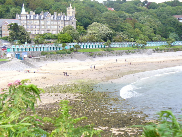
Langland Bay. Photo by Colin Smith, via Wikimedia Commons

Monday, 30 March 2015

THREE CLIFFS BAY


As its name suggests, this gorgeous bay on the Gower Peninsula is characterised by its limestone cliffs towering over the extensive golden sands.  One of the three cliffs of the name has been eroded by the sea to form a rock arch.  The beach takes some effort to get to, being reachable only on foot from either Parkmill or Southgate, but it is well worth the walk.  Near the bay is the village of Southgate, which is the starting point for a couple of cliff walks.  To the east is a path leading to Pwlldu Head and the sandy Pwlldu Bay, while to the west a more gentle walk leads along the cliffs to the 13th century ruin of Pennard Castle, based on an earlier fortification probably built by first earl of Warwick Henry de Beaumont.  The ruins, made of sandstone and limestone, lie at the edge of the Pennard Pill valley and offers wonderful views over Three Cliffs Bay.  It was abandoned at the end of the 14th century, not due to battle scarring as is so often the case, but because there was a problem with sand encroachment.  A mile to the north of Southgate is the Gower Heritage Centre and craft centre, occupying a restored 17th century water-powered corn and sawmill. 

Map of the area. 

File:Three Cliffs Bay - geograph.org.uk - 869888.jpg
Three Cliffs Bay - geograph.org.uk - 869888. Photo by Graham Taylor, via Wikimedia Commons

Saturday, 21 March 2015

OXWICH


The pretty village of Oxwich with its thatched cottages lies at the western end of Oxwich Bay, where the sandy beach is a magnet for watersports enthusiasts.  At one end of the village is St Illtyd'sChurch, a site originally dating from the 6th century.  The chancel is believed to be a 6th century cell, while the font is alleged to have been brought there by St Illtyd himself.  According to local legend the churchyard is haunted by a white 'ceffyl dwr' (water  horse), which has been seen disappearing into the well at the top of the churchyard.  The other notable building in the village is Oxwich Castle, built by the Mansel family from Tudor times.  The family's coat of arms can be seen on the gateway.  One of the features of the castle typical of those times is the long gallery, built high up with fabulous sea views.  The property is run by Cadw and is open to visitors.  Last year a prehistoric site was discovered on a headland in Oxwich.  The site was exposed by the uncharacteristically dry weather which had prevailed during the summer, although the experts investigating the site had to take to the air to properly discern the shapes in the ground which indicated that there was something there.  For nature lovers there is a National Nature Reserve with a dune system and cliffs offering habitats for a range of wildlife as well as flora such as orchids.  Birds found there include several varieties of warbler and bittern as well as overwintering teal and gadwall.

Map of the area 

File:St Illtyd's Church, Oxwich - geograph.org.uk - 46956.jpg
St Illtyd's Church, Oxwich - geograph.org.uk - 46956. Photo by Pip Rolls, via Wikimedia Commons

Thursday, 12 March 2015

PORT EYNON


With its proximity to Swansea and an abundance of small coves and caves, the Gower Peninsula was once a hotspot of smuggling activity, and the small village of Port Eynon played a major role in these nefarious goings-on.  The ruined 16th century Salt House on Port Eynon Point used to belong to the Lucas family, a dynasty which reigned supreme over the locality's smuggling.  One member of the family, John Lucas, set about building an underground passage between the Salt House and Culver Hole, a stronghold formerly known as Kulverd Hall which he allegedly used as a hiding place for arms and other contraband.  Even the village church was used as a hiding place during the Battle of Trafalgar, with kegs hidden in the altar.  The dunes at the back of the beach also proved to be a handy store.  

Long before the caves attracted the attention of the smugglers, one of them, Longhole Cave, was a place of habitation during prehistoric times.  The cave can be reached via a path overlooking Overton Cliff.  Back in the village, the churchyard of St Cattwg's Church has two memorials to three brave local lifeboatmen who lost their lives on New Year's Day in 1916 while going to the rescue of survivors of the SS Dunvegan, which suffered an engine failure and was driven ashore in heavy seas at Oxwich Bay.  One of the memorials is in the churchyard, while the pulpit within the church includes a second memorial to the men.

Map of the area.

File:Port-Eynon Bay - geograph.org.uk - 1481683.jpg
Port-Eynon Bay - geograph.org.uk - 1481683. Photo by Colin Smith, via Wikimedia Commons

Thursday, 5 March 2015

RHOSSILI BAY

On reaching the far west of the Gower Peninsula, the scene you are met with is, in my opinion, one of the finest sights on the whole of the British coast: the curved sweep of Rhossili Bay, backed by the elevated Rhossili Down, and at the far end the higgledy-piggledy shape of Worms Head stretching out into the Bristol Channel. Towards the northern end of the bay, and nestling in the shadow of the Down, is the surfing village of Llangennith which includes St Cennydd's, the largest church in Gower, originally thought to be a 6th century priory.  The name St Cenydd is the origin of the present-day name of Llangennith. From here, you have the choice of a long walk along the beach or a clamber over the Down. For post-walk refreshments with an amazing view, there is the Worms Head Hotel at the southern end of the bay. Worms Head itself is a major landmark on the South Wales coast, visible from many places for miles around.  It is possible to walk out onto the headland, but care should be taken as the causeway leading out to it is only exposed for two and a half hours before and after low tide. Get it wrong, and you could be spending a windswept few hours trapped on the headland waiting for the tide to recede again, a mistake famously made by Dylan Thomas when he fell asleep on the Inner Head. He was a frequent visitor to Worms Head and wrote of the "monstrous, thick grass there that made us spring-heeled". Back down on the beach, there are the remnants of a shipwreck poking out of the sand. This was the Norwegian barque Helvetia which fell foul of stormy weather in Autumn 1887, but now only a few timbers are still visible.

Live streaming webcam of Llangennith and Rhossili Bay.

Map of the area.

File:Low tide at Rhossili Bay - geograph.org.uk - 1379946.jpg
Low tide at Rhossili Bay - geograph.org.uk - 1379946. Photo by Trevor Rickard, via Wikimedia Commons

Thursday, 26 February 2015

THE LOUGHOR ESTUARY AND SALT MARSHES


The north coast of the Gower Peninsula largely consists of an expanse of salt marshes which, while bleak in nature, provides an ideal environment for the production of the highly prized lamb from the sheep grazing here.  There is an abundance of nourishment from the plants growing in the marshes: Samphire, Sorrel, Sea lavender and Thrift.  The salt marshes stretch westwards from Crofty and are fringed by a number of villages.  Penclawdd and Crofty are known for their cockle industry, which dates back to Roman times.  Penclawdd was once a thriving sea port exporting copper goods, coal and seafood, and there used to be coal mines in the area.  Salthouse Point is a man-made area which formerly played a role in the area's shipping history, and later formed part of an army practice range.  Now the Point is an important wildlife habitat.  

Towards the western end of the salt marshes is the village of Llanrhidian, which offers wonderful views over the marshes.  There are similarly impressive views from Llanmadoc further west, while down below is the Whiteford National Nature Reserve where, in addition to a variety of wildlife, there are wildflowers and orchids for botany enthusiasts.  Between Llanrhidian and Llanmadoc is Weobley Castle, a fortified manor house which dates from the 13th century and which belonged to the de la Bere family until the 15th century.  The castle offers one of the best views of the marshlands and mudflats.    

Map of the area. 


File:The salt marshes below Weobley castle - geograph.org.uk - 1311232.jpg
The salt marshes below Weobley castle - geograph.org.uk - 1311232. Photo by ceridwen, via Wikimedia Commons

Thursday, 19 February 2015

LLANELLI


Llanelli, the largest town in Carmarthenshire, is an ex-mining town where the economy once thrived not only from mining but also from the steelworks and the tinplate industry.  The latter led to the town being nicknamed 'Tinopolis'.  However, following a familiar pattern, the 1970s saw the start of an economic decline with the closure of the mines coupled with competition from overseas steel producers, although some steel manufacturing still goes on in the area.  Aside from economic activity, the town also has a proud rugby tradition.  A few years ago a new stadium called Parc y Scarlets was built, named after one of the town's two rugby teams the Scarlets, the other one being the Llanelli RFC.

Today one of the main attractions bringing visitors to the area is the National Wetlands Centre on the banks of the River Loughor to the east of the town, where familiar birds such as geese and other waterfowl are joined by the more exotic flamingoes.  Recent sightings include black tailed godwit, goldeneye and lapwing.  Another draw for visitors is the Millenium Coastal Park, including a Coastal Path running for 13 miles from Loughor to Pembrey. There are also cycle paths, beaches, coarse fishing and other leisure activities to be enjoyed in the Park, all accompanied by lovely views of the Gower Peninsula to the east.  Back in the town, Llanelli House is an early Georgian building offering tours which tell the history of the house and the town.  Parc Howard Museum occupies a 19th century Italianate house and houses a range of exhibits including a large collection of Llanelli pottery.  A range of events are held in the town during the course of the year, including the Big Day Out Music Festival, a Beer Festival and a Carnival.  

Map of the area. 


File:The National Wetlands Centre Wales - geograph.org.uk - 88688.jpg
The National Wetlands Centre Wales - geograph.org.uk - 88688. Photo by Nigel Homer, via Wikimedia Commons.

Friday, 13 February 2015

BURRY PORT


In my piece about Pendine I wrote about the ill-fated flight by female aviator Amy Johnson and her husband, who ran out of fuel and were forced to crash-land before arriving in New York, having started out in Pendine.  In 1928 Burry Port witnessed a similar incident involving a female pilot, but this time the pilot, Amelia Earhart, the first woman to fly across the Atlantic, was attempting her flight in the opposite direction bound for Southampton, and it was at Burry Port that she was forced to cut short her flight, also for lack of fuel.  However, she had a more fortunate outcome than the poor Johnsons: A Llanelli-based manager from the Anglo American Oil Company came to the rescue, ferrying cans of fuel out to Earhart's Fokker aircraft Friendship, with crowds of onlookers watching the spectacle from the quay.  The event is commemorated by engraved flagstones and a plaque in the harbour.

A harbour was built in this location in 1832 for shipping out the coal being mined in the locality, but the town did not grow up until a couple of decades later.  The canals used to transport the coal to the port gave way to the railway in due course.  Now the mines are closed, and the harbour has been converted to a marina for leisure craft.  The marina forms part of the Millennium Coastal Park with its coastal path.  Nearby Pembrey Burrows is home to a country park and the Saltings Local Nature Reserve.  Many rare plants are to be found here as well as birds such as ringed plovers, skylarks and redwing.  Pembrey Sands is treacherous to shipping, and as such has been the scene of many a shipwreck.  Not all of them, however, were accidents.  Some of the ships were lured onto the sands by local wreckers known as "The Men of Little Hatchets", so called because a type of hatchet was used for ripping open the cargo.

Map of the area.

File:Amelia Earhart memorial, Burry Port harbour - geograph.org.uk - 1025606.jpg
Amelia Earhart memorial, Burry Port harbour - geograph.org.uk - 1025606. Photo by Rose and Trev Clough, via Wikimedia Commons.