Labels

Aberdeenshire (21) Angus (4) antiquities (87) Argyll and Bute (35) Arran (7) art (37) birds (231) bridge (9) Caithness (12) Carmarthenshire (5) castle (165) Ceredigion (9) Channel Islands (13) Cheshire West and Cheshire (1) City and County of Swansea (1) City of Bristol (2) City of Edinburgh (4) Conwy (8) Cornwall (74) County Antrim (19) County Down (23) County Durham (3) County Londonderry (4) Cumbria (19) Denbighshire (2) Devon (48) diving (7) Dorset (18) Dumfries and Galloway (22) Dundee City (2) East Lothian (6) East Sussex (16) East Yorkshire (6) English Riviera (3) Essex (17) Fife (19) Flintshire (1) food (13) fossils (14) gardens (28) Ghosts (35) Glamorgan (1) Gower (7) Guernsey (4) Gwent (1) Gwynedd (19) Hampshire (13) Highland (72) Inner Hebrides (42) Inverclyde (5) Islay (8) Isle of Anglesey (14) Isle Of Man (7) Isle Of Wight (10) Isles of Scilly (3) Jersey (7) Kent (22) Lancashire (8) Lewis and Harris (7) lighthouse (62) Lincolnshire (8) Merseyside (8) Mid Glamorgan (1) mining (23) Moray (10) Mull (8) Norfolk (21) North Ayrshire (13) North Yorkshire (12) Northern Ireland (45) Northumberland (17) Orkney (10) Outer Hebrides (14) Pembrokeshire (27) pubs (47) Ross and Cromarty (20) Scotland (300) Scottish Borders (3) Shetland (14) shipwrecks (42) Skye (12) smuggling (48) Somerset (9) South Ayrshire (6) South Glamorgan (5) South Gloucestershire (1) Suffolk (18) surfing (83) Sutherland (16) Tyne and Wear (10) Wales (93) wartime (75) webcams (232) West Dunbartonshire (3) West Glamorgan (9) West Sussex (9)

Tuesday 31 May 2011

WORTHING

The stretch of coast heading east from Littlehampton is characterised by an almost unbroken string of coastal development. There are a series of small communities along the coast towards Worthing – Rustington with its flint cottages, Angmering-On-Sea with a 12th-century church, Ferring with a Norman church and Goring-by-Sea, a residential suburb of Worthing. Worthing is another of those fully-fledged traditional resorts which pepper the Sussex coast. Worthing made the transition from fishing hamlet to fashionable resort after a visit in 1798 by Princess Amelia, the sickly younger sister of the Prince Regent, who came to the town for health reasons. The local museum has a collection of costumes from 1700 to the present day as well as other events and exhibitions. A restored windmill, High Salvington Windmill, stands on the northern edge of the town.

Other attractions in the town include the Connaught Theatre and The Forge gallery.

For a list of events in Worthing follow this link.

Map of the area.


File:Boat on Worthing Beach, West Sussex - geograph.org.uk - 1113243.jpg
Boat on Worthing Beach, West Sussex - geograph.org.uk - 1113243. Photo by Roger Kidd, via Wikimedia Commons.

Monday 30 May 2011

LITTLEHAMPTON

Heading east from Middleton-On-Sea, we come to Climping Sands, and it is possible to walk from here to the mouth of the River Arun, from where there are good views of the castle at Arundel, just inland and a bit further upstream. Littlehampton lies on the east bank of the river. There is a ferry which links the boatyards and marinas of the west bank with the main part of town on the east bank, which is lined by a colourful array of harbourside buildings. Littlehampton is home to a highly acclaimed and architecturally unique cafe called East Beach Cafe. Some might regard it as an eyesore, but it certainly grabs the attention. It is brown in colour, and is meant to resemble a piece of driftwood, though to my mind it calls to mind a kind of layered cliff-face.

The writer John Galsworthy, best known for The Forsyte Saga used to stay at the Beach Hotel, and it was here that he wrote Saint’s Progress, completed in 1919. Not long after that, the town began to be known as the “Children’s Paradise” due to the safe bathing and general child-friendly ambience of the town. At one time there was a cross-channel ferry from here to Honfleur in France, but sadly this has now gone.

For events in the area follow this link.

Map of the area.

File:The East Beach Cafe, Littlehampton - geograph.org.uk - 1407279.jpg
The East Beach Café, Littlehampton - geograph.org.uk - 1407279. Photo by Kevin Gordon, via Wikimedia Commons.


Sunday 29 May 2011

MIDDLETON-ON-SEA

There are many places on the British coast, particularly in the south and east, which have fallen prey to coastal erosion over the years. In Middleton-On-Sea the erosion was so bad in the 1700s that the medieval church was looking at an uncertain future, and in spite of the best efforts of the rector to put defences in place, the erosion got worse, to the point where human remains from the graveyard started appearing along the shore. The church finally succumbed to the encroaching sea in the 1800s. The battle to defend the locality from the sea continued as the town developed into the 1900s, until finally in the 1990s the local council built eight rock islands offshore to lessen the force of the sea.

One feature of the British seaside which still persists in one form or another today, but which had its heyday in the 1950s and 1960s is the “holiday camp” of which Butlins and Pontins are probably the most famous names, and which was parodied in the popular British comedy series Hi-Di-Hi. One of the earliest examples of these was in Middleton-On-Sea where a seaplane factory which closed after the First World War was turned into a holiday camp by Sir Walter Blount in 1922, and was named the “New City”. The hangars of the former seaplane factory were put to good use, one being turned into a dance floor and another into indoor tennis courts. There were also countless outdoor activities laid on, with the aim of providing a self-contained seaside holiday base. By 1934, the New City had become a hotel and sports club.

Map of the area.
Empty seats at Middleton-on-Sea - geograph.org.uk - 849869. Photo by Basher Eyre, via Wikimedia Commons.


BOGNOR REGIS

Bognor Regis is one of those “traditional English seaside resorts” with an image problem. People will say things like “Money’s a bit tight, this year’s holiday will have to be a week in Bognor”. As early as the reign of King George V, the monarch was alleged to have uttered the words “Bugger Bognor” when it was suggested that he might convalesce in the town and that he might like to approve the Regis suffix in recognition of this fact (the suffix was granted anyway). There are claims doing the rounds that the words "Bugger Bognor" were the King's last, but this has been proven to be incorrect.  More recently, in 2008, the then Mayor of London, Boris Johnson, writing in the Telegraph, reiterated this expletive when announcing that he would not be holidaying in towns such as Bognor that year, prompting the head of Arun Council, which encompasses Bognor Regis, to challenge him to visit the town to see what a wonderful place it is, and to issue a grovelling apology. At least Bognor was not singled out: Boris managed to insult Eastbourne and Skegness in the same article.

I have only visited the town once, as a child holidaying nearby with my parents, and there was enough to satisfy my simple childlike needs: pier, ice cream, amusements etc. A quick search for 'Bognor Regis' in Google Books unearthed a book from 2008 called “Where To Retire In Britain”, which probably says a lot about the town. It is the sort of sedate seaside retreat favoured by the older generation, while still providing plenty of amusement for families. As well as the pier, fairground rides and so on there is Hotham Park with its Miniature Railway. The town’s tourist website claims that it is the sunshine capital of the country, having the greatest number of hours of sunshine per year. Added to which there are a host of events, including the International Bognor Birdman, in which the competitors, many of them in comedy costumes, fling themselves off the end of the pier to see who can remain airborne for the longest.  Other events include the annual Folk Festival.  So I say “Bugger Boris”, and let’s hear it for Bognor!

For events in Bognor see here.

Live streaming webcam view of the beach.

Map of the area.

File:Bognor Regis - geograph.org.uk - 537839.jpg
Bognor Regis - geograph.org.uk - 537839. Photo by Pam Goodey, via Wikimedia Commons.


Saturday 28 May 2011

PAGHAM HARBOUR

Pagham Harbour RSPB reserve is almost 150 acres in size and is home to plant and animal habitats of global rarity, for example its flora include Yellow Horned Poppy and Vipers Bugloss which form a backdrop to the seafront. In 1863 the harbour was described by “The Channel Pilot” as “so completely choked up by ever shifting banks that as a harbour it is utterly useless”. This rather dismissive description has been somewhat vindicated in more recent times by the fact that the Harbour now enjoys the status of a Site of Special Scientific Interest. Rare birds to be found here include the Little Tern, Ruff and Pintail.

There is a church beside Pagham Harbour called St Wilfrids which actually includes the chancel of the original Norman building, the remainder having been moved to Selsey. The font is Victorian, and thought to have come from the demolished church of St Martin in Chichester, while earthworks outside the church are all that remain of what is thought to have been an 11th century castle.

Map of the area.

File:Ferry Pool, Pagham Harbour - geograph.org.uk - 765577.jpg
Ferry Pool, Pagham Harbour - geograph.org.uk - 765577. Photo by Simon Carey, via Wikimedia Commons.


Wednesday 25 May 2011

SELSEY

The gentle headland sticking out to the east of East Wittering is Selsey Bill. Looking back over the news archives for this headland, the overriding theme seems to be frightful storms, whether it’s “heavy storms” (1908), “lashing winds” (1929), or “The Night The Selsey Twister wrecked a town” (1998). In fact, the 1998 tornado was not the first one experienced by Selsey: there was a less serious one in 1986. I still remember the news footage of the aftermath of the 1998 tornado, which included shots of the distinguished astronomer Patrick Moore’s garden; he has a house in the town, perhaps because Selsey allegedly has a particularly high incidence of clear night skies, something which is a rare commodity in Britain, and the tornado partially destroyed his observatory.

On its calmer days Selsey Bill offers great views of the Isle of Wight and eastwards along the coast. There are sandy beaches either side of the Bill, although bathing can be hazardous. At East Beach, visitors can buy locally caught fish and shellfish.

Map of the area.

Selsey - geograph.org.uk - 5078. Photo by Brendan and Ruth McCartney, via Wikimedia Commons.


Sunday 22 May 2011

THE WITTERINGS

Continuing further out to the mouth of Chichester Harbour and beyond round the coast, we come to the village of West Wittering and its neighbour, the larger East Wittering. Rock legend Keith Richards has a house in West Wittering, and in 2007, in an admirable display of solidarity with the local residents, he joined a protest march in Chichester against cuts at the local hospital. A more ignominious event involving the star took place back in 1967, when police raided a party held at the house whose guests included George Harrison and his then wife Patty Boyd, along with a female reportedly wearing nothing but a fur coat believed to have been Marianne Faithfull. The police search of the premises resulted in the arrest of Richards and Mick Jagger for possession of drugs.

East Wittering has a history stretching back to the Norman Conquest and beyond, and has a partly Norman church. In 1861, Black’s Guide to the South-Eastern Counties of England described the bay here as having “excellent sands, affording at low water a capital promenade”. Nowadays the bay is a magnet for surfers, enough to prompt a comment on the Beach Wizard website from a local resident: “East Wittering is the absolute mutts nuts for surfing”. 

Live streaming webcam of the surf at East Wittering.  

Map of the area.

File:Sunset at West Wittering - panoramio (5).jpg
Sunset at West Wittering - panoramio(5). Photo by ogwen, via Wikimedia Commons.


Thursday 19 May 2011

CHICHESTER

The pleasant, historic cathedral city of Chichester is not actually by the sea as such, but it is very near, and has a couple of waterside spots nearby worthy of mention. The wharf at Dell Quay was built in the 16th century, and was once the seventh most important port in England. It is still visited by a multitude of vessels, and there are harbourside footpaths to walk along. The Quay is part of Chichester Harbour, an AONB, or Area of Outstanding Natural Beauty, run by Chichester Harbour Conservancy, based in the village of West Itchenor. There is a Harbour Education Centre which runs marine field trips as well as art and photography courses.  From the Canal Basin in the city itself, it is possible to take a pleasant canal boat trip.  The cathedral with its imposing spire can be seen rising up majestically from the flat terrain around the city.  Other attractions in the city include the Pallant House Gallery, with a permanent Modern British collection plus temporary exhibitions.

Going back even further in time, the Romans used the harbour, which was navigable all the way to Fishbourne, the site of a Roman palace which was excavated during the 1960s. The palace was built in the 1st century and there are differing theories about who owned it, one being that the early phase of the palace belonged to King Cogidubnus, who although a British king, actually supported the Roman invasion, in return for which he was able to rule on their behalf. Another theory is that it was built for Sallustius Lucullus, a Roman Governor of Britain. There is a modern building which has been built to protect the precious mosaics and other remaining features of the interior, but visitors can handle Roman artefacts at the Collections Discovery Centre.

For events in Chichester follow this link.

Live streaming webcam from Itchenor Sailing Club near Chichester.

Map of the area.

File:Chichester Cathedral - geograph.org.uk - 1287890.jpg
Chichester Cathedral - geograph.org.uk - 1287890. Photo by Chris Gunns, via Wikimedia Commons.

Monday 16 May 2011

BOSHAM

Bosham is a picturesque village surrounded by creeks with a marina and sailing club. There is plenty of interest here for lovers of waterborne pursuits and wildlife, but the village’s most notable feature is its Saxon Holy Trinity Church. King Harold, England’s last Saxon King, who is thought to hail from Bosham, set out from the village in 1064 on his way to Normandy, a trip which proved to be the prelude to the Norman conquest of England two years later. Before leaving the village, he stopped at the church to pray, and as if to serve as a reminder of this, the church now contains a copy of a panel of the famous Bayeux Tapestry which depicts a feast in the local manor house attended by Harold, followed by a blessing service in the church, following which he set off in his boat for Normandy. It was in Bosham that Harold kept his fleet, and the vessels were probably also built there. Another regal character associated with Bosham is King Canute; it was allegedly here that he commanded the waves to go back.

Map of the area.

File:Bosham Harbour.JPG
Bosham Harbour. Photo by Charlesdrakew, via Wikimedia Commons.


Friday 13 May 2011

LANGSTONE/HAYLING ISLAND

Langstone Harbour is a Site of Special Scientific Interest which includes an RSPB reserve as well as Farlington Marshes Nature Reserve which offers the possibility of viewing many species of waders and wildfowl. The nearby village of Warblington, a suburb of Havant, has the remains of a red-brick castle which was built around 1525 but was largely ruined in 1644 during the Civil War.

The main claim to fame of Hayling Island, another island similar to Portsea Island, which is easily accessible from the mainland by road, is that it is where windsurfing was invented. It was in 1958 that Peter Chilvers first assembled a board combined with a sail, the forebear of the modern windsurfing board. Hayling Island has a seafront with funfairs and amusement arcades, and for the more nature-loving types there is a walking trail called the Hayling Billy Leisure Trail which follows the route of a disused railway line and provides a viewpoint for the birds in the Kench Nature Reserve.

In 1920 a Hayling Island Nun made the ultimate sacrifice when a fire broke out in a convent on the island. Acting Mother Superior Sister Celestine made sure that 60 sick children and 7 other nuns were evacuated safely from the burning convent, then returned to the building to make sure that nobody had been forgotten, but was overcome with smoke and was found dead near the altar by firemen.

To the east of Hayling Island is another island called Thorney Island, which is mainly off limits due to it being Ministry of Defence property, although there is a path which follows the foreshore. This brings us out of Hampshire and into West Sussex.

Map of the area.


File:Houseboats at hayling island.JPG
Houseboats at Hayling Island. Photo by Mark Murphy, via Wikimedia Commons.

PORTSMOUTH AND SOUTHSEA

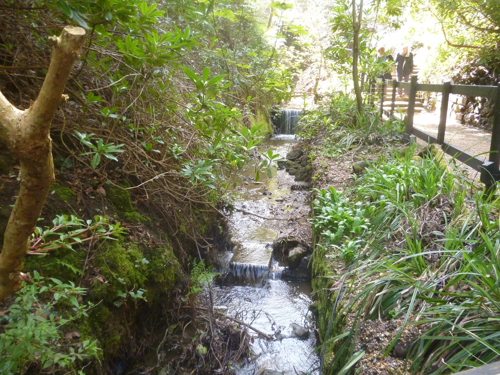
The city of Portsmouth occupies a rectangular island called Portsea Island, although it is easily accessible from the mainland via the road network. The city includes the seaside resort of Southsea, and it is a major hub for sea transport, with ferries linking the mainland not only with the Isle of Wight and the Channel Islands but also the coast of France and Spain. The port is also used by some cruise ships.  For people returning to the city by ferry, the most prominent sight that greets them is the Spinnaker Tower, an elegant 170-metre high tower in the style of a sail with magnificent views.

The western part of the island houses a naval base, and the Portsmouth Historic Dockyard including the National Museum of the Royal Navy, and three historic ships going back in time: HMS Warrior, dating from 1860, HMS Victory, launched in 1765, and Henry VIII's warship Mary Rose, which was raised from the seabed in 1982 watched by an anxious Prince Charles, who had closely followed the operation to bring the ship up from the seabed. There was a heartstopping moment when a steel frame supporting the vessel collapsed, but all was well in the end, and the ship is now on proud display to the public. The Dockyard was one of the locations used for the filming of Les Miserables.  Another maritime attraction which is bound to prove fascinating is the Explosion Museum of Naval Firepower.  One of Britain's most famous writers, Charles Dickens, was born in Portsmouth, and his birthplace is open to the public as a museum.

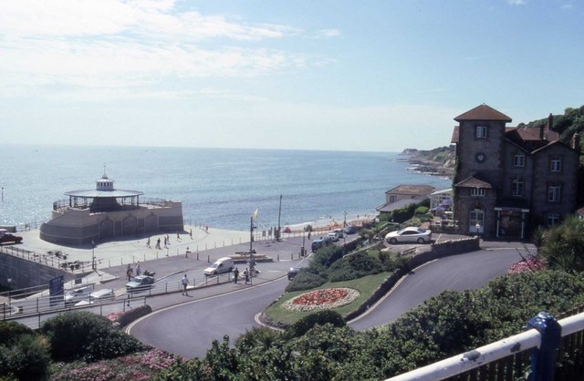
Southsea, meanwhile, is  home to the D-Day Story and the Blue Reef Aquarium.  Southsea Castle, built by Henry VIII in 1544, stands on the southern tip of the 'island' and offers displays on Tudor history and views out to sea at the eastern edge of The Solent.

For a list of events in Portsmouth, see here.

Webcam views of Portsmouth Harbour from HMS Warrior.

Map of the area.

https://upload.wikimedia.org/wikipedia/commons/7/70/Portsmouth_Harbour_from_Gosport_Haslar_Marina_3.JPG
Portsmouth Harbour from Gosport Haslar Marina 3. Photo by Editor5807, via Wikimedia Commons.

Tuesday 10 May 2011

FAREHAM/PORTCHESTER

Fareham is a market town which lies at the northwest corner of Portsmouth Harbour. The town dates back to the Norman era. In 2007, Baroness Thatcher, former Prime Minister of Britain, visited Fareham to unveil a commemorative arch to mark the 25th anniversary of the Falklands conflict. Many of the Task Force ships which took part in the conflict sailed from nearby Portsmouth.

Portchester is best known for Portchester Castle, formerly Portus Adurni, considered the finest example of a Roman fort in Western Europe, although it was also used by Britons, Saxons and Normans over the years. The walls of the original Roman fort, six feet thick, surround the remains of a Norman castle built by Henry II. It was here that Henry V marshalled his forces for the 1415 expedition to Agincourt. As well as a fortification, the castle has been used as a royal residence and as a prison.

Map of the area.

File:1229190-Portchester Castle.JPG
1229190-Portchester Castle. Photo by Johan Bakker, via Wikimedia Commons.


Monday 9 May 2011

GOSPORT

Gosport is not a very well known place on the British coast, but for somewhere so untrumpeted there are quite a few interesting spots to visit in the surrounding area. For a start, it hosts the Royal Navy Submarine Museum, where those who are not too subject to claustrophobia can step aboard real submarines to get an idea of what life on board these vessels is like. On the northern edge of Gosport is Fort Brockhurst, one of a number of forts built in the 1800s to protect Portsmouth and its harbour against a French invasion, and now owned by English Heritage. Meanwhile, on the western edge of the town, is Little Woodham, a recreation of a 17th century village taken from a time when the area was on the eve of Civil War, complete with “villagers” dressed in period costume on hand to answer questions and give an insight into the period.

In 2009 the British Parliament was in the grip of a scandal over the expenses claimed by its Members of Parliament. One of the most notorious examples of expenses abuse, so much so that it almost came to symbolise the whole expenses fiasco, was the example of a Scandinavian duck house which had been claimed for on expenses. The Member of Parliament responsible for this disgrace was none other than Sir Peter Viggers, MP for Gosport. Viggers stepped down in 2010 as a result of the investigation into MPs’ expenses.

Map of the area.

File:Approaching Gosport on a glorious morning in Late spring - geograph.org.uk - 1326417.jpg
Approaching Gosport on a glorious morning in Late spring - geograph.org.uk - 1326417. Photo by Basher Eyre, via Wikimedia Commons.

Sunday 8 May 2011

LEE-ON-SOLENT

Further along the Solent heading east is the small town of Lee-On-The-Solent, with a shingle beach backed by the seafront. The town was the home of Royal Naval Air Station HMS Daedalus, which has since closed, but an airfield remains here. It also has a rather unusual museum, the Hovercraft Museum, which has just held a Hovershow showcasing historic and modern hovercraft, seaplane displays and much more.

In 2006 the town hit the news when 900 homes had to be evacuated following the discovery of 30 unexploded Canadian pipe mines during repairs to the runway at Daedalus airfield. The mines were left over from World War II, when at one time there were 265 pipe mines on the airfield packed with 2,400 lb of gelignite. There is an interesting walk from Lee-On-Solent towards Gosport taking in an area known as Browndown, which is a former naval firing range, where there are still relics remaining from its former existence.

Map of the area.

File:Lee on Solent Beach - geograph.org.uk - 1106604.jpg
Lee On Solent Beach -0 geograph.org.uk - 1106604. Photo by Kevin Legg, via Wikimedia Commons.


Saturday 7 May 2011

HAMBLE/WARSASH

There are many eccentric traditions in Britain, including a lot of unusual sporting events. One of these takes place each year near Hamble, a village on the River Hamble, just off Southampton Water. The event is a cricket match between the local Royal Southern Yacht Club and the Island Sailing Club in Cowes which takes place annually on a sandbank called Brambles Bank in the middle of the Solent which once a year, when the tides are just right, dries out enough for such an activity to take place. Occasionally, however, the conditions fail to cooperate, as happened in 2008, when the cricketers found themselves playing with a foot of water splashing around them.

From Hamble there is a ferry across to Warsash, which is home to a Maritime Academy, as well as having a sailing club. A coastal path 4 miles long leads from here to Hill Head, taking in the Hook with Warsash Nature Reserve, which is frequented by birds such as oystercatchers, shelducks, linnets and meadow pipits. Hill Head is a former haunt of smugglers. To the east of Warsash is Titchfield Abbey, a ruined 13th century abbey with a four-storey Tudor gatehouse, owned by English Heritage.

Live webcam view of Hamble River.

Map of the area.

File:River-hamble-mouth-20040903-002.jpg
River-hamble-mouth-20040903-002. Photo by Ghouston, via Wikimedia Commons.


Friday 6 May 2011

RYDE

Ryde, the Isle of Wight town with the greatest number of inhabitants, is something of a transport hub. It has two connections to the mainland, by hovercraft to Southsea and by catamaran to Portsmouth Harbour. Having arrived at Ryde, there is then the possibility of an onward journey on the 8 ½ mile railway line linking Ryde with Shanklin, known as the Island Line. The town is a resort with an Esplanade, a swimming pool right on the sea front and the Canoe Lake. At low tide a large expanse of sand is revealed and there are sandbanks which cause occasional dramas when people get stuck on them as the tide starts coming in and they have to be rescued. The town became popular as a resort in the 19th century, and one particularly distinguished visitor was Karl Marx, who came for health reasons in 1874. Much later, in the 1960s the town was visited by John Lennon and Paul McCartney, and their trip to the town was the inspiration for their hit song “Ticket to Ride”. Visitors to the area may get the chance to try the award-winning Minghella ice cream. If this name rings a bell, it is because Mr. and Mrs. Minghella, the couple who make the ice cream, are the parents of an equally award-winning son, the late lamented Anthony Minghella, the director of The English Patient, which won nine academy awards, including for Best Picture. Ryde is also home to the Isle of Wight Bus Museum.

For events in the area, follow this link.

Live streaming webcam.

Map of the area.

Ryde from the pier

Thursday 5 May 2011

BEMBRIDGE

Bembridge is located at the extreme easternmost tip of the Isle of Wight. It used to be a virtual island before land reclamation rejoined it to the rest of the Isle of Wight. The village lends its name to a geological feature just offshore called the Bembridge Ledge, a rocky shelf which is only revealed at low tide, when it turns into a haven for people who love poking about in rockpools. Those who have come unprepared can purchase equipment such as nets and crabbing lines at the nearby cafe. A wide variety of creatures can be found in the rockpools, such as limpets, crabs and prawns, and proper sea fishing can be indulged in from the ledge itself, with the opportunity to catch bass, mullet and eels. The prawns found here are a species which seems to be particular to this area. On the outskirts of the village is the only surviving windmill on the Isle of Wight, now owned by the National Trust. It was built around 1700 and ceased operation in 1913. Visitors can climb to the top and learn about the milling process; most of the machinery is still intact.

Map of the area.

File:Bembridge Harbour 2.JPG
Bembridge Harbour 2. Photo by Editor5807, via Wikimedia Commons.

Wednesday 4 May 2011

SHANKLIN AND SANDOWN

Shanklin and Sandown appear as one place on the map, as they run into one another, but each has its own character. Shanklin has its own chine, and at the top of the chine is Old Shanklin, a picture postcard village complete with quaint thatched cottages. By contrast, the lower town has the appearance of a typical resort, with an esplanade lined by hotels and restaurants. A cliff lift is available for whisking people up to the top of the cliff. The poet Keats came to Shanklin for health reasons, staying at Eglantine Cottage in the High Street. Shanklin Chine, unlike its brash cousin along the coast, Blackgang Chine, is given over to nature lovers, with waterfalls, lush vegetation and pathways to facilitate exploration.

Sandown is a full-blown resort with all the bells and whistles. As well as the obligatory pier and promenade lined with restaurants, hotels etc., there is crazy golf, pitch and putt, tennis and bowls. Sandown is also the location of the Isle of Wight Zoo, which specialises in big cats. And if these magnificent animals are not enough to satisfy the budding zoologist, there is another attraction called the “Dinosaur Isle” (the big cats are real, the dinosaurs, sadly, are not). Sandown can be reached from Shanklin by means of a lovely clifftop walk.

For events on the island through the year, see here.

Live streaming webcam view of the coast at Shanklin from Haven Hall.

Map of the area.

Shanklin Chine

Tuesday 3 May 2011

VENTNOR

Ventnor was established as a seaside town by the Victorians, and in 1883 Henry Irwin Jenkinson, in his “Practical Guide to the Isle of Wight”, described it as “one of the most popular and best-known watering-places in the south of England”. It has a special character borne out of its position on the “Undercliff”, a product of the landslides which occur periodically in these parts. The town tumbles down the face of the Undercliff towards the Esplanade and beach in a manner that gives it an almost continental air. The unique environment of the Undercliff also contributes to the exceptionally mild climate enjoyed by this resort. A walk along the Esplanade brings you to Ventnor’s famous Botanical Gardens, consisting of 22 acres of subtropical vegetation.

There are many gracious buildings in Ventnor, and for many years a focal point of the town was the art deco Winter Gardens. This entertainment venue in its heyday saw performances by the likes of David Bowie and The Who, but recently became a victim of the recession when it closed after 75 years with the loss of 15 jobs. However, very recently it was revealed that there is a plan for a multi-million pound revamp of the venue, thanks to a michelin-starred Isle of Wight chef. The new venue would offer two restaurants, hotel accommodation and a multi-use cinema and theatre.

Postscript: The revamp is now complete. Visit the Winter Gardens website to find out more.

Map of the area.


File:Looking down on Ventnor (1) - geograph.org.uk - 1247731.jpg
Looking down on Ventnor (1) - geograph.org.uk - 1247731. Photo by Barry Shimmon, via Wikimedia Commons.


Monday 2 May 2011

ST CATHERINES POINT

This headland at the most southerly tip of the Isle of Wight now houses a much needed lighthouse. Much needed because before the lighthouse was built in 1840 the sea around here was a graveyard for ships. Between 1748 and 1808 there were on average ten ships a year coming to grief here. There are guided tours of the lighthouse in the summer. There is a nice walk to the point starting from the nearby village of Niton and taking in Knowles Farm, where the inventor Marconi set up an experimental station in 1900. From here the following year, he made contact with the Lizard Radio Telegraph Station at Bass Point in Cornwall. All that remains of the station now is the concrete base of the communication mast. There are wonderful views from the cliff top, taking in the surrounding landscape and the white buildings of the lighthouse. It is worth taking binoculars for the birdlife which is to be found here, which includes peregrine falcons and fulmars.

Map of the area.

File:St Catherine's Lighthouse entrance.JPG
St Catherine's Lighthouse entrance. Photo by Editor5807, via Wikimedia Commons.


Sunday 1 May 2011

BLACKGANG CHINE

One of the features of this stretch of coast on the Isle of Wight is the series of “chines”, or steep wooded valleys running down to the sea. These include Brook Chine, Whale Chine, Shanklin Chine and the one my parents and I visited during our trip to the island, Blackgang Chine. As I child, I rememeber being captivated by this spot, with its quirky features including a “gnome garden” a crooked house, and a maze. So I paid a visit to the Chine’s official website to catch up with the place, and it would appear that – as with the Needles, see earlier post – it has changed beyond recognition. The gnomes et al have been joined by a series of rides, an “Animated Indoors”, and themed areas Nurseryland, Dinosaurland and Fantasyland. As might be expected, this has attracted mixed reviews on travel review sites such as Tripadvisor.

Blackgang Chine was a very different place in the early days, the preserve of fishermen and, allegedly, smugglers. It was during Victorian times that this spot attracted the attentions of the growing number of tourists, prompting the establishment of attractive gardens, and it was after this that the other “attractions” began to be added. Blackgang Chine has developed a reputation among followers of the paranormal as a place rich in ghost sightings. In August 2008 the local paper carried a story about the sighting of the ghost of a little girl, which was captured on camera. However, among the reader responses to the story was one claiming that the “ghost” was simply one of the Chine’s characters, Little Miss Muffet, captured in such a way that she resembled a ghost! Oh well, there’s always the Haunted Mansion, one of the park’s amusements, to satisfy the thirst for the paranormal.

Map of the area.

Blackgang Chine water gardens. Photo by Chalkietom, via Wikimedia Commons.