Labels

Aberdeenshire (21) Angus (4) antiquities (87) Argyll and Bute (35) Arran (7) art (37) birds (231) bridge (9) Caithness (12) Carmarthenshire (5) castle (164) Ceredigion (9) Channel Islands (13) Cheshire West and Cheshire (1) City and County of Swansea (1) City of Bristol (2) City of Edinburgh (4) Conwy (8) Cornwall (74) County Antrim (19) County Down (23) County Durham (3) County Londonderry (4) Cumbria (19) Denbighshire (2) Devon (48) diving (9) Dorset (18) Dumfries and Galloway (22) Dundee City (1) East Lothian (6) East Sussex (16) East Yorkshire (6) English Riviera (3) Essex (17) Fife (19) Flintshire (1) food (12) fossils (14) gardens (28) Ghosts (36) Glamorgan (1) Gower (7) Guernsey (4) Gwent (1) Gwynedd (19) Hampshire (13) Highland (72) Inner Hebrides (42) Inverclyde (5) Islay (8) Isle of Anglesey (14) Isle Of Man (7) Isle Of Wight (10) Isles of Scilly (3) Jersey (7) Kent (22) Lancashire (8) Lewis and Harris (7) lighthouse (62) Lincolnshire (8) Merseyside (8) Mid Glamorgan (1) mining (23) Moray (10) Mull (8) Norfolk (21) North Ayrshire (13) North Yorkshire (12) Northern Ireland (45) Northumberland (17) Orkney (10) Outer Hebrides (14) Pembrokeshire (27) pubs (50) Ross and Cromarty (20) Scotland (299) Scottish Borders (3) Shetland (14) shipwrecks (42) Skye (12) smuggling (48) Somerset (9) South Ayrshire (6) South Glamorgan (5) South Gloucestershire (2) Suffolk (18) surfing (92) Sutherland (16) Tyne and Wear (8) Wales (93) wartime (75) webcams (232) West Dunbartonshire (3) West Glamorgan (9) West Sussex (9)
Showing posts with label Jersey. Show all posts

Saturday, 2 April 2011

ST AUBIN

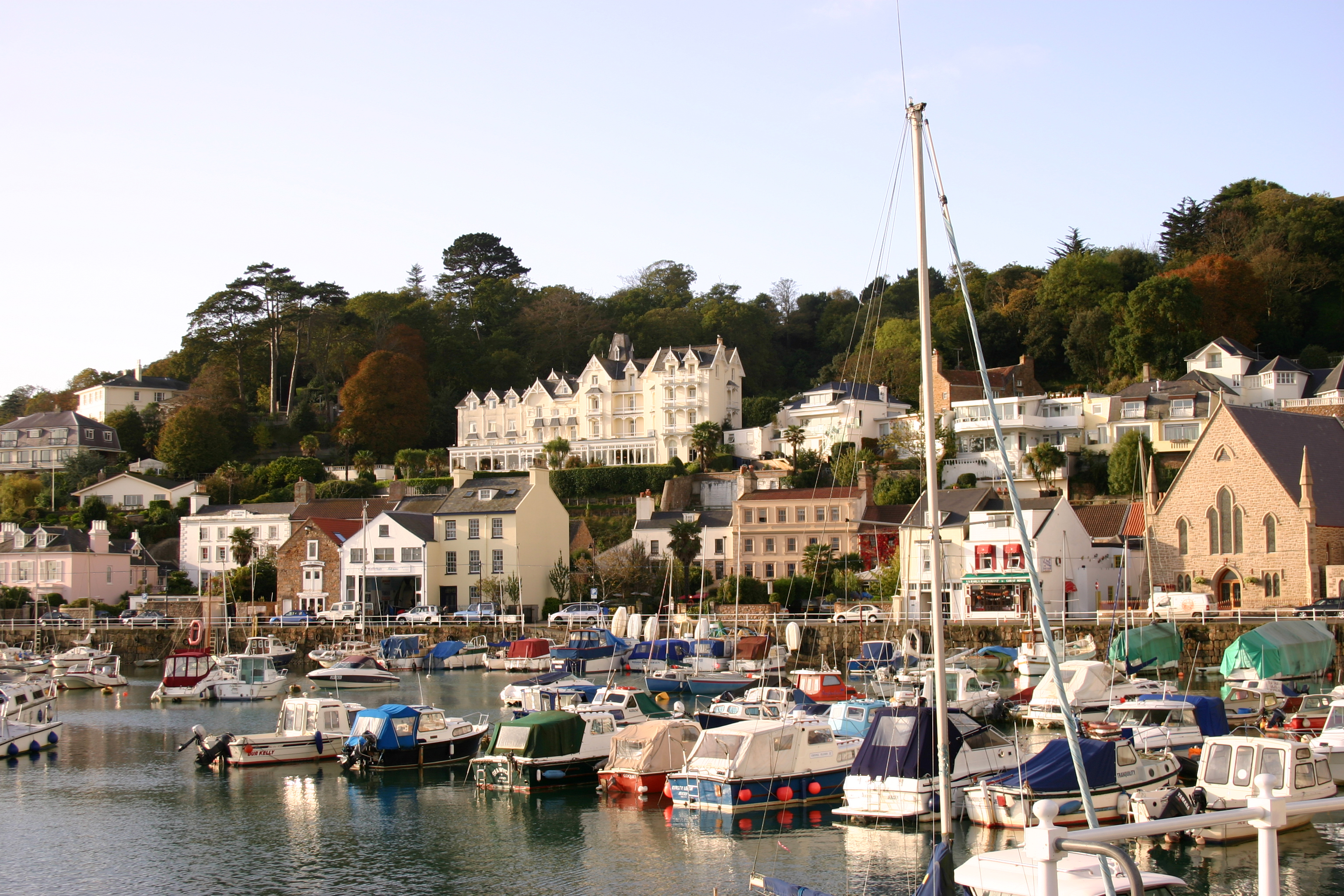
St Aubin is at the opposite end of the bay from the island’s capital. It forms part of the parish of St Brelade, and in fact the Parish Hall is located in St Aubin, in a former railway station. The railway line which used to go from here is now closed; for a time during the war it was used by the occupying German forces, but closed soon after. Like many former railway lines in Britain, it has been converted into a walking trail, linking St Aubin with Corbiere, a distance of 6km. As well as the wonderful plantlife and trees which can be enjoyed along this trail, if you are lucky you may glimpse the odd red squirrel.

A few miles inland from St Aubin is probably Jersey’s most memorable wartime site, the War Tunnels, which were built into the hillside and used as a barracks and for storing ammunition. Exhibits inside paint a fascinating picture of what life on Jersey was like during the German occupation. 

Live streaming webcam view from Panorama Guest House.

Map of the area.


File:St Aubin Jersey.jpg
St Aubin Jersey. Photo by Marilyn Peddle, via Wikimedia Commons.


Friday, 1 April 2011

ST BRELADE/PORTELET BAY

St Brelade’s Bay has a big, sweeping crescent shaped beach lined with hotels, restaurants and cafes. Overlooking this enticing scene is the St Brelade parish church, which has alongside it the Fishermen’s Chapel, which, dating from the 11th century, is older than the church. During restoration work frescoes from the 14th century were discovered in the chapel, the one in best condition depicting The Annunciation.  The parish of St Brelades is named after a Welsh saint, allegedly the son of Kenen.

Such is the appeal of the nearby highly picturesque Portelet Bay that it is often used in promotional material for Jersey tourism. The golden sandy beach is lovely, but escapes the worst crowds due to the long descent down via steps. Of course what goes down must come back up, but there is a pub at the top with lovely views where any thirst brought on by the climb can be quenched. There is a large rock just off the beach reachable by a short causeway – a kind of baby St Michael’s Mount – with a small martello tower on top dating from 1818. There is a sad story attached to this island, which is called l’Ile au Guerdain, or Janvrin’s tomb. Philippe Janvrin was a local seaman who in 1721 died of plague while out at sea. Due to the hysteria surrounding this particular disease the locals would not allow the body on land, but instead allowed it to be buried on the island, although it was later moved to nearby St Brelade.

Map of the area.

File:L'Île au Guerdain Jersey.JPG
L'Ile au Guerdain Jersey. Photo by FoxyOrange, via Wikimedia Commons.


Thursday, 31 March 2011

ST OUEN'S BAY

This bay, on the west coast of Jersey. has a vast sandy beach stretching for 5 miles from end to end which is very popular for surfing due to the fact that it is right in the line of fire of the westerly winds which prevail here. There are many relics of the German wartime occupation dotted around Jersey, and several of them can be found in St Ouen’s Bay. At La Carriere there is a twin bunker complex housing a tank turret, railway truck and searchlight. At Val de la Mar there is a heavy machine-gun turret bunker, and there are gun emplacements and underground bunkers at Les Landes. These and the other wartime relics on the island are lovingly cared for by a voluntary society called the Channel Islands Occupation Society. Whether or not you are interested in the history of the Second World War, they make a different sort of tourist sight. An earlier relic in this part of the island is the Kempt Tower, a martello tower dating from 1834, which is now an interpretation centre for Les Mielles conservation area

Live streaming webcam view of the bay.

Map of the area.


File:St Ouen's Bay, Jersey.jpg
St Ouen's Bay, Jersey. Photo by Man vyi, via Wikimedia Commons.


Wednesday, 30 March 2011

BONNE NUIT BAY

There are a number of theories about the origins of the name Bonne Nuit Bay, or “Good Night Bay”. One version suggests that it was so named because of the shelter it offered to sailors overnighting there. Another claims that Charles II, on leaving the island from this bay before it came under Cromwellian control at the end of the Civil War, exclaimed “Bonne nuit belle Jersey”. However, the latter version is blown out of the water by the fact that the name Bono Nocte was recorded as early as the 12th century, having a medieval chapel as its origin. Whatever the reason for this rather charming name, the bay is a beautiful stretch on the north coast of Jersey, between the headlands of Frémont and La Crête. It is ideal for walkers, who have a choice of paths to wander along and admire the views out to sea. There is a distinctive little round stone building on La Crête which was once intended as a fortification, but is now available as a holiday let.

Map of the area.

File:Bonne Nuit Bay.jpg
Bonne Nuit Bay. Photo by Andy Hawkins, via Wikimedia  Commons.


Tuesday, 29 March 2011

ROZEL/BOULEY BAY

Rozel is a picturesque little beach village in the north-east of the island of Jersey. As well as being a lovely spot to go for a swim, it also makes a great lunch spot, being the home of a famous cafe called The Hungry Man, a colourful little kiosk with outside tables on the harbour wall. This spot is also known for its friendly ducks, and if you’re lucky they may accompany you on your swim. Rozel is a popular base for sea kayaking.

For walkers, there is a path starting at Rozel which stretches along the whole length of the north coast as far as Grosnez. The first bay along the route is Bouley Bay, which is reputed to be haunted by a big black dog with eyes the size of saucers. The sound of its chains dragging along the ground would precede a vision of the beast itself, which terrifies its victims by circling round them at great speed. Funnily enough, Bouley also has a history of smuggling, so one can’t help but wonder whether this is another instance of a ghost story being made up to keep prying eyes away from the activities of the smugglers.

Map of the area.


File:Rozel Jersey 2015.jpg
Rozel Jersey 2015. Photo by Unukorno, via Wikimedia Commons.


Monday, 28 March 2011

GOREY

The picturesque small harbour town of Gorey is just 30 kilometers from the coast of the Cotentin Peninsula as the crow flies, and as such was right in the line of fire during the wave of invasions by the French. This is surely the reason for the building of the impressive castle of Mont Orgueil which towers above the town, and which has served as protection for the island since the early 13th century. The site had in fact already been fortified long before that, since prehistoric times. The main part of the town, nestling at the foot of the castle, forms a row of harbourside buildings in an attractive palette of pastels, many housing enticing restaurants, pubs and hotels.

Each year in August, Gorey hosts one of the biggest events in Jersey, the Gorey Fête, which is a merry whirl of live music, beach-based games and competitions, eating and drinking, fireworks and a funfair. Another popular festival, for seafood fans, is the Fête de la Mer in May, while in June there is a regatta.

Map of the area.

File:Gorey Jersey Mount Orgueil and Harbour.jpg
Gorey Jersey Mount Orgueil and Harbour. Photo by Unukorno, via Wikimedia Commons.


Sunday, 27 March 2011

ST HELIER

St Helier is the main town on Jersey, the largest island of the Channel Islands. It lies at the eastern end of a lovely bay called St Aubin’s Bay. The town’s name originates from the name of an abbey which was built on a tidal island just offshore. The abbey has since been replaced by a castle called Elizabeth Castle, named after Queen Elizabeth I by Sir Walter Raleigh, who was Governor of Jersey at the time. However, the town’s earlier origins are believed to date back to Roman times.

It is impossible to visit the Channel Islands without coming across stories about what happened there during the Second World War, when they were subjected to a Nazi occupation. One of the reminders of this time in St Helier is a square called Liberation Square, which was the scene of great rejoicing when the occupation ended. There is a sculpture in the square which was erected in 1995 for the 50th anniversary of the liberation. Seemingly in imitation of the Bayeux Tapestry for which their near neighbours the French are famed, the local people produced a 12-panel Occupation Tapestry, also in commemoration of the 50th anniversary, which is housed in the Maritime Museum. There were plenty of earlier conflicts which took place here, not surprisingly involving the French, given the proximity to France. Another square in St Helier called Royal Square, which houses a statue of George II, was the scene of the last attempt by the French to seize Jersey during the Battle of Jersey in 1781. Happily, those turbulent times are now easily forgotten as one takes pleasure in the continental atmosphere and benign climate which reign supreme here.

One of the most spectacular annual events in Jersey is the Battle of Flowers, which takes place in August. For more events on Jersey, see here.
Map of the area.

File:St Helier Views.jpg
St Helier Views. Photo by Amanda Slater, via Wikimedia Commons.