Labels

Aberdeenshire (21) Angus (4) antiquities (87) Argyll and Bute (35) Arran (7) art (37) birds (231) bridge (9) Caithness (12) Carmarthenshire (5) castle (164) Ceredigion (9) Channel Islands (13) Cheshire West and Cheshire (1) City and County of Swansea (1) City of Bristol (2) City of Edinburgh (4) Conwy (8) Cornwall (74) County Antrim (19) County Down (23) County Durham (3) County Londonderry (4) Cumbria (19) Denbighshire (2) Devon (48) diving (9) Dorset (18) Dumfries and Galloway (22) Dundee City (1) East Lothian (6) East Sussex (16) East Yorkshire (6) English Riviera (3) Essex (17) Fife (19) Flintshire (1) food (12) fossils (14) gardens (28) Ghosts (36) Glamorgan (1) Gower (7) Guernsey (4) Gwent (1) Gwynedd (19) Hampshire (13) Highland (72) Inner Hebrides (42) Inverclyde (5) Islay (8) Isle of Anglesey (14) Isle Of Man (7) Isle Of Wight (10) Isles of Scilly (3) Jersey (7) Kent (22) Lancashire (8) Lewis and Harris (7) lighthouse (62) Lincolnshire (8) Merseyside (8) Mid Glamorgan (1) mining (23) Moray (10) Mull (8) Norfolk (21) North Ayrshire (13) North Yorkshire (12) Northern Ireland (45) Northumberland (17) Orkney (10) Outer Hebrides (14) Pembrokeshire (27) pubs (50) Ross and Cromarty (20) Scotland (299) Scottish Borders (3) Shetland (14) shipwrecks (42) Skye (12) smuggling (48) Somerset (9) South Ayrshire (6) South Glamorgan (5) South Gloucestershire (2) Suffolk (18) surfing (92) Sutherland (16) Tyne and Wear (8) Wales (93) wartime (75) webcams (232) West Dunbartonshire (3) West Glamorgan (9) West Sussex (9)
Showing posts with label Ross and Cromarty. Show all posts

Sunday, 2 September 2012

PLOCKTON

The 'Plock' in Plockton derives from the Gaelic word 'ploc' which means a "lumpish promontory". The promontory in question is at the seaward end of Loch Carron, on which this picturesque village stands, looking improbably riviera-esque due to the palm trees which are allowed to thrive here thanks to the North Atlantic Drift. With its idyllic setting, looking out on a landscape of mountains, islands, heather and pine trees, the village is, not surprisingly, a magnet for artists. Just across the way from the village is Duncraig Castle, which was built by the Matheson family from the proceeds of trading activities in China. The castle is currently being renovated, but when the renovations are completed next year it will offer elegant guest accommodation.

Plockton may be recognised by many as the backdrop for the beat of TV cop Hamish Macbeth. The TV series led to a surge in popularity due to the numbers of fans of the series visiting the village. However, as is so often the case, this phenomenon has led to a sharp rise in property prices in the locality. According to a report by scotsman.com in 2002, both well-heeled British people and Americans were offering well over market price for houses in the area, placing them beyond the reach of most locals, and a recent survey had revealed that over a third of homes here were owned by outsiders and being used as holiday homes. Coming from Cornwall, I can sympathise with the plight of the local residents.

Map of the area.


Tuesday, 28 August 2012

ATTADALE

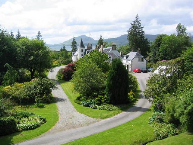
Like Poolewe further to the north, Attadale has a treat in store for garden lovers, in the form of the fabulous Attadale Gardens, a colourful 20 acres of rhododendrons, Himalayan primula and other exotic plants set in a beautiful location with lovely views across the loch, with the peaks of Skye visible in the distance.  The gardens, which also feature a sculpture collection, form part of a 30,000 acre estate belonging originally to the Clan Matheson, with as its focal point a house built in 1755. Fans of the TV series Hamish Macbeth may experience a deja vu moment when visiting the house, as it was used in the series. There is not a lot more to Attadale, but it does have a tiny railway station, being on the Inverness-Kyle of Lochalsh railway line.

Map of the area.


File:Attadale House and Gardens by Loch Carron - geograph.org.uk - 68846.jpg
Attadale House and Gardens by Loch Carron - geograph.org.uk - 68846. Photo by David Crocker, via Wikimedia Commons.


Sunday, 26 August 2012

LOCHCARRON

One of the many legends and mysteries around the coast of Scotland concerns a wise woman who lived at the head of Loch Carron. Such were her powers of healing that a person only had to present her with a piece of clothing belonging to the sick individual, which she would work her magic on, resulting in a miraculous recovery. However, there was an unfortunate side effect for the woman, who herself became very ill for several days afterwards. People came from miles around to avail themselves of her services.

The village of Lochcarron, which lies strung out on the shores of the loch, started out as a much smaller settlement known as Janetown, but it grew dramatically in size due to the arrival of people displaced by the Highland Clearances. The area to the north of the village, known as Kirkton, is the location of a small, whitewash church built in 1883, and there is also a ruined church and graveyard dating from 1751. Walking is a favourite activity around here, as well as wildlife watching, with plenty of opportunities to combine the two. Otters, pine martens and deer are just some of the creatures the patient walker might encounter.


Map
of the area.

Lochcarron - geograph.org.uk - 8142. Photo by Anne Burgess, via Wikimedia Commons.


Friday, 24 August 2012

APPLECROSS

Applecross, which lies on a peninsula bearing the same name, has as its origin a monastery which was established by the Irish monk Maelrubha in 673. The area around the monastery was made into a sanctuary, hence the gaelic name of the village, a'Chomraich. The village was a good choice for a sanctuary, with its location on a sheltered bay, surrounded by wooded hills. You know you are in for something special in Applecross on the approach to the village, which is reached via Bealach Na Ba ('Pass of the Cattle'), the highest mountain pass in Britain, a highlight for anyone undertaking the North Coast 500 scenic route. The journey over the pass is rewarded with spectacular views of Raasay and Skye as well as the mountains of the mainland.

The weather can be savage in this part of Scotland but shelter from the worst that the elements can throw at the visitor can be found in a couple of cafes, one forming part of a Walled Garden, as well as the acclaimed Applecross Inn, renowned for its food, and also offering accommodation. There is a campsite for hardier types, while those wanting to brave the great outdoors will find sea kayaking, mountain walking and other outdoor activities.  Just outside the village is the Applecross Heritage Centre, which keeps a collection of artefacts and archives from the local area.


Map of the area.


Monday, 20 August 2012

TORRIDON

The village of Torridon within the area of the same name is a tiny settlement close up, but from a distance it appears positively minute set against the enormous backdrop of the Liathach mountain. Beinn Alligin and Beinn Dearg are two other peaks contributing to the dramatic scenery surrounding the village, with the mountains rising up to 3,500 feet above the lochs. Walking is a favourite pastime here, and the Countryside Centre, run by the National Trust for Scotland, has plenty of information on walks in the area. The estate where the centre is located is also home to a Deer Museum, and herds of red deer and Highland cattle can be viewed nearby, while the loch is frequented by otters and seals. Birdwatchers should keep an eye out for sea eagles and golden eagles.

Life in Torridon has not always been so idyllic. The area suffered particularly badly during the Highland Clearances at the hands of one Colonel McBarnet who, not content with having exploited workers at his plantation in the West Indies, moved on to kicking out the local populace of Torridon, forcing them to move to inferior land at the head of the loch. However, better times came with the sale of the estate to Duncan Darroch, who was responsible for introducing the deer to the area and gave evicted tenants their land back. There is a memorial stone by the roadside erected by Darroch's widow in 1921 with an inscription which makes reference to the "devotion and affection shown by one hundred men on the estate of Torridon".

Map of the area.

View northwest from below Carn Dhonnachadh - geograph.org.uk - 694215. Photo by Nigel Brown, via Wikimedia Commons.


Friday, 17 August 2012

GAIRLOCH

Glancing through the news archives for Gairloch, a headline from 1961 caught my attention: ""Terrorists" beaten back at Gairloch". Intrigued that such a dramatic event should have taken place in an idyllic spot on the west coast of Scotland, I clicked through to the article, but it turned out to be an exercise involving nearly 500 officer cadets from Sandhurst. The exercise had the "terrorists" landing on the shore with the aim of inciting the locals to riot, while being dealt with by troops aided by army helicopters. The exercise must have toughened the cadets up quite considerably, as the weather was atrocious and they were forced to spend much of their time out in the open. No doubt the proceedings provided a considerable amount of excitement for the residents of this sleepy community.

Loch Gairloch is one of a series of bays and sea lochs along this stretch of coast, with Gairloch itself consisting of several communities strung out along the shores of Strath Bay. Settlement here dates back at least to the Iron Age, and the remains of a fort from that time still occupy a headland near the Golf Club. Later, the Vikings arrived and used the loch as a haven. The area is now owned by the Mackenzies, who were granted the land by King James IV in 1494. Gairloch used to have an important cod fishing industry, with a large proportion of the catch being dried at Badachro on the south side of the loch for export to Spain. Now there are only a few fishermen left, while some boat owners have turned their attention to tourism, with wildlife viewing and fishing trips on offer. Gairloch has its own heritage museum, where one of the exhibits is a Pictish stone with a salmon carving, found here in 1880.

Map of the area.


Gairloch, Strath Bay - geograph.org.uk - 2229942. Photo by Ken Bagnall, via Wikimedia Commons.

Wednesday, 15 August 2012

POOLEWE

The sea loch known as Loch Ewe has something in common with Gruinard Bay to the north, in that it has an island in the middle of it, the Isle of Ewe. The views across the loch are enhanced by the dramatic backdrop of the mountains just inland. The River Ewe flows into the loch at Poolewe, an attractive village with neat little whitewash houses at the head of the loch. The main attraction hereabouts is the spectacular Inverewe Garden. Visitors to the garden could be forgiven for thinking they had been teleported to Cornwall, as the plants here have more in common with the gardens of the south west than anything normally found in Scotland. It is thanks to the North Atlantic Drift that such subtropical beauties as rhododendrons, azaleas and exotic border plants are able to thrive here. Naturally, summer is the most colourful time to visit the garden, but autumn brings its own reward, when the treasures on view include Agapanthus and Watsonias, natives of South Africa. The wildlife in the area around Poolewe includes seals, otters, pine martens and sea eagles.

Map of the area.

Inverewe Gardens. Photo by Tom Pennington, via Wikimedia Commons.


Monday, 13 August 2012

GRUINARD BAY

Gruinard Bay is a north-facing bay with the small Gruinard Island in the middle. There are several beaches on the east side of the bay, at Mungasdale, at the mouth of the Gruinard River and at Little Gruinard. Along this stretch of the bay is Gruinard House, with a lovely garden which is occasionally open to the public on certain dates in aid of charity. Further round towards the west is the small settlement of Laide, notable for its ancient chapel and cemetery overlooking a small sandy beach. The chapel is believed to date originally from medieval times, with restoration work carried out in 1713. There may have been an even earlier place of worship on the site built by St Columba. Further round still is Mellon Udrigle, from where a path leads to the fabulous Camas a'Charaig beach, an expanse of white sand backed by dunes offering spectacular views of the mountains to the north, including the mighty Suilven near Lochinver.

Map of the area.


Gruinard Bay Panorama - October 15th 2012. Photo by Synchronium, via Wikimedia Commons.

Sunday, 15 July 2012

ULLAPOOL

Ullapool is a picturesque little fishing town on the shores of Loch Broom comprising mainly whitewashed buildings, giving it a strikingly brilliant appearance from afar. The town was designed by Thomas Telford, in collaboration with the British Fisheries Society. Fishing remains an important economic mainstay of the town, although it has had its ups and downs over the years. At one time the loch was used as a base for Russian and East European factory trawlers known as "klondykers", whose crew members used to arrive in the town in August each year for a stay lasting several months.

Ullapool makes a good base for touring the area, with a range of shops, pubs and accommodation options. The Ullapool Museum and Visitor Centre has displays on the history of the town and surrounding area, known as Wester Ross, as well as research facilities. For those wanting to venture away from the mainland, Ullapool is the main departure point for the ferry to Stornoway, capital of the Isle of Lewis. For shorter boat trips, the Summer Queen offers cruises to Loch Broom and the Summer Isles.

Map of the area.

Ullapool sun. Photo by Paul Hart,via Wikimedia Commons.


Friday, 13 July 2012

ACHILTIBUIE

Heading south from Lochinver the Inverpolly National Nature Reserve makes a spectacular diversion, with mountain walks and trails through the reserve's diverse habitats. Knockan Crag National Nature Reserve also has a Visitor Centre. The road leading down towards Ullapool is regarded as one of the most beautiful in the country, and was a favourite of Wainwright, who dubbed it the "wee mad road of Sutherland". The village of Achiltibuie overlooks the uninhabited Summer Isles, and boat trips around the islands can be arranged, with the opportunity to view wildlife including grey seals and gannets. There is a range of accommodation in the village from the Summer Isles Hotel with its fine dining down to the Youth Hostel for those watching their wallets. Achiltibuie's most unusual visitor attraction must be its Hydroponicum, where plants are grown using the "hydroponics" technique, that is to say they are grown without the use of soil, instead using nutrient solutions. Visitors who want to try the technique for themselves can buy a variety of kits and accessories. On the shore of the nearby Badentarbat Bay there is a water-powered corn mill dating from the 19th century, and nearby is the Coigach Free Church.

Map of the area.

Achiltibuie - geograph.org.uk - 7287. Photo by Anne Burgess, via Wikimedia Commons.


Sunday, 11 March 2012

TAIN

Tain is the oldest Royal Burgh in Scotland, having been granted its first royal charter in 1066. In 1966 a rose garden was planted with 900 roses to commemorate the 900th anniversary of the charter. Somewhat earlier, around the 8th or 9th century, St Duthus, or Duthac, was born there and a ruined chapel near the shore of Dornoch Firth is believed to be the site of his birth. St Duthus Collegiate Church was built in the town between 1370 and 1458 to house the Saint's shrine, and Tain became an important place of pilgrimage; visitors to the shrine included James IV. During the Second World War, there was a large military presence in the town, and in nearby Inver, which was used as as a training ground. There were once five airfields in the area, but now only RAF Tain remains, which is used for weapons training for other RAF bases.  A short distance to the north of the town is one of Scotland's best known distilleries, Glenmorangie.

The town's long history, which included the burning of the church during a clan feud, the capture of Robert the Bruce's family by the English and the presence of Bonnie Prince Charlie's troops in the area, is explained in the District Museum, which also houses the Clan Ross Centre. The town's turretted Tollbooth, built between 1706 and 1733, makes an impressive sight; it was built as a prison and to safeguard the town's charters and arms. Tain is noted for its crafts, which include silverware and pottery. Tain Golf Club offers lovely views over the Dornoch Firth. Every year at the end of June/beginning of July, the town holds a gala which includes air displays, pipe bands and other "fun for all the family" events. In August it is the turn of the Tain Highland Gathering, whose games events include the enigmatically named Heavies during which competitors vie for the British Championship Medals for Light and Heavy Hammers. This video gives an idea of the jollities on offer, which also include highland dancing.

Map of the area.

Tain 01. Photo by Postdlf, via Wikimedia Commons.


Thursday, 8 March 2012

TARBAT NESS AND PORTMAHOMACK

Tarbat Ness is a narrow strip of land which sticks out into the sea like a human finger making a rude sign. The headland is topped off with the third tallest lighthouse in Britain at 174 feet, a slender, red-and-white striped affair built by Robert Stevenson in 1830. The headland is an important landfall area for birds migrating from Scandinavia. There is a cliff nearby known as Creag nan Eun, or the Cliff of Birds, where breeding seabirds can be observed in the Spring. To the south-west of the Ness, the ruins of the 16th century Ballone Castle stand on a clifftop overlooking the Moray Firth.

Portmahomack is a fishing village on the landward side of the peninsula where the main economic activity consists of catching prawns, lobsters and scallops. The village is home to the Tarbat Discovery Centre museum, which includes a lot of information about the Picts.  In 1989 a writer of Victorian detective stories called Anne Perry moved to the village, later followed by her mother, and the two women came to be respected members of the community. It was not until later that the villagers discovered that Anne had a past: her real name was Juliet Hulme, and she had been convicted of murder in New Zealand after she and a friend had conspired to kill her friend's mother. When the word got out among the villagers, rather than ostracising Anne, they lavished her with kindness, recognising that she was truly sorry for what she had done. Anne's story was immortalised in a 1994 film called Heavenly Creatures.

Map of the area.

Tarbat Ness - geograph.org.uk - 8541. Photo by Anne Burgess, via Wikimedia Commons.

Monday, 5 March 2012

SHANDWICK AND BALINTORE

Just to the south of Balintore, the tiny village of Shandwick is most notable for a beautiful carved Pictish cross-slab which stands nearby called Clach a'Charridh. The stone's carvings depict angels, warriors, hunting men and animals, and it has been encased in glass to protect it. The name of the village is an indication that the Picts were displaced by Vikings, having as its origin the Norse sand-vik or sand bay.

Balintore's harbour was built in the late 19th century; up to that time boats were pulled up onto the beach. A walk over the cliff tops towards Nigg can offer the possibility of spotting the local dolphins as well as enjoying wonderful views of the Moray Firth. A walk in the other direction will take you to the Mermaid of the North, a nod to the more famous Copenhagen one.  Another notable Pictish carved stone is the Hilton of Cadboll Stone, originally located at the village of the same name near Balintore next to an ancient chapel called Our Lady's Chapel. However, this one has been removed for safekeeping at the Royal Museum of Scotland in Edinburgh.

Map of the area.

Shandwick 'Pictish Cross' - geograph.org.uk - 260334. Photo by Stanley Howe, via Wikimedia Commons.


Friday, 2 March 2012

NIGG

Nigg lies on Nigg Bay near the mouth of the Cromarty Firth. The village faces Cromarty and there is a ferry linking the two during the summer which carries 4 cars and 50 passengers. The village is most notable for a 9th century carved Pictish stone called the Nigg Stone, housed in Nigg Old Church, which, though dating from the 18th century, stands on a site going back to at least the 8th century. The stone is considered to be one of Scotland's greatest art treasures. The bay, which is an RSPB reserve, consists of mudflats, salt marsh and wet grassland. Springtime is the time to come for pink-footed geese and skylarks, while summer brings large numbers of breeding birds such as lapwings and redshanks. From the reserve it is possible to walk over the cliffs to North Sutor, where what remains of the 12th century Dunskeath Castle can be found a mile to the east of Nigg Ferry. Starting out as a motte castle, it was fortified by King William the Lion in 1179. The castle, as well as recalling countless conflicts from the far past, has a reminder of a more recent conflict in the form of a gun emplacement from the Second World War.

Map of the area.

Nigg Ferry Pier - geograph.org.uk - 19216. Photo by Bob Jones, via Wikimedia Commons.

Wednesday, 29 February 2012

INVERGORDON

Does this scenario sound familiar? The Government of the day, in an attempt to deal with harsh economic conditions, imposes swingeing cuts in public spending. Public sector workers find themselves hit particularly hard, and even the military are not spared, with the Navy facing a 10% cut. But hold on a minute: this is not 2012 we are talking about, but 1931, during the Great Depression. When the news of the cuts reached the crew of the Atlantic Fleet as they arrived at Invergordon the result was the infamous "Invergordon mutiny", with the crew members going on strike for two days, one of few such events in British history. Twenty-four of the men were dismissed as a result of the disturbances.

Although there is no longer a naval base in Invergordon, the port still welcomes larger vessels such as cruise ships, whose passengers are taken off on tours of the region's castles, or down to Loch Ness. The town itself has a mural trail, with 17 paintings depicting past and present life in the Highlands. As well as cruise ships, the port services oilfield support vessels. The town's past as a naval port is recalled in the Naval Museum and Heritage Centre. Culture vultures can find displays by local artists at the Arts Centre, which also has a theatre. There are also a range of sporting activities, including an 18-hole golf course with views over the Cromarty Firth.

Map of the area.


Invergordon from the air. Photo by W. L. Tarbert, via Wikimedia Commons.

Monday, 27 February 2012

UDALE BAY

Udale Bay, to the west of the delightfully named Jemimaville on the north coast of the Black Isle, is an RSPB reserve which serves as an important wintering destination for a variety of waders and wildfowl. Visitors who come just before or after high tide are rewarded with the sight of enormous flocks of birds flying. Ospreys can be observed in late summer, peregrines in winter, and in the autumn up to 5,000 wigeon come here to feed. Other birds frequenting the site include redshanks, lapwings, pink-footed geese and pintails. Out in the bay, leaping dolphins are a frequent sight. Earlier this month it was reported that a new purpose-built hide is to be built at Udale Bay with the aim of providing a more comfortable viewing experience than that afforded by the present hide.

Map of the area.

Udale Bay - geograph.org.uk - 1039936. Photo by Sylvia Duckworth, via Wikimedia Commons.


Friday, 24 February 2012

CROMARTY

Cromarty stands on a nose-shaped protuberance of land at the mouth of the Cromarty Firth. The town's buildings largely date from the 18th and 19th centuries, and one of them was the birthplace of an eminent geologist and writer called Hugh Miller. The house is now open to visitors, and there is also a memorial to Miller nearby. Another attraction in the town is the Cromarty Courthouse, built in 1773, which has been turned into a museum which, as well as local history exhibits, retains the prison cells and trial room dating from its time as a place of punishment. Cromarty East Church featured in the BBC Restoration series, being voted best runner up. The church is thought to be of medieval origin, due to the discovery of a 14th century grave found inside the church, but the building is mostly 18th century. As well as Miller, another famous figure associated with the town was the 17th century Sir Thomas Urquhart, who translated the works of Rabelais. He is reputed to have died as a result of a fit of laughter on learning of the restoration of Charles II to the throne.

It is possible to walk along the foreshore from Cromarty to the South Sutor headland, from where there are fine views of the Cromarty Firth and looking across to North Sutor across a narrow channel. Or you can walk along to the Links, where there is an Emigration Stone, erected in 2002 to commemorate the emigrant ships which left for the Colonies in the 19th century. The town's harbour offers dolphin watching trips, and there is also sea kayaking available.  The town's lighthouse was decommissioned in 2006, but performs an important role as the home of a bottlenose dolphin project run by the University of Aberdeen.

Map of the area.

Cromarty and Cromarty Firth. Photo by Bob Jones, via Wikimedia Commons


Wednesday, 22 February 2012

ROSEMARKIE

Anyone wanting to explore the world of the Picts should head to Rosemarkie. Not only was this ancient village settled by Picts, but their legacy lives on in the form of a number of carved stones dotted around the locality. Added to which the Groam House Museum in Rosemarkie is the Pictish Centre for Ross and Cromarty, whose displays include 15 carved Pictish stones. Near the village is a cave called Caird's Cave which was excavated in 1912, revealing bone, stone and deer horn implements. One of the pieces was a bone pin inset with amber, and was dated as post-Roman. The village is also a popular resort thanks to its sandy beach. Rosemarkie's Parish Church makes an impressive sight, clearly visible from the sea, which is why it is used as a landmark by mariners. In earlier times, the first Cathedral of Ross was established on the site by King David I in 1125, although this was subsequently outgunned by the cathedral in neighbouring Fortrose.

For walkers, there is a treat of a walk leading inland from the village through an area known as the Fairy Glen Nature Reserve, which got its name from eyewitness accounts of fairies there - the whisky must be strong around these parts! The reserve is run by the RSPB and comprises a wooded area centred on the Rosemarkie Burn, featuring two waterfalls. Birdwatchers will enjoy this walk, as there are buzzards, dippers, willow warblers and grey wagtails to be found here. 

Map of the area.


Rosemarkie Beach - geograph.org.uk - 4751193. Photo by Peter Bond, via Wikimedia Commons.

Monday, 20 February 2012

FORTROSE

The piece of land we are now on is known as the Black Isle, although it is actually a peninsula surrounded by the Cromarty Firth, the Beauly Firth and the Moray Firth. It gets its name from the fact that snow does not tend to lie there, so it shows up as black compared to the surrounding land. Fortrose used to be called Chanonry, and this name continues to be used for the nearby peninsula known as Chanonry Point. The village was made a Royal Burgh in 1455 by James II and it once had a cathedral. Although this is now ruined, it remains an impressive sight, built of red sandstone, and with parts remaining from the 13th and 14th centuries, including the chapter house. Every year in August a medieval fair is held in the cathedral square called St Boniface's Fair, with the participants dressed in medieval clothing.
Fortrose Cathedral, Fortrose - geograph.org.uk - 1037474. Photo by Tom Richardson, via Wikimedia Commons.


Fortrose used to be a fishing village, but the harbour is now used mainly by pleasure craft, and there is a yacht club. A walk out to Chanonry Point is rewarded by a lovely view across the Moray Firth to Fort George. Added to which, this is one of the best places along this coast for viewing the famous Moray Firth dolphins.  The day we were there, there were many people out by the whitewashed lighthouse with high-powered binoculars and camera equipment, but there were no dolphins in sight.  So we gave up and headed back to the waterside car park, to be greeted by the sight of a lone dolphin gently surfacing at intervals.  As well as the lighthouse, you will find the Brahan Seer Stone, a memorial to the 17th century seer called Kenneith MacKenzie who was condemned to death as a witch. The peninsula also houses the Fortrose and Rosemarkie Golf Club.

Map of the area.


Saturday, 18 February 2012

AVOCH

Hooray! I've found another wonderful local website with fascinating old photographs. Those who have been following my blog for a while will gather by now that I am a big fan of such websites.     The Avoch Archive website has heaps of old photographs divided into different categories, as well as telling the history of the village, including the dark days of the 19th century when cholera spread to the village and when food riots broke out following the potato blight which hit the area.

Avoch is still a functioning fishing village, but incresingly makes its living from tourism. Boat trips leave the harbour in the summer months, taking visitors to see the famous Moray Firth dolphins and porpoises. There are also seals, ospreys and red kites to look out for. Walkers can make use of a disused railway line which forms part of a circular walk between Avoch and Fortrose. The Scottish explorer famous for his travels around Canada, Sir Alexander MacKenzie, is buried in the churchyard of Old Avoch Church. Avoch is very proud of its traditional character, so much so that when the actress Penelope Keith tried to open a cafe there in 2008 the plans were opposed by locals worried that it would be "not in keeping" with the area.

Map of the area.

Avoch Cottages - geograph.org.uk - 478889. Photo by Keith Salvesen, via Wikimedia Commons.