Labels

Aberdeenshire (21) Angus (4) antiquities (87) Argyll and Bute (35) Arran (7) art (37) birds (231) bridge (9) Caithness (12) Carmarthenshire (5) castle (164) Ceredigion (9) Channel Islands (13) Cheshire West and Cheshire (1) City and County of Swansea (1) City of Bristol (2) City of Edinburgh (4) Conwy (8) Cornwall (74) County Antrim (19) County Down (23) County Durham (3) County Londonderry (4) Cumbria (19) Denbighshire (2) Devon (48) diving (9) Dorset (18) Dumfries and Galloway (22) Dundee City (1) East Lothian (6) East Sussex (16) East Yorkshire (6) English Riviera (3) Essex (17) Fife (19) Flintshire (1) food (12) fossils (14) gardens (28) Ghosts (35) Glamorgan (1) Gower (7) Guernsey (4) Gwent (1) Gwynedd (19) Hampshire (13) Highland (72) Inner Hebrides (42) Inverclyde (5) Islay (8) Isle of Anglesey (14) Isle Of Man (7) Isle Of Wight (10) Isles of Scilly (3) Jersey (7) Kent (22) Lancashire (8) Lewis and Harris (7) lighthouse (62) Lincolnshire (8) Merseyside (8) Mid Glamorgan (1) mining (23) Moray (10) Mull (8) Norfolk (21) North Ayrshire (13) North Yorkshire (12) Northern Ireland (45) Northumberland (17) Orkney (10) Outer Hebrides (14) Pembrokeshire (27) pubs (48) Ross and Cromarty (20) Scotland (299) Scottish Borders (3) Shetland (14) shipwrecks (42) Skye (12) smuggling (48) Somerset (9) South Ayrshire (6) South Glamorgan (5) South Gloucestershire (2) Suffolk (18) surfing (90) Sutherland (16) Tyne and Wear (8) Wales (93) wartime (75) webcams (232) West Dunbartonshire (3) West Glamorgan (9) West Sussex (9)
Showing posts with label Essex. Show all posts

Sunday, 24 July 2011

MANNINGTREE

There was surely no-one who put the fear of God into the people of 17th century Eastern England more than Matthew Hopkins, the self-styled Witchfinder General. Hopkins, a failed lawyer, reckoned to have possession of the Devil’s own list of all the witches in England. He began his reign of terror in Manningtree, where he lived at the time, getting off to a rather mean-spirited start by picking on his poor crippled neighbour and denouncing her as a witch. He proceeded to scour the Eastern counties of England in search of further likely witches, bringing about their interrogation and eventual execution. This all took place against the backdrop of the Civil War, a time of religious upheaval accompanied by fierce anti-Catholic sentiment.

Nowadays, Manningtree lives a peaceful life as a small market town on the banks of the Stour. Its High Street contains many Georgian buildings whose origins date back to the Middle Ages, including some old coaching inns. Although it is on the river it has its own beach, Manningtree Beach, a pleasant place to sit and watch the river scene. The market square has a sculpture of the “Manningtree Ox”, which dates back to the 16th century, when a whole ox was roasted for the annual Whitsun Fair. The ox got a mention in Shakespeare’s Henry IV Part 1, when Falstaff is described as “that roasted Manningtree ox with a pudding in its belly”.

Manningtree is widely thought of as the gateway to “Constable Country”, being very near some of the most famous locations used in this quintessentially English artist’s paintings, including the iconic Flatford Mill, a short distance upstream from Manningtree. Walkers can reach the Mill from Manningtree in around an hour, following the course of the River Stour.  Back in town, for culture vultures there is the Manifest Theatre and the North House Gallery.

Map of the area.

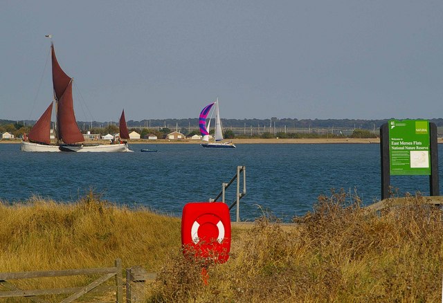
River Stour by Manningtree - geograph.org.uk - 1808044. Photo by Tim Marchant, via Wikimedia Commons.


Saturday, 23 July 2011

WRABNESS AND MISTLEY

Heading up the estuary towards Manningtree from Harwich, we come to the village of Wrabness and the small town of Mistley. Wrabness is most notable for its ancient church dating from around 1100, All Saints Church, which has a detached belfry consisting of a wooden cage in the churchyard with the bell in it. The belfry collapsed in the 17th century, and the wooden cage idea was meant as a temporary solution, but it remains to this day. Wrabness Nature Reserve on the banks of the River Stour has wildfowl year-round, but in winter it comes into its own as a place for observing Brent geese and black-tailed godwits.

Mistley is a small riverside town with a quay dating from 1720 by local landowner Richard Rigby. Rigby also had plans to turn the town into a spa, and to this end commissioned a church now known as Mistley Towers, now looked after by English Heritage. Churches around here don’t seem to have much luck, because like the one in Wrabness, this one suffered a collapse in the 1840s, this time of the middle section of the church, and now only the towers remain plus a fountain known as the Swan Basin fountain, featuring a life-size replica of a swan. Sadly, this is all that remains of Rigby’s ambitions for a spa in the town.

One of the scourges of life in Britain during the last ten years or so has been the curse of the “health and safety” brigade, who seem to be rampaging around the country, hell-bent on spoiling people’s enjoyment of life in whichever way they can dream up. In Mistley, this much despised phenomenon reared its head in 2008 when a fence was erected on the quayside for “’elf and safety” reasons, prompting the furious locals to comment that it made their scenic quayside look like a concentration camp. At the beginning of September 2008, the press reported that the residents were preparing to launch a campaign against this abomination. A fine example of feisty Brits refusing to cower in the face of authority.

Map of the area.


Strandlands, Wrabness - geograph.org.uk - 337306. Photo by Liz McCabe, via Wikimedia Commons.

Friday, 22 July 2011

HARWICH

Due to its geographical location, on a peninsula sticking out into the estuary formed by the mouths of the rivers Stour and Orwell, Harwich has long been an important port, providing the only safe anchorage between the rivers Thames and Humber. The site’s rise to prominence as a port began in 1340, when King Edward III’s fleet gathered at Harwich prior to its departure to defeat the French at Sluys in the first major naval bustup of the Hundred Years’ War. The town certainly seems to have made an impression on Queen Elizabeth I when she stayed there in 1561, as she proclaimed that it was “a pretty place and wants for nothing”. Our old friend Samuel Pepys was elected MP for Harwich in 1679, and it was during his time in this role that he was imprisoned in the Tower of London, accused of leaking naval intelligence. He was, in fact, the victim of a stitch-up by his political enemies, and was subsequently released. Fast-forwarding to the First World War, Harwich became the home of an important submarine force, which took part in a number of clashes with the German navy. After the end of the war, the surrender of a number of German U-boats took place there.

Today, Harwich is an important international port, serving ferries to the continent, cruise ships and cargo ships. Old Harwich is the focal point for sites of historic interest, with a Napoleonic fort called The Redoubt and several museums including The National Vintage Wireless and Television Museum, housed in a lightship dating from 1818. The part of town known as Dovercourt has a sandy beach with two more lighthouses. The lighthouses, built on stilts in 1863, were fitted with gas lamps, and were in use until 1917. Pleasure cruises can be taken along the Stour and Orwell rivers, departing from the Ha’penny Pier, so named because it used to charge a halfpenny toll. This was also where steamships to the continent used to depart from. This year, the Napoleonic fort is being used for a more light-hearted purpose than in its former life, having been chosen as the venue for the Harwich Brewery Beer Festival.

For a list of events in Harwich, follow this link.

Live streaming webcam views.

Map of the area.

Ferries in Harwich Harbour - a. Photo by Martin Pettitt, via Wikimedia Commons.


Thursday, 21 July 2011

WALTON-ON-THE-NAZE

Walton-On-The-Naze has a pier whose length, at three-quarters of a mile, makes it the second longest in the country after Southend’s. The ‘Naze’ part of the name comes from the name of a clifftop area to the north of the resort where there is an art gallery which has been established in a tower built in 1720 as a navigational aid. From here, a walk to the headland is rewarded with great views of the passing shipping going in and out of the nearby ports of Harwich and Felixstowe, as well as the chance to observe migrant birds. A walk in the other direction towards Frinton-On-Sea, a relatively unspoilt, genteel resort of Victorian origins boasting a long esplanade and a broad, clifftop expanse of grass known as The Greensward, is accompanied by the cheering sight of a line of colourful beach huts, which, as we have seen elsewhere, are a regular feature of the coast in this part of the country. During the heydey of Walton-On-The-Naze as a resort, the sea holly which grows in this area was much prized by visiting tourists who were persuaded to buy the plant’s candied roots by dint of its supposed aphrodisiac properties.

For a list of events in Walton-On-The-Naze, see here.

Map of the area.


Naze Tower, Walton-on-the-Naze - geograph.org.uk - 90077. Photo by John Davies, via Wikimedia Commons.

Wednesday, 20 July 2011

CLACTON-ON-SEA

As was so often the case, it was the railways which were responsible for the rise of Clacton-On-Sea as a popular resort. Up until the 1860s, all that was here was the sleepy village of Great Clacton with its medieval church and old inns, lying a mile offshore. Then along came railway promoter Peter Schuyler Bruff, who changed the area forever as, with the backing of the Woolwich Steam Packet Company, he set about developing a resort. At first people arrived by steamer, landing at the pier, which opened in 1871, then in 1882 the Great Eastern Railway began bringing holidaymakers to the town, and the resort really took off, to the point where by the time of Schuyler Bruff’s death in 1900 it was one of the most popular resorts in the country. Today, Clacton remains a popular resort, with the pier now housing undercover amusements and a fun fair, a safe, sandy beach, and a full programme of events including an Air Show at the end of August.  The town boasts two theatres, the West Cliff Theatre and the Princes Theatre.

One unfortunate feature of British sea-side life during the 1960s was the phenomenon of “mods and rockers”, two youth subcultures whose members regularly came to blows in the seaside resorts of the south, especially on bank holidays, sparking mayhem among the law-abiding holidaymakers, and battles with the police. Unfortunately, Clacton was not immune to this phenomenon. At Easter in 1964, hordes of leather-jacketed teenagers, described in the press as “rampaging teen-aged wild ones”, came to blows with “truncheon-swinging police” while their girlfriends stood by, screaming and egging them on (reports of the clash reached as far as the US, the above quotes coming courtesy of the Charleston News and Courier).

For a list of events in Clacton-On-Sea and the surrounding area, see here.

Map of the area.


Clacton-on-Sea. Photo by Oxyman, via Wikimedia Commons.

Tuesday, 19 July 2011

ST OSYTH AND JAYWICK

Such is the labyrinth of waterways running through the coastal areas of Essex that there are creeks coming off the creeks. St Osyth Creek is an offshoot of Brightlingsea Creek, and on its northern shore is the village of St Osyth with a medieval abbey and a deer park. The village is named after the daughter of a 7th century East Anglian King who was beheaded by Danish invaders because she would not worship their idols. This part of Britain is characterised by the decorative signs at the entrances to villages and small towns, and the sign for St Osyth includes a grisly depiction of the headless princess. There are a number of myths and legends surrounding the unfortunate royal, including the suggestion that on one day each year her ghost can be seen walking along the priory walls carrying her decapitated head.

Back on the coast proper, the Colne Point Nature Reserve, consisting of salt marshes and mudflats, is located at the mouth of the Colne opposite the eastern end of Mersea Island. Moving towards Clacton-On-Sea we pass a succession of small coastal settlements – Point Clear, Lee-over-Sands and Seawick, before reaching Jaywick. Jaywick, originally intended as a holiday resort for Londoners, and therefore composed of poorly constructed housing, was earlier this year named as the most deprived place in England. It is an extreme example of a holiday resort in decline as a result of the growth of foreign package holidays, with a high level of unemployment and large numbers of pensioners. Soaring crime and anti-social behaviour add to an overall depressing picture. On a slightly brighter note, Jaywick Martello Tower has been turned into an art and heritage centre with regular art exhibitions.

Map of the area.

File:St Osyth Stone Point - geograph.org.uk - 534846.jpg
St Osyth Stone Point - geograph.org.uk - 534846. Photo by M J Richardson, via Wikimedia Commons


Monday, 18 July 2011

BRIGHTLINGSEA

Brightlingsea has a distinguished history as a port, having been the only associate member of the Cinque Ports outside Kent and Sussex, though it was known as a “Limb of Sandwich”. Relics of the port’s past include the traditional fishing smacks, a type of handsome sailing vessel which makes an evocative sight. Each year there is a “smack and barge race” held in Brightlingsea, whose participants compete for the “Cock of the Colne” trophy, named after the river on which the town lies. There also an annual regatta held by the local Sailing Club. For beach lovers there is a sandy beach backed by a promenade and a fetching line of multi-coloured beach huts. Another distinctive sight on the town’s waterside is a folly called Bateman’s Tower, built in 1883 and recently restored.  The Brightlingsea Museum tells the story of the local heritage and history.

Brightlingsea made the national news in 1995, when the practice of exporting live animals via the port of Brightlingsea was met with a series of protests by animal rights demonstrators. The protests went on for nine months, costing an estimated 4 million pounds to police. A report in the Independent described “middle-class grannies hurling obscenities at lines of police” and an atmosphere in the town such that “it is dangerous to express a view about the subject in the pub”. Local businesses were dismayed at the loss of trade brought about by the disturbances.

Live streaming webcam view from Brightlingsea Sailing Club.

Map of the area.

File:Groynes and beach huts, Brightlingsea - geograph.org.uk - 1141593.jpg
Groynes and beach huts, Brightlingsea - geograph.org.uk - 1141593. Photo by Bob Jones, via Wikimedia Commons


Sunday, 17 July 2011

MERSEA ISLAND

Mersea Island is the most easterly island in the British Isles, although it is only just an island, and is accessible by road from the mainland in the form of a causeway known as The Strood. The largest settlement on the island is West Mersea, where evidence of human habitation has been found dating back to 10,000 BC. The two main attractions of West Mersea are oysters and boating. The big event of the year for the latter is Mersea Week, which takes place every August and involves a round-the-island race as well as myriad other events.

For the other main settlement on the island, East Mersea, it’s all about the wildlife. The salt marsh and mudflats are a haven for birds such as plovers, dunlins and oystercatchers. In addition to this, there is plenty of interest for fossil enthusiasts. The pleistocene interglacial sediments here have yielded the remains of small mammals, but more dramatically have thrown up hippopotamus remains. Cudmore Grove Country Park, at the eastern end of Mersea Island, is a good place to observe migratory birds as well as wading birds and wildfowl. History buffs can visit the remains of a Tudor fort and World War II defences.

Live streaming webcam view of the Strood Road.

Map of the area.


File:East Mersea Flats - geograph.org.uk - 558235.jpg
East Mersea Flats - geograph.org.uk - 558235. Photo by Glyn Baker, via Wikimedia Commons

Saturday, 16 July 2011

TOLLESBURY

The village of Tollesbury has come to be known as the “The Village of the Plough and Sail”, as depicted in the jaunty sign at the entrance to the village. It is ideally situated for sailing, given its geographical position on a peninsula, surrounded by the creeks and channels of Tollesbury Fleet to the north, and the River Blackwater to the south, and there is a marina and a sailing club in the village. The white painted wooden boathouses with their balconies and ladders make a picturesque sight. The ‘plough’ part of the title comes from the fact that Tollesbury had an important role in transporting grain. There is a large wooden granary in the village which became disused during the 1950s, and which was a regional runner-up in the BBC’s Restoration series. One of the vessels used in the Dunkirk Evacuations is a barge named Tollesbury. There is plenty of interest for wildlife enthusiasts in the surrounding marshes. The area around Tollesbury is also known for its oyster cultivation. Tollesbury Wick Nature Reserve is a Site of Special Scientific Interest, and sightings there include Marsh Harriers, Hen Harriers and Short-eared owls, as well as a variety of mammals and insects.

Map of the area.

File:Tollesbury Marina 06 (7275070840).jpg
Tollesbury Marina 06 (7275070840). Photo by Ronnie Macdonald, via Wikimedia Commons


Friday, 15 July 2011

MALDON

The historic town of Maldon lies at the point where the Blackwater River opens out into a wide estuary. The estuary at this point is thronged with pleasure craft, which can be observed from a promenade accessible from the quay. Among the town's historic points of interest are the Church of All Saints with its triangular tower and the 15th-cenury Moot Hall. The town has been an important centre for salt over the centuries, due to the proximity of the salt marshes, and Maldon Sea Salt remains a sought-after product on the supermarket shelves to this day. The town’s geographical position also led to it becoming a major maritime hub for trade both within England and across to Europe.

In Viking times, the salt was a contributing factor in the town’s attractiveness as a target for attacks, prompting King Edward the Elder to camp there in the 900s in an effort to hold back the Vikings. An old English poem called The Battle of Maldon tells the story of a raid in 991 by the “Northmen”, who were camped on an island in the estuary. Maldon has its own version of the Bayeux Tapestry in the form of an embroidery depicting scenes from the Battle of Maldon. The tapestry, which resides in the Maeldune Heritage Centre and was designed by Humphrey Spender, was created to mark the 1000th anniversary of the battle.

For a list of events in Maldon see here.

Map of the area.

File:Boats in the distance at Maldon, Essex - geograph.org.uk - 833314.jpg
Boats in the distance at Maldon, Essex - geograph.org.uk - 833314. Photo by Gill Edwards, via Wikimedia Commons


Thursday, 14 July 2011

THE DENGIE PENINSULA

In my last post I described the piece of land between Southend and Maldon as having the appearance of an animal’s head with the River Crouch as the mouth. The upper part of the ‘head’, with the northern part resembling a blunt rhinoceros horn, is the Dengie Peninsula, a bleak, end-of-world environment consisting of a vast expanse of marshland extending between the River Crouch to the south, the North Sea to the east, and the River Blackwater to the north. Standing proud among this eerie landscape is the ancient chapel of St Peter-On-The-Wall, one of Britain’s oldest churches, located on the site of the Roman fortress of Othona. It was a Northumbrian missionary called St Cedd who arrived in AD653 and built the chapel out of stones from the fortress. The church can be accessed from Bradwell-on-Sea, but only on foot for the last half mile. Each year on the first weekend in July hundreds of people take part in a pilgrimage which involves walking the two miles from St Thomas’ Church in Bradwell-On-Sea to St Peters.

Bradwell-on-Sea is a small village surrounded by marshes and reclaimed farmland, and nearby Bradwell Waterside with its Marina lies on a narrow creek separating the mainland from Pewet Island, which disappears at high tide. This whole area is dominated by the decommissioned Bradwell Power Station. Within the last few weeks it has been announced that Bradwell is one of eight locations earmarked as new sites for nuclear power stations, where the next generation of reactors will be built. The plan has, predictably, split the populace down the middle, with some lamenting the reliance on nuclear power for the country’s energy needs, while others are cheered by the prospect of the new jobs that such a development will bring.

Map of the area.


Blockhouse - geograph.org.uk - 180949. Photo by Glyn Baker, via Wikimedia Commons.

Wednesday, 13 July 2011

BURNHAM-ON-CROUCH

Viewed on a map, the chunk of land between Southend and Maldon bears a slight resemblance to the head of a large animal, with the ‘mouth’ being formed by the River Crouch. Burnham-on-Crouch sits on the north bank of the river. Just as Southend is Essex’s answer to Brighton, so Burnham-on-Crouch is the county’s answer to Cowes, being a major yachting centre. The town has several yacht clubs, chief among them the Royal Burnham Yacht Club and the Royal Corinthian Yacht Club. Burnham’s big yachting event of the year, Burnham Week, occurs in late August. In August 1971, the then Prime Minister Ted Heath, who was an avid sailor, was pottering in his yacht near Burnham when he encountered two teenagers who had got into trouble in their sailing dinghy, which capsized. The PM came to the rescue, picking up the capsized boat and its occupants.

The town centre is a classic Georgian mix of red brick and whitewash, with a liberal sprinkling of old inns. The surrounding area offers estuary walks and a country park including a small wetland area and rough grassland where skylarks, linnets and goldfinches can be seen. The area around Burnham was used by H. G. Wells as the setting for the Martian invasion in his literary classic War Of The Worlds, describing how the invaders came “striding over some stunted trees” beyond the River Crouch. In the last couple of years, several real-life UFO sightings have been reported in the area, including a “cigar-shaped object” and “4 lights”...”orange and disc-shaped” – of course, the latter could well have been Chinese lanterns, which are increasingly found to be the source of “UFO” sightings.

Map of the area.

Burnham-on-Crouch waterfront - geograph.org.uk - 554058.  Photo by Bob Jones, via Wikimedia Commons.


Tuesday, 12 July 2011

FOULNESS ISLAND

Moving out of the Thames Estuary to the North Sea coast, we come to a strange little patch of land with the unfortunate name of Foulness Island. The name actually comes from the Old English 'fulga-naess', meaning 'birds promontory'.  Much of the island has been taken over by the military, who purchased the land in 1915. A report in the Guardian in 2002 described how the military presence on the island led to a feeling of isolation from the rest of the world, rendering the island’s community “the closest thing to a police state on British soil”. The strict security imposed on the islanders has been a mixed blessing. One local pub landlord whose pub The George and Dragon featured in the article had the unique business disadvantage of customers having to phone ahead and give their name and address at the military checkpoint. Needless to say the pub’s customers gradually dwindled, and the pub finally closed in 2007. On the plus side, the island’s crime rate is exceptionally low thanks to the military presence and attendant security, and the island is an exceptionally safe environment for bringing up children. Another victim of the island’s unique situation was the old school house, which closed in 1988. However, this has been turned into a heritage centre displaying archaeological finds and information on the flora and fauna of the island. In fact, the island is a haven for wildlife, which includes wading birds such as oystercatchers, avocets, little egrets and brent geese, as well as grey seals, which can be spotted just offshore.

Map of the area.

Crouch Corner Foulness - geograph.org.uk - 180961.  Photo by Glyn Baker, via Wikimedia Commons.


Monday, 11 July 2011

SOUTHEND-ON-SEA

Southend-On-Sea is Essex's answer to Brighton, being its premier seaside resort. In fact, in one respect it has the edge on Brighton, namely that it boasts the longest pleasure pier in the world. So long, in fact, that those who don't fancy walking its length of 1.3 miles have the option of taking an electric railway. The pier was opened in 1830, and since then has suffered a number of mishaps mostly involving fires, but in one case a tanker crashed into the pier leaving a 70-foot gap. Like so many resorts of its kind, Southend boomed during the Victorian era, which left its legacy in the form of features such as the bandstand on the esplanade. There is no shortage of traditional seaside attractions such as amusements, parks and gardens, as well as an aquarium featuring an underwater glass tunnel.  Other attractions include the Adventure Island amusement park and a Casino, located in the part of the resort known as Westcliff-on-Sea.

The urban sprawl that constitutes present-day Southend had its beginnings as a village at the "south end" of a medieval priory called Prittlewell Priory, which is now surrounded by a park with attractions including tennis and bowls. Another quaint part of Southend's administrative area is Leigh-On-Sea, an old fishing village with a narrow cobbled high street where jellied eels and cockles from Maplin Sands further round the coast can be bought from stalls. It is possible to walk for 7 miles along the seafront from there to Shoeburyness, to the east of the resort, with its MOD artillery range.

Southend-On-Sea takes its annual Carnival very seriously, with an extensive diary of events listed on its website. For other events in the resort follow this link.

Map of the area.

File:Pier Sunset (219457381).jpeg
Pier Sunset (219457381). Photo by Rodrigo Argenton, via Wikimedia Commons

Sunday, 10 July 2011

CANVEY ISLAND

Continuing east along the Thames estuary, past the huge Coryton oil refinery, we come to Canvey Island. From the time of the Roman invasion until the 20th century, Canvey Island was mainly agricultural, then for the 40 years between 1911 and 1951 it rapidly developed into a seaside resort. Then in 1953 disaster struck. On the night of 31 January 1953 a violent storm in the North Sea, combined with a high spring tide, caused massive flooding over large areas of North Sea coastline, not only in England, but also in the Low Countries, with the largest number of casualties in Zeeland. As a result of the storm, Canvey Island was devastated by flooding, leaving 53 dead. The Times Daily reported that “A fleet of small boats made trip after trip into flooded Canvey, called “the island of death”. Families huddled on rooftops awaiting rescue.”

Now the land has been reclaimed, and is protected by a massive sea wall. The main attraction for pleasure seekers is the Fantasy Island Amusement Park.  More recently in happier times, Canvey Island became closely associated with a genre of music in the 1970s called Pub Rock, whose main proponents were Dr Feelgood, known as “Canvey Island’s finest”. The Pub Rock movement, so named because it marked a return to the concept of bands playing in pubs and small clubs instead of huge stadium venues, was meant as a rebellion against the earlier phenomena of progressive rock and glam rock.

Map of the area.

Canvey Island sea wall - geograph.org.uk - 1195825. Photo by william, via Wikimedia Commons.


Saturday, 9 July 2011

TILBURY

Many of the cruisers heading to the Baltic and Scandinavia will find themselves leaving from Tilbury, which is well placed for cruises heading to the northern reaches of Europe. Tilbury is also an important container port. Next time you open your newspaper, you might want to reflect that the paper used will have arrived via Tilbury, since this is another important product handled by the port. Another mode of water transport at Tilbury is the Gravesend-Tilbury ferry, which has a long history dating back to the 14th century, when the ferry consisted of a rowing boat and was thought to transport sheep and wool. Anyone who enjoys looking at old photographs can see a collection of photos of vessels used on this crossing from 1862 to 1984 on the Simplon Postcards website.

Tilbury Fort, originally built by Henry VIII and rebuilt under Charles I with the aim of defending the Thames estuary from first the Spanish Armada and later the Dutch and the French, is a star-shaped fortification built right on the estuary, surrounded by an elaborate array of moats and earthworks. The Fort is now run by English Heritage, and visitors to the site can explore the magazine houses and passages and view an exhibition which tells the story of the Fort’s role in defending London over the years.

Map of the area.

Tilbury fort river battery. Photo by Mark.murphy, via Wikimedia Commons.


Friday, 8 July 2011

GRAYS

On the northern bank of the Thames is the town of Grays in the borough of Thurrock. Cinema fans may remember a part-animated film from the late 1980s called Who Framed Roger Rabbit starring Bob Hoskins. There is one scene in which Hoskins and the rabbit of the title, having shaken off a gang of weasels who were pursuing them, hide out in a cinema. The building used as the cinema is the now-closed Gray’s State Theatre. Back in the day, this thirties movie palace was the largest single-screen auditorium in Europe. More recently it was used as a nightclub. Another showbiz connection with the town is that it is the home town of the comedian Russell Brand.

The name Grays derives from the descendant of a norman knight, Henry de Grai, who was granted the manor of Grays Thurrock by Richard I in 1195. There is a wood in Grays ominously called Hangmans Wood which features an intriguing phenomenon, a large number of shafts in the ground named deneholes. 72 of them have been counted, and there are a variety of theories about their origin, but the most popular is that they were flint mines, the presence of a large number of flints being a bit of a giveaway. Another theory is that the name “denehole” comes from “Dane hole”, i.e. a place where people hid during viking raids in the area, though there is little proof of this.

Map of the area.


File:Grays Beach - geograph.org.uk - 636629.jpg
Grays Beach. Photo by John Winfield, via Wikimedia Commons