Labels

Aberdeenshire (21) Angus (4) antiquities (87) Argyll and Bute (35) Arran (7) art (37) birds (231) bridge (9) Caithness (12) Carmarthenshire (5) castle (165) Ceredigion (9) Channel Islands (13) Cheshire West and Cheshire (1) City and County of Swansea (1) City of Bristol (2) City of Edinburgh (4) Conwy (8) Cornwall (74) County Antrim (19) County Down (23) County Durham (3) County Londonderry (4) Cumbria (19) Denbighshire (2) Devon (48) diving (7) Dorset (18) Dumfries and Galloway (22) Dundee City (2) East Lothian (6) East Sussex (16) East Yorkshire (6) English Riviera (3) Essex (17) Fife (19) Flintshire (1) food (13) fossils (14) gardens (28) Ghosts (35) Glamorgan (1) Gower (7) Guernsey (4) Gwent (1) Gwynedd (19) Hampshire (13) Highland (72) Inner Hebrides (42) Inverclyde (5) Islay (8) Isle of Anglesey (14) Isle Of Man (7) Isle Of Wight (10) Isles of Scilly (3) Jersey (7) Kent (22) Lancashire (8) Lewis and Harris (7) lighthouse (62) Lincolnshire (8) Merseyside (8) Mid Glamorgan (1) mining (23) Moray (10) Mull (8) Norfolk (21) North Ayrshire (13) North Yorkshire (12) Northern Ireland (45) Northumberland (17) Orkney (10) Outer Hebrides (14) Pembrokeshire (27) pubs (47) Ross and Cromarty (20) Scotland (300) Scottish Borders (3) Shetland (14) shipwrecks (42) Skye (12) smuggling (48) Somerset (9) South Ayrshire (6) South Glamorgan (5) South Gloucestershire (1) Suffolk (18) surfing (83) Sutherland (16) Tyne and Wear (10) Wales (93) wartime (75) webcams (232) West Dunbartonshire (3) West Glamorgan (9) West Sussex (9)

Monday 30 December 2013

PARKGATE AND NESTON


In my Liverpool post I mentioned that Liverpool became a major port after the River Dee started silting up.  The ports of Neston and, later, Parkgate on the River Dee were Liverpool's predecessors, so Neston and Parkgate's loss was Liverpool's gain.  Neston, whose history goes back as far as Viking times, became an important port in the 1500s when it became the main point of departure for Spain, France and Ireland, helped along by excellent coaching links to London.  As the River Dee began to silt up the port activity moved to Parkgate, which in turn became one of the main departure points for Ireland.  It also became a fashionable resort, but now that the sea has receded the promenade looks out over a vast salt marsh.  However, this change in geography has made the area  a magnet for birdlovers.  The Gayton Sands RSPB Reserve to the west of Parkgate welcomes large flocks of wintering waders such as pintails and bar-tailed godwits, while along the foreshore birds of prey such as peregrines and hen harriers can be seen going about their hunting.  Another popular area for nature-lovers is the Wirral Country Park near Neston, which follows the path of a disused railway line.  There used to be collieries operating around Neston, and this part of the local history can be relived by following the Neston Colliery Trail.  To the south-east Ness Botanic Gardens enjoys a favourable geographical position with relatively low rainfall for the west coast and less severe frosts than other areas nearby, allowing the beautiful collection of plants to thrive.

Map of the area. 

File:Ness Botanic Gardens, Wirral - geograph.org.uk - 290775.jpg
Ness Botanic Gardens, Wirral - geograph.org.uk - 290775. Photo by Alan Pennington, via Wikimedia Commons.

Thursday 26 December 2013

HOYLAKE AND WEST KIRBY


Hoylake and the neighbouring West Kirby, situated at the mouth of the River Dee on the Wirral Peninsula, make the most of their seaside position with a range of watersports.  The Wirral Sailing Centre on West Kirby Marine Lake offers windsurfing, dinghy sailing, kayaking and power boating courses, while Hoylake has hosted the European Sand Yachting Championships.  Between the two communities is the Royal Liverpool Golf Club and a 300 acre patch of land nearby is being earmarked for a world class golf resort.  Hoylake is gaining a reputation as something of a hub for artists with its growing population of painters, sculptors and other arty types.  One particularly prominent project is a pirate ship 'beached' on the seafront made from driftwood and named the Grace Darling.  The Festival of Firsts in Hoylake is an arts festival with a difference, focussing on innovation and creativity and community participation.  There is plenty of interest for lovers of wildlife in this part of The Wirral.  The Dee Estuary is a Site of Special Scientific Interest for its birdlife, which includes overwintering wildfowl and waders.  Old favourites such as oystercatchers, curlews and redshank can be seen going about their business on the shoreline.  Meanwhile, natterjack toads can be found in an area along the shore called Red Rocks, and there are rare grasses in the dunes.  At low tide there is access from West Kirby to the Hilbre Islands, where there are grey seals and a bird observatory.  

Webcam view of Hoylake Beach.

Map of the area. 


File:Red Rocks, Hoylake (geograph 3146708).jpg
Red Rocks, Hoylake (geograph 3146708). Photo by El Pollock, via Wikimedia Commons.

Thursday 19 December 2013

NEW BRIGHTON


New Brighton became a popular daytripping destination in Victorian times, when visitors from Liverpool used to cross the Mersey by ferry, landing at a pier in the resort.  The pier has since been demolished, as has the New Brighton Tower, built in 1898 and at 621 feet the tallest structure in Britain at that time.  During the resort's peak period of popularity in the early 1900s it had a ballroom and an outdoor swimming pool as well as a host of other attractions.  The ballroom, named The Tower Ballroom, was still going strong during the height of the Merseybeat era, hosting concerts by groups including the Beatles.  Sadly, a lot of the attractions from the resort's early days went the way of the pier and the tower, but now there is a redevelopment plan underway resulting in a new pavilion, the Floral Pavilion, and the Marine Point leisure and retail complex.  However, one remaining relic of earlier times is the striking art deco building housing the New Palace amusement arcade, which along with the Adventureland attraction provides plenty of fun for the kids.  There are golf courses with sea views in neighbouring Wallasey and Leasowe

A causeway from the mainland leads out to Fort Perch Rock, with a battery of 18 guns built in the 1820s during the Napoleonic Wars to fend off the French.  The fort occupies what at that time was a strategic position, facing onto the main entrance for shipping approaching the Mersey.  Its position and purpose earned it the nickname the "Little Gibraltar of the Mersey".  Now the fort is open to visitors and houses a museum with maritime and aviation displays including aircraft wreckage dating from World War II.


In the 1980s a book of photographs by the photographer Martin Parr called The Last Resort featured New Brighton as its subject.  The book became a classic of documentary photography and put Parr firmly on the map as a leading photographer.  The book, which featured the working classes holidaying in what was at the time a depressing and decaying resort, divided opinion among those who viewed it, with some finding its images disturbing, while others saw a more affectionate and humorous side to them.

For a list of events in the Wirral follow this link.

Map of the area.

File:Fort Perch Rock, New Brighton - 2011-12-01 (8).JPG
Fort Perch Rock - 2012-10-27(9). Photo by Rept0n1x, via Wikimedia Commons.


Tuesday 17 December 2013

BIRKENHEAD


The distinctively shaped, angular chunk of land across the River Mersey from Liverpool is an area within Merseyside known as The Wirral, and Birkenhead is on its eastern flank, facing Liverpool.  The "Ferry Cross The Mersey" made famous in the song by Gerry and the Pacemakers (see previous post) can be traced back to monks from an ancient priory.  In the 12th century the monks of Birkenhead Priory established a ferry to Liverpool as part of their duty of care towards travellers.  In the early 1800s a steam ferry took over the crossing and merchants from Liverpool developed shipyards and docks in the area.  Shipping activity has largely moved to Seaforth, but one reminder of those days remains in the form of the Shore Road Pumping Station, where a large steam engine called the Giant Grasshopper was built by the inventive Victorians to prevent the flooding of the Mersey rail tunnel.  Meanwhile back at the Priory, which adjoins the towering cranes of the Cammell Laird Shipyard, the tower is open to visitors who can enjoy amazing views over the Mersey and The Wirral from the top.  The tower is dedicated to the 99 men who died in a disaster aboard the Laird-built HMS Thetis submarine in 1939.  Other museums include the Williamson Art Gallery and Museum and the Wirral Transport Museum.

A short distance to the south of Birkenhead is Port Sunlight, a striking example of 19th century town planning.  The village was created by the soap magnate William Hesketh Lever as housing for his workforce, and it is now a conservation area charmingly termed a Garden Village.  The village makes for a pleasant day out, with a museum bringing to life what it was like to live here during Edwardian and Victorian times, and refreshment facilities including a hotel with fine dining.  There is a walking trail available from the museum for those who want to explore the village on foot.  

Map of the area. 

File:Dell Bridge, Port Sunlight.JPG
Dell Bridge, Port Sunlight. Photo by Gary Beale, via Wikimedia Commons.


Sunday 15 December 2013

LIVERPOOL


I have a confession to make.  I have something in common with Prince Charles.  Prince Charles hates modern architecture, and has been known to describe modern buildings in terms such as “monstrous carbuncle”.  I often shake my head in despair at the sight of modern buildings, as I genuinely can’t understand why something has to be ugly just because it’s modern.  At least this was the case until I visited Liverpool for the first time when, totally out of character, I found myself gazing admiringly at the city’s architecture both old and new.  There can be few skylines in the country to match that of Liverpool, which features a fascinating mix of buildings. 

Waterfront near Albert Dock


The elegant trio of buildings overlooking the docks – the Royal Liver Building, the Cunard Building and the Port of Liverpool Building, all built in the early 20th century – is referred to affectionately by the locals as the “three graces”.  Nearby is the impressive new Museum of Liverpool, with its diagonal lines resembling an x-shape, its big picture windows providing wonderful views over the Mersey.  Other nearby buildings are equally striking, some with shiplike outlines.  Higher up in the city centre, Liverpool’s two cathedrals continue the “old and new” theme, the old cathedral towering over everything, the fifth largest in the world and unusually these days free to enter, while a short distance away the newer Catholic Metropolitan Cathedral provides a complete contrast with its wigwam-like shape – in fact the Liverpudlians in typical comic style often refer to it as “Paddy’s Wigwam”.  All this splendour has led to Liverpool being awarded World Heritage Site status, but last year it was reported that this status could be under threat due to a planned waterfront development called Liverpool Waters which some believe has the potential to jeopardise the city's heritage.

File:Liverpool skyline.jpg
Liverpool skyline. Photo by G-Man, via Wikimedia Commons


Waterfront, with the Cathedral towering over everything


Liverpool's importance as a port began as far back as the early 18th century when Chester's status as a port was scuppered by the silting of the River Dee.  By the end of the 19th century it was one of the most important ports in the world, with 40 per cent of the world's trade accounted for by Liverpool's ships.   Now the docks dating from those times, most notably Albert Dock, have been given over to tourism, with a heady mix of restaurants, shops and attractions such as the Tate Liverpool.   When we visited we went on a hugely entertaining tour on land and water in a wartime amphibious vehicle called the Yellow Duckmarine.  Unfortunately in March this year the Duckmarine sank in the Albert Dock and all the tourists on board had to be evacuated.  Then, unbelievably, the same thing happened again in June.  Fortunately everyone was okay, but the incidents seem to have forced a halt in operations, as the website states that tours are unable to operate at present.  

Albert Dock, with the ill-fated Yellow Duckmarine


London may have been the epicentre of the Swinging Sixties, but there was plenty going on in Liverpool also, where the pop music scene was dubbed Merseybeat.  The city is inextricably linked to The Beatles, who played in the famous Cavern Club nearly 300 times in their early days.  The club is still open for business and still putting on live bands.  There is also a bar opposite called the Cavern Pub which has live music nightly and is free to enter.  There are Beatles tours available for those who want to follow in the footsteps of the Fab Four, some of which take in the childhood homes of Paul McCartney and John Lennon, and which also visit Strawberry Field and Penny Lane.  Then there is the Beatles Story down by the docks for those who like such things.  Near the old Cathedral is an amazing old pub called  The Philarmonic Dining Rooms, apparently affectionately named The Phil by John Lennon, who is said to have complained that one of the prices of fame was no longer being able to go there for a drink.  So as you can see, you can't get away from The Beatles in Liverpool - even the airport is named after John Lennon.  Other 60s icons associated with the city include Cilla Black, whose broad Liverpool accent was one of her trademarks, and Gerry and the Pacemakers, whose most famous song was Ferry Cross The Mersey, also the title of a film starring the band.  Meanwhile, on TV, The Liver Birds sitcom, first shown in 1969, told the story of two trendy young women sharing a flat in Liverpool.

Aside from the "Ferry Cross The Mersey", which still runs today, taking people across to the Wirral Peninsula, there are ferries to Dublin, Belfast and the Isle of Man.  Liverpool is also visited by cruise ships.  In the absence of the duck tours there are 'hop on hop off' bus tours available for exploring the city.  There are numerous museums and galleries, including the Walker Art Gallery,  the Merseyside Maritime Museum and the International Slavery Museum.  As one would expect from such a vibrant city, there are a host of festivals and events all year round, covering everything from food and drink to sport, from music to comedy and much more.

For a list of events in Liverpool, follow this link.
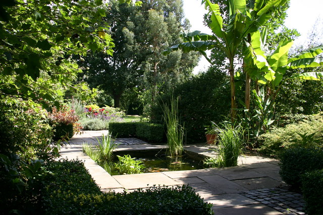
Webcam view of Liverpool Waterfront.  

Map of the city.


Wednesday 11 December 2013

BOOTLE


Bootle is almost a suburb of Liverpool, although it is a town in its own right, in the Metropolitan Borough of Sefton on Merseyside.  During the war the town took a hammering, largely due to the presence of the docks on the foreshore.  90% of homes in the borough were damaged during the Liverpool Blitz, making it the most bombed borough in the country.  The Gladstone Dock was the base of the escort ships which were charged with protecting the convoys crossing the ocean during the Battle of the Atlantic.  Frederic John Walker, the Captain of HMS Starling and well-known pursuer of u-boats, used to stay in the Mayor's Parlour at the Town Hall and would sail out of Bootle. 

Much of the architecture in the centre of town is Victorian, notably the Town Hall and the Municipal Baths (now disused), a relic from the time when Bootle grew up as a bathing resort for wealthy Liverpudlians in the 19th century.  The town's Derby Park is a fine example of an urban Victorian park.  Bootle lies on the Leeds and Liverpool Canal, 2 miles from Liverpool's Stanley Dock in one direction and 7 miles from Aintree racecourse in the other.  As is so often the case, Bootle's docks went into a decline during the 1960s and 1970s, but there is a regeneration underway.  The Gladstone Dock is now the departure point for ferries to Ireland with P&O.  Among the famous people born in Bootle are a number of footballers and the 60s rock 'n' roll star Billy J. Kramer, who has a statue down the road at Liverpool's Albert Dock.

Map of the area.

File:Bandstand, Derby Park - geograph.org.uk - 1437738.jpg
Bandstand, Derby Park - geograph.org.uk - 1437738.  Photo by Sue Adair, via Wikimedia  Commons.


Thursday 5 December 2013

CROSBY


Like many towns in the area, Crosby's roots are Viking, but much of the present-day town is characterised by elegant Regency buildings.  These can be attributed to the wealthy local merchants who built the town's terraces and crescents in the 18th and 19th centuries.  The town as it stands today is the successor to the original hamlet of Little Crosby, which lies around one mile inland.  The southern end of Crosby's sandy beach is home to the Crosby Marina Club, which offers sailing lessons for beginners.  Swimmers should beware though: the strong currents here coupled with the shipping lanes close by given the proximity of the Mersey make the Crosby Channel a hazardous place for swimmers. 
 
Crosby's beach has a unique art installation spread over 3 kilometers of the foreshore called Another Place.  The work of Antony Gormley, it consists of 100 life-size, cast-iron figures stretching almost one kilometer out to sea.  The sculptures were originally displayed in various locations on continental Europe before settling in Crosby, where they look set to stay. As I sit typing up this piece many parts of the country are being battered by the worst storm for decades.  I've been wondering how the Crosby sculptures are bearing up, and I am pleased to report that I have just seen a photograph of one of them on the Liverpool Echo website standing defiantly facing the incoming waves.  Let's hope they all survive the tempest.

Map of the area.

File:Crosby Beach Statues.jpeg
Crosby Beach Statues. Photo by WillDaviess, via Wikimedia Commons

Monday 2 December 2013

FORMBY


There are many places around the British coast where signs of early human habitation have been found - the remains of an early tool, a burial chamber, human bones for example.  However, Formby has something rather different.  At Formby Point when the tide is low human footprints can be made out in the mud.  These have been dated to the late Neolithic era 7,000 years ago, and were probably made by the hunter-gatherers who roamed the area at that time.  Animal footprints have also been discovered there, made by a variety of creatures including deer and wolf.  Formby Point is part of the Sefton Coast Site of Special Scientific Interest, and is characterised by extensive sand flats and dunes.  This part of the seafront is administered by the National Trust and there is an NT car park there.  This is a rewarding area for walkers who like an interesting view: as well as the ships going in and out of the Mersey the mountains of North Wales can be discerned on the horizon.  Wildlife enthusiasts are in for a treat in the woodlands near here, where there is a red squirrel sanctuary, while the dunes are home to the natterjack toad.  

On the other side of the dunes is the town of Formby, originally a Viking settlement called Fornebei.  The town's landmarks include the Church of St Luke, which is 19th century, but some of the graves in the churchyard go back much further.  One of the gravestones to be found there is that of Richard Formby, armour-bearer to Henry IV and Henry V - he was known as 'Richard The Giant' due to the fact that he was 7ft tall.  Another interesting feature of the churchyard is a cross which originally stood on the village green.  During the Plague of 1665 its hollows were filled with vinegar so that coins could be disinfected.  One of Formby's streets is called Lifeboat Road, named after the lifeboat station which was built there in 1776, making it Britain's first lifeboat station.  Formby has a golf club, which adjoins the National Trust land at Formby Point.

Map of the area. 


File:Formby beach - geograph.org.uk - 327762.jpg
Formby beach - geograph.org.uk - 327762. Photo by Tom Pennington, via Wikimedia Commons

Sunday 24 November 2013

SOUTHPORT


Natives of Southport, which lies on the Sefton Coast of Merseyside, have the intriguing nickname Sandgrounders, but there are very strict rules as to who qualifies as a true Sandgrounder.  According to legend a Sandgrounder must be "born on sand land 'betwixt Alt and Astland.'" - Alt and Astland being two specific areas of town.  As with other resorts in the area, Southport's growth coincided with the industrial revolution and the attendant coastal downtime which was increasingly sought by workers in the industrial towns of the north.  As early as 1792 a local man called William Sutton, aka "The Mad Duke", saw the possibilities arising from this trend and built a bathing house at South Hawes, the former name of the original town.  He also built a hotel at the southern end of Southport's main shopping street, Lord Street.  There is a plaque in Sutton's memory which is placed at the corner of Lord Street and Duke Street.  

As well as Lord Street, Southport's attractions include the obligatory pier and tramway.  For the kids there is the Pleasureland fairground and the Lakeside Miniature Railway.  Older folk will enjoy strolling in its parks and gardens, particularly the Botanic Gardens in the suburb of Churchtown.  Nature lovers can head to the Ainsdale Sand Dunes NNR a short distance to the south of the town, while for walkers there is the Sefton Coastal Footpath.  There are numerous events throughout the year in Southport, most notably the Southport Air Show and the Southport Flower Show, as well as a food and drink festival and a jazz festival, to name just a few.  There is a memorial in the town to the lifeboats, which commemorates a tragedy in 1886 involving a barque called the Mexico which sent distress signals when it got into trouble in heavy seas.  A lifeboat called the Eliza Fernley was sent to help but tragically the lifeboat capsized with the loss of 14 of its 16 crew members. 

For a list of events in Southport follow this link

Live streaming webcam view of the pier.

Map of the area.

File:South Marine Gardens, Southport - geograph.org.uk - 63857.jpg
South Marine Gardens, Southport - geograph.org.uk - 63857. Photo by Sue Adair, via Wikimedia Commons

Thursday 21 November 2013

LYTHAM ST ANNES


There are actually two main communities occupying the stretch of coast between Blackpool and the Ribble Estuary, an area which has been inhabited since the Bronze Age: Lytham and St-Anne's-on-the-Sea.  Tourism came to the area with the advent of recreational opportunities for the workers of the nearby mill towns, and thus the two settlements gradually melded into one resort, commonly known as Lytham St Annes.  The resort is best known for its golf, with four courses in all.  One of these, the Royal Lytham & St Anne's Golf Club, founded in 1886, has hosted many important tournaments over the years, including 10 Opens and 2 Ryder Cups.  The Walker Cup is due to be held there in 2015. 

The main feature of Lytham's seafront is The Green, a strip of grass between the main road and the shore.  If strolling along The Green for the first time, you could be forgiven for thinking you had been flung across the country to Norfolk, as one of the most prominent sights you are greeted with is The Windmill, a handsome whitewash building, built in 1805 and restored in 1989.  The windmill houses a seasonal museum telling the history of mills and milling.  Next door is the Lifeboat Museum - also seasonal - housed in the Old Lifeboat House.  The views from the seafront are lovely, taking in the mountains of North Wales.  In the gardens next to the pier is a statue of Les Dawson, the late comedian, who lived in the town.  Another comedian who was resident in the town was the late George Formby, while Roy Walker, originally from Northern Ireland, currently lives there.  On the outskirts of town is Lytham Hall, the family seat of the local Clifton family until 1979.  The grounds are occasionally used for open-air concerts and plays.

St-Anne's-on-the-Sea started out as a 19th century planned town, from a plan drawn up by businessman Eliljah Hargreaves, aimed at attracting visitors from the mill towns.  It is a traditional resort with a sandy beach, donkey rides and a small pier.  There is also a nature reserve occupying an area of sand dunes.  One piece of trivia associated with St-Anne's-on-Sea is that it was the original home of the Premium Bonds and ERNIE, the machine that decides who is going to be rich and who isn't by generating the random numbers of the winning bonds.  The operation moved to larger premises in Blackpool in the late 1990s.

There is a third area between Lytham and St Anne's called Fairhaven, which has a wildfowl reserve at Ashton Marine Park, aka Fairhaven Lake.  There is also an RSPB Visitor Centre dispensing information about the birds of the area.  The Ribble Estuary, meanwhile, is an important habitat for waders.  


Map of the area.

File:Windmill, Lytham - DSC07143.JPG
Windmill, Lytham DSC07143. Photo by Rept0n1x, via Wikimedia Commons

Sunday 17 November 2013

BLACKPOOL


It is an undeniable fact that Blackpool is the premier resort of north-west England.  The town's popularity started when the mill workers in the booming Lancashire textile industry starting flocking there in the years leading up to World War I.  The British Pathe website has some wonderful footage from the year 1900 showing turn of the century people enjoying the resort's delights.  One of the most enduring landmarks over the years in Blackpool has been Blackpool Tower, which was prefabricated in Manchester and brought to Blackpool by train to be assembled.  The tower was modelled on the Eiffel Tower in Paris, though half the height of its renowned French cousin.

Blackpool is popular year-round, but one of the times of the year when it comes into its own is from late summer through into the autumn, when the Blackpool Illuminations dominate the resort.  Such is the allure of the Blackpool Illuminations that people travel to the resort from all over the country to feast their eyes on this annual spectacle.  Added to which the resort boasts three piers and a 7-mile promenade which, for those who don't fancy the legwork involved offers an electric tram service.  There are countless other attractions, too numerous to list here - best to visit the Blackpool Tourism website.

One group of people who have become inextricably linked to Blackpool over the years are the good folk of Coronation Street.  From the year 1961 when Ena, Minnie and Martha took a trip up the Blackpool Tower to 1985 when Bet Lynch declared that "Everybody's letting their hair down. You can cut smell of shrimps and best bitter with a knife."  Fast forward to 1989 when one of Coronation Street's worst villains, Alan Bradley, met his end at the hands of a Blackpool tram while stalking Rita Fairclough, who had moved to the town to escape from him.  Then there was the recent heart-rending scene involving Roy and Hayley Cropper who went to Blackpool to try to blot out Hayley's terminal cancer.

For a list of events in Blackpool follow this link.

Live streaming webcam view of the beach and pier.

Map of the area.

File:Central Pier, Blackpool.jpg
Central Pier, Blackpool. Photo by Parrot of Doom, via Wikimedia Commons

Friday 15 November 2013

FLEETWOOD


Fleetwood is one of the most interesting coastal towns on the north-west coast of England.  The most fascinating aspect of the town is its lighthouses.  There are three of them, two on land and one out in the bay, and all three of them came into use in the year 1840.  The Lower Lighthouse, aka the Beach Lighthouse, was designed by Decimus Burton, a protege of John Nash.  It appears to have an identity crisis, with its neoclassical colonnaded base more reminiscent of a civic building than a beacon for troubled mariners.  It is a beautiful sight though and worthy of preservation.  The Upper Lighthouse, or Pharos Lighthouse, was also designed by Burton and looks much more like a traditional lighthouse, apart from the fact that it is very much in the town.  It also has a striking red colour, from the sandstone used in its construction.  The relative positions of these two lighthouses was a deliberate attempt to ensure a safe passage into the channel leading into Fleetwood.  The last of the three lighthouses is the WyreLight, an iron "screw-pile" lighthouse built by a blind engineer called Alexander Mitchell.  The lighthouse, which has fallen into disrepair, is sunk into the seabed at the edge of a sandbank in Morecambe Bay.  Every year the local RNLI organises a four-mile guided walk across the sands at low water to the remains of the lighthouse, an event dubbed the Wreck Trek.

Lighthouses aside, Fleetwood is a perfect example of a traditional Victorian seaside resort.  Landmarks along the seafront include the Marine Hall, an art-deco building which hosts shows and concerts.  The North Euston Hotel and Gardens is another prominent landmark.  Designed by Decimus Barton and opened in 1841, the hotel became a School of Musketry in the latter half of the 19th century before reverting to its original purpose around the turn of the century.  The pleasant gardens outside the hotel house a number of features including an obelisk and memorial stone dedicated to those who have lost their lives at sea.  Other attractions in the town include the Affinity Outlet Village and the Fleetwood Museum, housed in a handsome building and telling the story of the Fylde coast.  One of Fleetwood's claims to fame is that John Lennon had a cousin who lived in Fleetwood and the young John used to spend his summer holidays there. 

Each year at the end of August/beginning of September the town hosts the Fylde Folk Festival.  For other events in Fleetwood follow this link.

Map of the area. 

File:The Lower Lighthouse - geograph.org.uk - 1454967.jpg
The Lower Lighthouse - geograph.org.uk - 1454967. Photo by John Driscoll, via Wikimedia Commons

Wednesday 13 November 2013

THE WYRE ESTUARY


The River Wyre cuts through a coastal plain known as The Fylde, meandering towards Morecambe Bay, where at its mouth Knott End-on-Sea and Fleetwood gaze across at each other.  Knott End-on-Sea is a quiet little place with a big wide beach of sand and mud.  In summer it is linked to Fleetwood by a ferry service.  Walkers can set off along the eastern shore of the estuary on the Wyre Way, which leads the long way round to Fleetwood.  The path leads south to an area of salt marsh with two nature reserves: Barnaby's Sands and Burrows Marsh. 

Moving round to the west shore, Skippool Creek attracts birds such as lapwings, ducks and herons, while humans use its moorings and jetties for sailing.  Skippool was a port way back in the 16th century, serving Poulton-le-Fylde, just inland.  Incredibly, the port was allegedly doing more trade than Liverpool by the mid-18th century, with a range of imports including guano from Africa, which was used as fertiliser for the farms in the Fylde.  Further up the west shore at Stanah is the Wyre Estuary Country Park with the Wyreside Ecology Centre giving information on the estuary's wildlife, which includes golden plovers, redshanks and oystercatchers, along with many other birds on the mudflats and sandbanks.  The Wyre Way leads from here to the southern end of Fleetwood, of which more in the next blog post. 

Map of the area. 

File:The Knott End to Fleetwood Ferry - geograph.org.uk - 1401572.jpg
The Knott End to Fleetwood Ferry - geograph.org.uk - 1401572. Photo by Dr Neil Clifton, via Wikimedia Commons
 

Monday 11 November 2013

GLASSON

Glasson, also known as Glasson Dock, lies at the mouth of the River Lune.  There has been a port here since the late 18th century when the dock was built as an alternative to the harder to reach docks in Lancaster.  The port was linked to the main Lancaster Canal in 1826, and it handled raw materials for Lancaster's mills and slate which was imported and transported to Preston, while coal was exported to Ulverston, North Wales and Ireland. Due to the nature of the river at this point entry to the dock is tightly controlled and limited to short periods.  Nowadays the working docks share the area with a yacht basin and the barge-lined canal.  There is a six-mile walk from Glasson to Lancaster via the Lune estuary which is great for birdwatching.  

Map of the area.

File:Glasson Dock - geograph.org.uk - 996464.jpg
Glasson Dock - geograph.org.uk - 996464 Photo by Tom Richardson, via Wikimedia Commons

Saturday 9 November 2013

HEYSHAM


What do rock band Black Sabbath and Heysham have in common?  Answer: there is a collection of graves at Heysham Head in the grounds of the ruined St Patrick's Chapel, close to the present-day St Peter's Church, which featured on the front of The Best of Black Sabbath album cover. St Patrick reputedly landed here after crossing from Ireland.  The grounds of  St Peter's house many Saxon and Viking remains, and there is a Viking hogback stone (grave marker) in the church.   Heysham was visited by the artist J. M. W. Turner, and he produced a number of paintings of the village with the Lake District peaks in the background, including 'Heysham and Cumberland Mountains', painted in 1818. To the east of the town is Heysham Moss Nature Reserve, which provides interest for botanists, with such delights as twelve species of "bog moss" or Sphagnum on offer, while ornithologists are likely to encounter breeding birds such as Reed Bunting and wintering birds such as Snipe.  As a contrast to Heysham's ancient heritage and nature, Heysham is the location of a nuclear power station, in fact two of them, Heysham 1 and Heysham 2.  Near the power stations is a ferry terminal offering a ferry service from Heysham to the Isle of Man.        

Map of the area. 

File:Ancient stone graves at St. Patrick's Chapel, Heysham - geograph.org.uk - 333469.jpg
Ancient stone graves at St. Patrick's Chapel, Heysham - geograph.org.uk - 333469. Photo by Tom Pennington, via Wikimedia Commons

Wednesday 6 November 2013

MORECAMBE


Halloween may be over, but that's no reason not to share a good ghost story.  The Midland Hotel in Morecambe was built in 1933 in the art deco style.  During World War II the hotel was used as a hospital for officers of the RAF, and its cellar was used as a mortuary.  This may explain the ghostly occurrences that have manifested themselves within its walls.  There have been reports of a misty figure which apparently has the ability to operate the lift.  The figure would emerge from the cellar and float towards the lift, whereupon the lift doors opened, allowing the figure to enter.  The doors then closed again and the lift ascended complete with its nebulous passenger.  It is said that these events caused the hurried resignation of several members of hotel staff.

Over the years following the post-war period the hotel, along with the resort as a whole, went into a decline.  In fact Morecambe deteriorated to the point where it was included in a book called Crap Towns about some of the most dismal locations in Britain.  However, the authorities have made sterling efforts to turn things around.  The Midland Hotel was renovated and reopened in 2008, still retaining the artworks by the controversial artist Eric Gill which graced the original building.  His work called "Odysseus Welcomed from the Sea by Nausicaa" has pride of place behind the main reception desk.  All of which is fitting treatment for a hotel which in its early days was frequented by the likes of Coco Chanel and Noel Coward.   Another listed building is the Morecambe Winter Gardens, aka the Victoria Pavilion, which is being looked after by a preservation trust.  Meanwhile, the promenade has been enhanced with the addition of public artworks such as sculptures of the Morecambe Bay birdlife.  Another point of interest on the seafront is the statue of Eric Morecambe of comedy duo Morecambe and Wise, whose original surname was Bartholomew but who renamed himself after the town of his birth.

The leisure activities on offer in the resort are many and varied.  Active types can enjoy a round of golf at the Golf Club, learn to sail at the Bay Sea School or take a guided Cross Bay walk across the treacherous sands of Morecambe Bay.  Morecambe is also the eastern terminus of the Way of the Roses Cycle Route, the other end being Bridlington.  For the kids, there is the Wacky Warehouse.   The Winter Gardens offers ghost hunts along with its other more conventional entertainments.

Live streaming webcam.

Map of the area. 

File:Midland Hotel, Morecambe, Lancashire, England-31Aug2010 (1).jpg
Midland Hotel, Morecambe, Lancashire, England-31Aug2010 (1). Photo by Tom Heyes, via Wikimedia Commons