Labels

Aberdeenshire (21) Angus (4) antiquities (87) Argyll and Bute (35) Arran (7) art (37) birds (231) bridge (9) Caithness (12) Carmarthenshire (5) castle (165) Ceredigion (9) Channel Islands (13) Cheshire West and Cheshire (1) City and County of Swansea (1) City of Bristol (2) City of Edinburgh (4) Conwy (8) Cornwall (74) County Antrim (19) County Down (23) County Durham (3) County Londonderry (4) Cumbria (19) Denbighshire (2) Devon (48) diving (9) Dorset (18) Dumfries and Galloway (22) Dundee City (2) East Lothian (6) East Sussex (16) East Yorkshire (6) English Riviera (3) Essex (17) Fife (19) Flintshire (1) food (13) fossils (14) gardens (28) Ghosts (35) Glamorgan (1) Gower (7) Guernsey (4) Gwent (1) Gwynedd (19) Hampshire (13) Highland (72) Inner Hebrides (42) Inverclyde (5) Islay (8) Isle of Anglesey (14) Isle Of Man (7) Isle Of Wight (10) Isles of Scilly (3) Jersey (7) Kent (22) Lancashire (8) Lewis and Harris (7) lighthouse (62) Lincolnshire (8) Merseyside (8) Mid Glamorgan (1) mining (23) Moray (10) Mull (8) Norfolk (21) North Ayrshire (13) North Yorkshire (12) Northern Ireland (45) Northumberland (17) Orkney (10) Outer Hebrides (14) Pembrokeshire (27) pubs (47) Ross and Cromarty (20) Scotland (300) Scottish Borders (3) Shetland (14) shipwrecks (42) Skye (12) smuggling (48) Somerset (9) South Ayrshire (6) South Glamorgan (5) South Gloucestershire (1) Suffolk (18) surfing (84) Sutherland (16) Tyne and Wear (8) Wales (93) wartime (75) webcams (232) West Dunbartonshire (3) West Glamorgan (9) West Sussex (9)

Monday, 25 August 2014

PORTHGAIN


You only have to look around you to realise that Porthgain's past was much more industrial than its leisure-oriented present.  The remains of large brick hoppers are still clearly visible, recalling a time in the early 1900s when crushed granite was brought to the village prior to shipment from what was at the time an important industrial port.  40,000 tons of the stuff were shipped yearly by coastal steamers, and the granite-crushing continued until 1932 when the crushing plant was closed.  Slate from a quarry to the south was also shipped out of the harbour.  The hoppers have been left in place as a scheduled ancient monument, in addition to which the village was made a 'conservation area' in 1987.  Prior to this period the main activities were the 'burning' of limestone and fishing, which continues to this day with the local fishing boats sharing the harbour with leisure boats.  The village pub, The Sloop, has a characterful interior with plenty of nautical images and memorabilia and a small terrace overlooking the harbour.  Once upon a time the boatmen were able to moor up right alongside the pub, causing it to be known as the 'Step In'.  Many visitors to the village use it as a starting point for a walk along the wonderful Pembrokeshire Coast Path, aided by a bus service called the Strumble Shuttle which, with careful timing, enables walkers to walk one way and bus the other.  The Porthgain to Abereiddi stretch of the path was once voted one of the top ten walks in the country.

Map of the area.

File:Rusting anchor, Porthgain - geograph.org.uk - 1524078.jpg
Rusting anchor, Porthgain - geograph.org.uk - 1524078. Photo by Pauline Eccles, via Wikimedia Commons.

Sunday, 17 August 2014

FISHGUARD


The first thing many people think of when they hear the name Fishguard is the ferry service to Ireland.  In fact, the name of the port the ferry goes from is Goodwick, down the hill from Fishguard town centre.  One word of warning to anyone heading to Goodwick to catch a ferry from the M4 direction: allow plenty of time.  The first time we made the journey we thought we had plenty of time, only to find that the roads became progressively narrower and slower as we neared Fishguard, meaning we almost missed the ferry.

Anyway, back to Fishguard itself.  In 1797 the town was the scene of what is often referred to as the "last invasion of Britain", the invasion in question being on the part of the French, who proved to be unequal to the forces led by Lord Cawdor, otherwise known as John Campbell.  Lord Cawdor used Fishguard's Royal Oak Pub as his Headquarters, and it was here that the French surrender was signed.  The pub has battle memorabilia recalling the event, while the Town Hall houses a tapestry called the Last Invasion Tapestry.  Fishguard is somewhat split into two, with the higher part of town housing most of the shops and galleries including the West Wales Arts Centre, as well as the aforementioned pub, while the Lower Town, laid out around the mouth of the River Gwaun, has the feel of a fishing village.  To the north lie the ruins of the Old Fort, built in 1781; it was from here that guns were fired to warn off the approaching French ships in 1797.    

Map of the area.  


File:Fishguard Harbour.JPG
Fishguard Harbour. Photo by Tim A Lee, via Wikimedia Commons.

Tuesday, 12 August 2014

DINAS ISLAND

Dinas Island is not actually an island at all, but a rounded rocky headland between Newport and Fishguard. A walk along the coast path around the headland provides fantastic views of the Pembrokeshire coastline. On the Newport side of the peninsula the path can be joined at Cwm-yr-Eglwys ('Valley of the Church'), named for the ruined church of St Brynach's overlooking the beach. The church, which dates from pre-Norman times, succumbed to the sea twice in the mid-1800s: once in 1850, when the chancel was destroyed, then again during the so-called Royal Charter Storm of 1859 (the Royal Charter was a ship which ran aground on Anglesey during this once-in-a-century storm). The 1859 storm did for most of the rest of the church, so that following demolition work in 1880 there was just one end left standing plus the graveyard. A sea wall was built to protect the site. Walkers wanting to reach Pwllgwaelod, which lies on the Fishguard side of the peninsula, have two choices: stick with the coast path following the peninsula around to Pwllgwaelod, or head inland on a wheelchair-friendly path along a valley which cuts across the landward side of the headland. Pwllgwaelod has a small sand-and-shingle beach with a pub/restaurant which was occasionally visited by Dylan Thomas.

Map of the area.

File:Ruins of St Brynach's, Cwm-yr-Eglwys - geograph.org.uk - 1800572.jpg
Ruins of St Brynach's, Cwm-yr-Eglwys - geograph.org.uk - 1800572. Photo by Richard Law, via Wikimedia Commons.

Wednesday, 6 August 2014

NEWPORT


First up, potential visitors to Newport should be aware that there are actually two Newports in Wales.  This one is the small town of Newport, Pembrokeshire, which is in the south-west portion of the country.  The other one is a larger town just to the east of Cardiff.  This Newport grew up as a garrison town around the castle, built in the 12th century by Robert FitzMartin, a Norman knight and first Lord of Cemaes.  The town later became an important trading port and market town, with a herring fishing fleet.  The eccentric Welsh antiquarian and historian, George Owen, born in the 16th century, was somewhat dismissive of the markets of Newport and of St Davids further round the coast, describing them as "not worth the speaking of, partly for what they be so small and bad". 

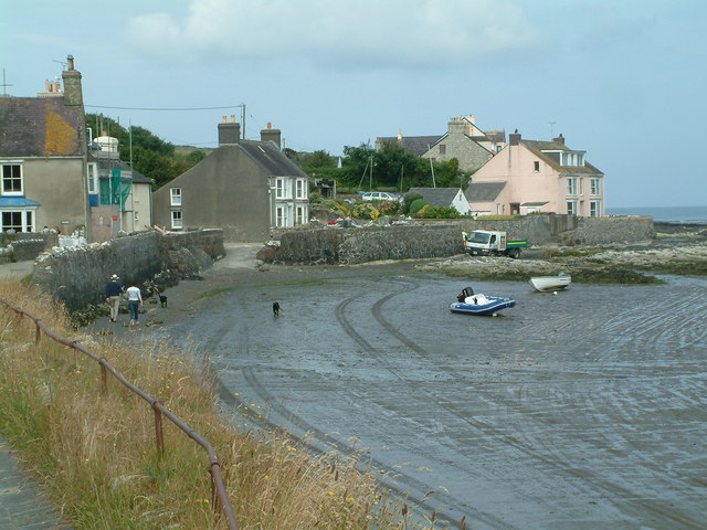
Notwithstanding this unkind remark, the town has more recently developed into a popular stopover for visitors.  Set back a bit from the coast, the town centre straddles the main Cardigan-Fishguard road, and is a pleasant mixture of pubs, cafes and small shops.  The old port, known as Parrog, still has parts of the old quay walls and two former lime kilns.  There are two beaches, Parrog Beach and the extensive Traeth Mawr, where the remains of a petrified forest can be seen when the tide is very low.  The Nevern Estuary is a draw for birdwatchers, with ducks, swans and egrets among its feathered inhabitants.  

There is a form of medieval football called Cnapan which used to be played on Traeth Mawr beach.  The sport - actually in some ways more akin to rugby - was played by opposing teams from neighbouring parishes, and the object was to get the ball to one team's parish church by whatever means possible.  The game was described in detail by the aforementioned George Owen, who claimed that its purpose was to provide some exercise for the naturally warlike youth of the nation during times of peace.  The game was revived in Newport, playing against Nevern, during the mid 80s-90s but was discontinued for 'elf and safety reasons (sigh!).  However, its legacy lives on in the form of the Cnapan 'restaurant with rooms' in the town.

Map of the town.

File:Foreshore at Parrog, Newport Sands - geograph.org.uk - 415803.jpg
Foreshore at Parrog, Newport Sands - geograph.org.uk - 415803. Photo by Robin Lucas, via Wikimedia Commons.