Labels

Aberdeenshire (21) Angus (4) antiquities (87) Argyll and Bute (35) Arran (7) art (37) birds (231) bridge (9) Caithness (12) Carmarthenshire (5) castle (164) Ceredigion (9) Channel Islands (13) Cheshire West and Cheshire (1) City and County of Swansea (1) City of Bristol (2) City of Edinburgh (4) Conwy (8) Cornwall (74) County Antrim (19) County Down (23) County Durham (3) County Londonderry (4) Cumbria (19) Denbighshire (2) Devon (48) diving (9) Dorset (18) Dumfries and Galloway (22) Dundee City (1) East Lothian (6) East Sussex (16) East Yorkshire (6) English Riviera (3) Essex (17) Fife (19) Flintshire (1) food (12) fossils (14) gardens (28) Ghosts (36) Glamorgan (1) Gower (7) Guernsey (4) Gwent (1) Gwynedd (19) Hampshire (13) Highland (72) Inner Hebrides (42) Inverclyde (5) Islay (8) Isle of Anglesey (14) Isle Of Man (7) Isle Of Wight (10) Isles of Scilly (3) Jersey (7) Kent (22) Lancashire (8) Lewis and Harris (7) lighthouse (62) Lincolnshire (8) Merseyside (8) Mid Glamorgan (1) mining (23) Moray (10) Mull (8) Norfolk (21) North Ayrshire (13) North Yorkshire (12) Northern Ireland (45) Northumberland (17) Orkney (10) Outer Hebrides (14) Pembrokeshire (27) pubs (50) Ross and Cromarty (20) Scotland (299) Scottish Borders (3) Shetland (14) shipwrecks (42) Skye (12) smuggling (48) Somerset (9) South Ayrshire (6) South Glamorgan (5) South Gloucestershire (2) Suffolk (18) surfing (92) Sutherland (16) Tyne and Wear (8) Wales (93) wartime (75) webcams (232) West Dunbartonshire (3) West Glamorgan (9) West Sussex (9)

Friday, 1 July 2011

FAVERSHAM AND GRAVENEY MARSHES

Faversham used to be a busy port until the creek on which it is situated silted up, although there is still a quay called Standard Quay with moorings for yachts and barges. The town has many listed buildings, and was a popular stopover for pilgrims on their way to Canterbury. The gunpowder industry brought new prosperity to the town, and the 18th century Chart Gunpowder Mills, which remained in use until the 1930s, tells the story of the industry and its significance for the town. Another local producer which may be of interest to real ale enthusiasts is the Shepherd Neame Master Brewers, whose ales include Spitfire, whose sales have helped armed forces charities such as Help For Heroes. The brewery, which is the oldest in the country, was founded in 1698, although its heritage stretches back even further. Brewery tours are available to visitors. Inevitably, a historic town such as Faversham will have its ancient pub with associated ghost stories. The Shipwrights Arms overlooking the surrounding marshes and creeks near Faversham is haunted by a seafaring gentleman wearing a reefer jacket who has been known to wander into the bar. There is a theory that the ghost is of a Cornish captain called Frederick Symes whose ship was wrecked and who trekked across the marshland only to collapse and die outside the pub. The TV medium Derek Acorah once came to film at the pub and claimed to have made contact with Frederick.

Graveney Marshes is an area of mudflats and grassland to the north-east of Faversham, incorporating the South Swale Nature Reserve. Large numbers of waders and wildfowl visit during winter. Beside the sea wall, the grassland forms part of the Saxon Shore Way walking trail. As well as nature, the marsh is famous for a wartime battle, the Battle of Graveney Marsh in September 1940, which turned out to be the last action by a foreign invasion force to take place on British soil.

Map of the area.


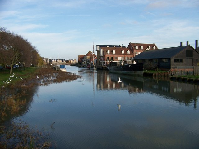
File:Looking towards the coast from the swing bridge - geograph.org.uk - 1066272.jpg
Looking towards the coast from the swing bridge - geograph.org.uk - 1066272. Photo by Elliott Simpson, via Wikimedia Commons.


Thursday, 30 June 2011

WHITSTABLE

The mere mention of the name Whitstable conjures up the heady aroma of freshly caught seafood. Not only is the town famous for its oysters, so much so that there is an annual Oyster Festival in July, but once upon a time there was a short railway line linking Whitstable to the cathedral city of Canterbury which was nicknamed the Crab and Winkle Line in honour of the crustacean gourmet delights to be had at the Line’s seaside terminus. The Crab and Winkle Line, its route laid out by Robert Stephenson, had the distinction of being the oldest regular steam passenger railway in the world. However, the line was closed to passengers in 1930 and thereafter was used only for freight, but was finally closed down altogether in 1952. The route has now become the Crab and Winkle Way, linking Whitstable with Canterbury for cyclists and walkers.  The story of the line is told in the local museum, along with the story of its maritime past and displays of some of the many fossils found along this coast.

Nowadays Whitstable is still easily accessible by train, being just over an hour from London, and this has contributed to its popularity with Londoners hungry for seafood, to the point where it has earned the nickname Islington-On-Sea. The Oyster Festival is obviously a big draw, but added to that is a thriving arts scene and an abundance of charming fisherman’s cottages and of alleyways formerly used by smugglers. Attractive shops, restaurants and cafes all add to the appeal of the town. A reminder of the earlier days of the oyster trade is on display on the Island Wall, the road running parallel to the beach: a restored example of a vessel known as the “oyster yawl”, this particular one named Favourite. During the Oyster Festival, children are invited to come to the beach to revive the tradition of “grotters”, glowing shrines built of oyster shells to mark St James’ Day.


Live streaming webcam view of the beach.

Map of the area.

Whitstable Harbour

Wednesday, 29 June 2011

HERNE BAY

I first became aware of the existence of Herne Bay as a child when I came across a photograph of my Dad relaxing on the beach there with two floral-clad ladies with wartime hairstyles (neither of them my mother!). He was stationed in the area during the Second World War. Herne Bay had a part to play during the war when the stretch of beach towards Reculver was used as a testing ground for the bouncing bomb of the type used in the Dambusters raids. A statue of the inventor of the bomb, Sir Barnes Neville Wallis, has recently been erected near the site of the tests. The Seaside Museum has a prototype of the Bouncing Bomb, as well as finds from the Reculver Roman fort and mammoth tusks from the nearby beaches. Another point of interest is Herne Mill, dating from 1789.

Herne Bay was developed as a resort in the 1830s, with a distinctive clock tower and bandstand as the centrepiece of the seafront. The resort had its heyday in the Victorian era, which is reflected in the style of many of the buildings on the seafront, but went into a decline partly because of the growth of tourism to foreign countries and partly due to problems with flooding. That said, it is becoming more popular again as Londoners head here for the weekend, drawn by the smart seafront with its colourful beach huts and what was the second longest pier in Great Britain. The pier was destroyed in a storm in 1978, leaving only a stub at the landward end, but there is a bid underway to restore it to its former glory.

Map of the area.


File:Herne Bay (35040491065).jpg
Herne Bay (35040491065). Photo by Alex Liivet, via Wikimedia Commons.


Tuesday, 28 June 2011

RECULVER

The stretch of coast between Margate and Herne Bay is dominated by one particular landmark: the ruined St Marys Church at Reculver. The twin 12th century towers of the church have been designated a Scheduled Ancient Monument and make an impressive sight viewed from a distance. As I type this I am looking at an amazing photograph in the area tourist brochure of the towers silhouetted against a flaming red sunset. The land around the church is the site of a Roman fortress, called Regulbium, built in the 3rd century AD to protect the northern end of the Wantsum Channel, the stretch of water responsible for making Thanet an island in the old days. It was in 669 that King Egbert of Kent founded a monastery and church inside the fort. There is a lasting legacy from the Romans in the form of the plants called Alexanders which grow at the base of the towers and sport yellow flowers and celery-flavoured stems. Reculver Country Park, incorporating Bishopstone Cliffs, is visited every winter by thousands of migratory birds. The Park has been designated a Special Protection Area.

A local legend tells of the sound of babies crying on stormy nights, which seems to tie in with the discovery by archaeologists in the 1960s of a number of babies' skeletons.  

Map of the area.

File:Reculver Towers - Front view.jpg
Reculver Towers - Front view. Photo by Kevin Figg, via Wikimedia Commons.


Monday, 27 June 2011

WESTGATE-ON-SEA AND BIRCHINGTON-ON-SEA

Westgate-on-Sea is a pleasant suburb of Margate, with a couple of sandy bays separated by a promontory topped with landscaped gardens. The town had an important role during World War I when it was the site of a Royal Naval Air Service seaplane base which defended the towns of the Thames estuary. The famous British poet John Betjeman was moved to write an entire poem about the town, which begins: "Hark, I hear the bells of Westgate/I will tell you what they sigh/Where those minarets and steeples/Prick the open Thanet sky".  The Heritage Centre tells the story of the locality from 1865 when the first houses were built.

Birchington also had its literary connections, being home to the Victorian artist and poet Dante Gabriel Rossetti during the last months of his life, which he spent in a bungalow here. The bungalow is now gone, but Rossetti was buried in the churchyard of the medieval church of All Saints, and the Rossetti Memorial Garden remains as a reminder of his association with the town. There are four bays around Birchington, including Minnis Bay which was a popular haunt of smugglers and Beresford Gap which has been given over to powerboat and waterskiing enthusiasts.  Just outside Birchington is Quex Park, a 15th century estate and house incorporating the Powell-Cotton natural history museum.

Map of the area.


File:Birchington Coastal Path.jpg
Birchington Coastal Path. Photo by Hywel Williams, via Wikimedia Commons.


Sunday, 26 June 2011

MARGATE

Margate’s history as a seaside resort has followed a by now familiar trajectory. In its early days as a resort, a local glovemaker called Benjamin Beale invented the covered “bathing machine”, a wooden cart with wheels which could be used as a changing room, then rolled down to the sea, thus preserving the modesty particularly of the female bathers. Margate had its heyday in the 1950s, when people used to flock down from London, but by the 1990s it had started to go into a seemingly terminal decline, with soaring crime and unemployment and a run-down appearance. In 2009 the town featured in an episode of The Apprentice in which the contestants were given the task of rebranding Margate as a cool destination. Now there is a glimmer of hope for a revival in the form of the Turner Contemporary art gallery which opened earlier this year. Turner lived in Margate, and during his time there developed a close relationship with his landlady, Mrs Booth, even going so far as to call himself Mr Booth following the death of her husband. Another famous artist who grew up in Margate is the contemporary artist Tracy Emin. Those who like visiting smaller galleries should head for the Old Town, which has branded itself the “creative quarter” for the number of galleries, along with specialist shops and a range of pubs, cafes and restaurants. There is a similar range of attractions down at the Harbour Arm.

I have only visited Margate once, on a daytrip with my parents in the 1960s. One of the most memorable attractions I remember from that time was the vast Dreamland amusement park. The site was closed in 2003, but has now been restored as a major attraction: the world’s first amusement park with historical rides, including the oldest roller coaster in the UK. Another unique attraction which remains open to the public is the Shell Grotto, which was discovered in 1835. The grotto is a man-made subterranean passageway with ornate shell ‘mosaics’, but its origins are shrouded in mystery. Needless to say, there are countless theories, such as that it was used as a sun temple because of the way the sun’s entry into the Dome of the grotto coincides with the fertile season.

For events in Margate see here.

Map of the area.


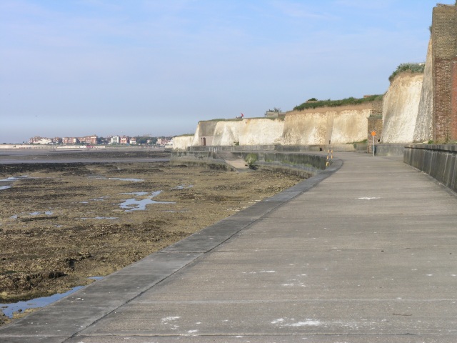
https://upload.wikimedia.org/wikipedia/commons/f/f8/Margate_beach%2C_deserted_in_October_sunshine_-_geograph.org.uk_-_1032944.jpg
Margate beach, deserted in October sunshine - geograph.org.uk - 1032944. Photo by Nick Smith, via Wikimedia Commons.

BROADSTAIRS

Those who have read the works of Charles Dickens, one of the most famous British writers of all time, will no doubt be familiar with Bleak House. This forbidding sounding name is the title of Dickens’ ninth novel, but it is also an actual house, located in Broadstairs. The house, originally called The Fort, was the seaside residence used by Dickens, and it was where he completed one of his most famous works, David Copperfield. Each year in June, the town hosts a Dickens Festival. For other events see here. Broadstairs is still a popular seaside resort, and extends from the northern reaches of Ramsgate to North Foreland, which is the easternmost part of the Isle of Thanet. The Isle of Thanet is no longer actually an island, although it was once separated from the mainland by the River Wantsum.

The Isle of Thanet is at the opposite extreme of Britain’s south coast from Land’s End, but is rather different in character, being much more built up. So there we are, it has taken me six months to blog my way along the entire south coast of England. We have cantered along the rugged cliffs of Cornwall, roamed around the rias of South Cornwall and the South Hams of Devon, fossicked for fossils on the Jurassic coast of East Devon and Dorset, sampled the island life in the Channel Islands and the Isle of Wight, marvelled at the naval history of Hampshire, had a jolly time in the resorts of Sussex and been dazzled by the white cliffs of Kent. But don’t go away, there is much more to come. Time to head up the East coast.

Map of the area.


File:Viking Bay, Broadstairs - geograph.org.uk - 39663.jpg
Viking Bay, Broadstairs - geograph.org.uk - 39663. Photo by John Smitten, via Wikimedia Commons.