Labels

Aberdeenshire (21) Angus (4) antiquities (87) Argyll and Bute (35) Arran (7) art (37) birds (231) bridge (9) Caithness (12) Carmarthenshire (5) castle (164) Ceredigion (9) Channel Islands (13) Cheshire West and Cheshire (1) City and County of Swansea (1) City of Bristol (2) City of Edinburgh (4) Conwy (8) Cornwall (74) County Antrim (19) County Down (23) County Durham (3) County Londonderry (4) Cumbria (19) Denbighshire (2) Devon (48) diving (9) Dorset (18) Dumfries and Galloway (22) Dundee City (1) East Lothian (6) East Sussex (16) East Yorkshire (6) English Riviera (3) Essex (17) Fife (19) Flintshire (1) food (12) fossils (14) gardens (28) Ghosts (36) Glamorgan (1) Gower (7) Guernsey (4) Gwent (1) Gwynedd (19) Hampshire (13) Highland (72) Inner Hebrides (42) Inverclyde (5) Islay (8) Isle of Anglesey (14) Isle Of Man (7) Isle Of Wight (10) Isles of Scilly (3) Jersey (7) Kent (22) Lancashire (8) Lewis and Harris (7) lighthouse (62) Lincolnshire (8) Merseyside (8) Mid Glamorgan (1) mining (23) Moray (10) Mull (8) Norfolk (21) North Ayrshire (13) North Yorkshire (12) Northern Ireland (45) Northumberland (17) Orkney (10) Outer Hebrides (14) Pembrokeshire (27) pubs (50) Ross and Cromarty (20) Scotland (299) Scottish Borders (3) Shetland (14) shipwrecks (42) Skye (12) smuggling (48) Somerset (9) South Ayrshire (6) South Glamorgan (5) South Gloucestershire (2) Suffolk (18) surfing (92) Sutherland (16) Tyne and Wear (8) Wales (93) wartime (75) webcams (232) West Dunbartonshire (3) West Glamorgan (9) West Sussex (9)

Wednesday, 31 July 2013

RUTHWELL


Dr. Henry Duncan, who spent much of his life as a minister in the village of Ruthwell, would be turning in his grave if he could witness the goings-on in today's world of personal finance.  He would be horrified at the rapacious treatment of the poorest in society by the purveyors of so-called "pay-day loans", and he would despair of the derisory interest rates offered to hard-working savers.  Dr. Duncan believed passionately in the dignity of the poor, of whom there were plenty at that time - the early 1800s - and he campaigned for the financial independence of the ordinary man, setting up "an economical bank for the savings of the industrious", effectively the first proper trustee savings bank.  The bank offered the chance to open an account with as little as sixpence and an interest rate on deposits of 5% - a distant dream for today's savers.  There is a Savings Banks Museum in Ruthwell which tells Dr. Duncan's story. 

Dr. Duncan also had a hand in the other main attraction in the village, namely the Ruthwell Cross.  The cross dates from the 7th century and is carved with Biblical scenes and verses from The Dream of the Rood, the oldest-known English poem, whose authorship is unknown but is likely to be an Anglo-Saxon poet.  The cross was smashed by Presbyterian iconoclasts in the 1600s, but Dr. Duncan restored it and it now has pride of place in the cute little whitewashed Ruthwell Church.  To the west of the village is a well called Brow Well, with water containing supposedly health-giving salts of iron.  The well was visited in 1796 by Robert Burns, in a quest to cure his ailments by drinking the water.  Near Ruthwell is the village of Powfoot, which has a golf course and a beach which is suitable for paddling but not swimming.  There is a coastal path and plenty of birdlife to watch out for.

Map of the area. 

File:Ruthwell Parish Church - geograph.org.uk - 1065124.jpg
Ruthwell Parish Church - geograph.org.uk - 1065124. Photo by Walter Baxter, via Wikimedia Commons

Monday, 29 July 2013

CAERLAVEROCK


There are two reasons for those following the north shore of the Solway Firth to stop off at Caerlaverock.  The first is the Wildfowl and Wetlands Trust site, where among the species on view is a pair of ospreys who migrate to here from Africa each spring.  There are also barn owls, and in autumn or winter you will be treated to the sight of large numbers of barnacle geese who have made their way here from Spitsbergen, and pink-footed geese from Iceland.  There is also a large colony of rare natterjack toads.  The site offers accommodation with the chance to see badgers as well as the wealth of birdlife.  Recent sightings at Caerlaverock WWT include Marsh Harriers, Lapwings and Little Grebes. 

The other attraction in the area is Caerlaverock Castle, a moated medieval fortification with an unusual triangular shape and a twin towered gatehouse.  With its proximity to England, it goes without saying that the castle has had an eventful past.  The Romans got here first, building a fort on Ward Law Hill, which overlooks the present-day castle.  Around 1220 a later fort was built by Alexander II's chamberlain, Sir John de Maccuswell (Maxwell), but 50 years later his nephew built the "new" castle nearby, and this became the stronghold of the Maxwells for the next 400 years.  The castle endured siege after siege during its history.  In one such event in 1300 the men stationed at the castle lasted just two days of battering from Edward I's army before giving in to the onslaught.  The castle's last siege in 1640 took place during the ongoing battle between Charles I and the Covenanters.  This time the garrison managed to last 13 weeks before surrendering.   Following this event the castle was looted and partially demolished.  The castle, which is run by Historic Scotland, includes a siege warfare exhibition, a children's adventure park and a nature trail.

Live streaming webcam view of Caerlaverock WWT.

Map of the area. 

File:Caerlaverock Castle - geograph.org.uk - 1211185.jpg
Caerlaverock Castle - geograph.org.uk - 1211185. Photo by Iain Russell, via Wikimedia Commons

Saturday, 27 July 2013

NEW ABBEY


The name New Abbey is something of a misnomer, since the abbey in question, now a ruin, dates from 1273.  There are many examples in the world of a building being erected by a grieving spouse in memory of their other half, but in the majority of cases it is the husband who erects the memorial - the Taj Mahal is probably the most famous example.  However, in the case of this abbey it was the wife of a dead husband who founded the abbey in his memory.  The husband was John de Balliol, a leading Scottish figure who died in 1268, and it was his wife Lady Devorguilla who started the abbey.  The story goes that after John's death Lady Devorguilla carried his embalmed heart around everywhere with her, and that she was buried with it in the abbey, hence the rather endearing name: Sweetheart Abbey. The abbey is run by Historic Scotland.

The village of New Abbey is on the New Abbey Pow burn, which runs into the Nith estuary, and the whole scene is dominated by the Criffel, a nearby prominent hill.  Energetic walkers who climb to the top of the hill are rewarded with views of the Nith estuary and even as far as the Isle Of Man.  Another popular walk with estuary views starts from the abbey and leads up to the Waterloo Monument on Waterloo Hill just outside the village.  One of the more prominent buildings in the village is Shambellie House, surrounded by beautiful grounds.  The house used to contain the National Museum of Costume, but sadly this has become a victim of the recession, with a reduction in funding coupled with low visitor numbers necessitating its closure.  It was a former owner of Shambellie House who built the Corn Mill, a water-powered mill which is still in full working order.  The mill is in a picturesque setting with a duck pond nearby.  Nearby Mabie Forest has a number of picnic areas and walking trails, one of which takes in the Mabie Nature Reserve.

Map of the area. 

File:Sweetheart Abbey - geograph.org.uk - 1716748.jpg
Sweetheart Abbey - geograph.org.uk - 1716748. Photo by Andrew Curtis, via Wikimedia Commons

Friday, 26 July 2013

SOUTHERNESS AND ARBIGLAND


The most prominent feature at Southerness is its lighthouse, one of the oldest in Scotland, having been built in 1749.  This spot is home to a large holiday village; sadly, earlier this month it was reported that the leisure centre at the village was destroyed by fire.  There is also a golf club.  Heading round the coast from Southerness we come to the Arbigland Estate.  The gardens here are open to visitors, and feature glades with a range of semi-tropical shrubs and trees leading down to a sandy beach.  A former head gardener here was the father of John Paul Jones, a founder of the US Navy (see Kirkcudbright).  The cottage where the mariner was born is now a museum, and the parish church in nearby Kirkbean has a memorial font illustrating the USS Bonhomme Richard, which was named after John Paul Jones' frigate, which was placed at his disposal by King Louis XVI of France.  Incidentally, Kirkbean was the birthplace of another prominent naval officer, John Campbell, who became governor of Newfoundland.  Other interesting features of the Arbigland Estate include McCulloch's Castle, which is an Iron Age fort.  The small fishing port of Carsethorn was once used by visiting Vikings.  Later, in the late 18th/early 19th centuries, Carsethorn was a point of departure for the numerous Scots who left for a new life in Australia and America.  The area adjacent to the shore known as the "merse" (low level ground by a river or shore) is home to millions of seabirds.

Map of the area. 

File:Flock of Oystercatchers at Carsethorn - geograph.org.uk - 689425.jpg
Flock of Oystercatchers at Carsethorn - geograph.org.uk - 689425. Photo by Debbie Turner, via Wikimedia Commons

Tuesday, 23 July 2013

KIPPFORD AND ROCKCLIFFE


The former shipbuilding centre of Kippford, previously known as Scaur, lies on the east bank of the River Urr where near where it joins the Solway Firth.  The village gained in importance as a port due to its being the highest point on the Urr reachable by large ships.  Nestling under a high crag with houses strung out along the river's edge it makes for a picturesque spot, so that with the shipbuilding now gone it has become popular as a resort, particularly since it is the base of the Solway Yacht Club.  Other leisure pursuits include golfing on the nearby Craigieknowes golfcourse, birdwatching and walking.  At low tide a shingle spit leads to Rough Island, run by the National Trust of Scotland, where there is a bird sanctuary which hosts nesting terns and oystercatchers in May and June.  In the summer months tours to the island are available from Kippford and Rockcliffe.  Between Kippford and Rockcliffe on Scaur Hill is the Motte of Mark, a 6th century Celtic fort which was so badly burnt by raiders that the stones were vitrified.

The mile-long Jubilee Path leads from Kippford to Rockcliffe, and makes for a wonderful walk thanks to the views of the Galloway Hills, St Bees Head and the peaks of the Lake District - a reminder of the proximity of the border with England.  Rockcliffe developed as a resort during Victorian times, and is ideal for families with its sandy shore and rock pools.  Sea angling from the rocks around the bay is a popular activity here, while a short walk along the footpath at the edge of Rough Firth leads to Castlehill Point from where there are panoramic views across the Solway Firth to Cumbria.  At nearby Portling smugglers' caves are visible at low tide.   

Map of the area. 

File:Moorings at Kippford from the Jetty. - geograph.org.uk - 155729.jpg
Moorings at Kippford from the Jetty - geograph.org.uk - 155729. Photo by Colin Smith, via Wikimedia Commons

Sunday, 21 July 2013

AUCHENCAIRN BAY


The north shore of the Solway Firth is full of bays and peninsulas.  Auchencairn Bay is named after the steep village of Auchencairn with its whitewashed cottages and its pebble beaches.  The village was once the haunt of smugglers, who used caves in the nearby Hestan Island to hide their contraband.  In the 18th century the economy of the village was dominated by iron mining.  Further back around the coast to the west is Dundrennan Abbey, built in the latter half of the 12th century and now a ruin run by Historic Scotland.  Hestan Island was owned by the monks from the abbey, who maintained a fishpond there, traces of which can still be seen.  At the north end of the island is the ruined manor house built by Edward Balliol, a 14th century claimant to the throne.  At the south-west end of the bay is Balcary Point, where birdwatchers can observe oystercatchers, curlews, and in summer sandpipers.  Balcary House was built by smugglers and used as their headquarters and storage place, while Balcary Tower lies in the shelter of the point.  The tower was built in around 1860 by the Laird of Auchencairn House for his French governess and mistress.  The tower was up for sale two years ago for a cool £850,000.  The Torr Peninsula separates Auchencairn Bay from the neighbouring Orchardton Bay, and Auchencairn Bay and Orchardton Bay are separated from Rough Firth by Almorness Point.  Near Orchardton Bay is Orchardton Tower, maintained by Historic Scotland.  This 15th century tower house is the only surviving example of such a  house in the cylindrical style common in Ireland.

Map of the area. 

File:Hestan Island and Auchencairn Bay - geograph.org.uk - 1567051.jpg
Hestan Island and Auchencairn Bay - geograph.org.uk - 1567051. Photo by Anthony O'Neil, via Wikimedia Commons.

Tuesday, 16 July 2013

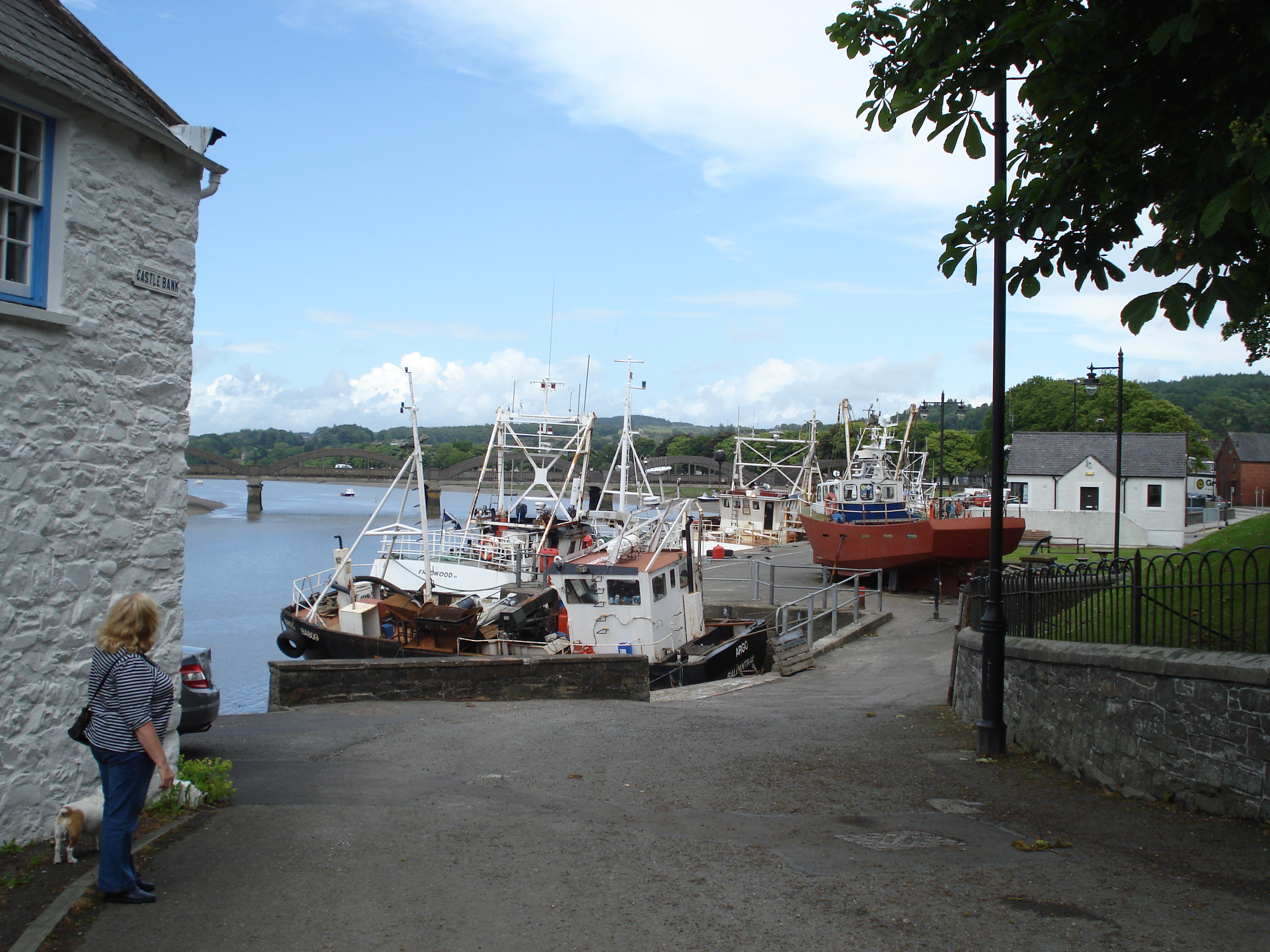
KIRKCUDBRIGHT


The first thing any visitor to Kirkcudbright will have to learn about the town is how to pronounce its name!  The name does not rhyme with "night" but with "brie", and the proper pronunciation is "kercoobree".  The town was granted Royal Burgh status by James II in 1485, and there is a reminder of this each July with the Riding Of The Marches reenactment performed by the Kirkudbright Cornets Club.  Kirkcudbright has a thriving arts scene; many artists have settled here, and the town has styled itself the "Artists' Town".  One such was Edward Atkinson Hornel, born in Australia but whose family moved to Kirkcudbright.  He became associated with an art movement called the Glasgow Boys (there is also a Glasgow Girls) and his paintings include Blossom Time - Brighouse Bay, depicting a bay in the Kirkcudbright area.  The house where Hornel lived is owned by the National Trust for Scotland and is open to visitors who can view paintings by him and other artists.  The house also has a Japanese style garden.  Each summer the town hosts an Arts and Crafts Trail, with studios and galleries throwing open their doors.  

Other attractions in the town include the 16th century McLellan's Castle, a working harbour and a marina from where boat trips on the tidal River Dee depart.  There is a golf course overlooking the town and estuary.  The Tollbooth was built in the 1620s and among other uses it was once a prison.  One of the most famous inmates of the prison was John Paul Jones, the Master Mariner who founded the US Navy, and who was born in nearby Arbigland.  Jones was incarcerated for the death of a sailor from flogging but was later released on bail. There is plenty going on in Kirkcudbright - as well as the Riding Of The Marches and the Arts and Crafts Trail, the town holds a medieval fayre, a jazz festival and the Kircudbright Tattoo.  For a list of events see here.

Map of the area. 

File:Kircudbright - panoramio (1).jpg
Kirkcudbright - panoramio (1). Photo by ian freeman, via Wikimedia Commons.