Labels

Aberdeenshire (21) Angus (4) antiquities (87) Argyll and Bute (35) Arran (7) art (37) birds (231) bridge (9) Caithness (12) Carmarthenshire (5) castle (165) Ceredigion (9) Channel Islands (13) Cheshire West and Cheshire (1) City and County of Swansea (1) City of Bristol (2) City of Edinburgh (4) Conwy (8) Cornwall (74) County Antrim (19) County Down (23) County Durham (3) County Londonderry (4) Cumbria (19) Denbighshire (2) Devon (48) diving (9) Dorset (18) Dumfries and Galloway (22) Dundee City (2) East Lothian (6) East Sussex (16) East Yorkshire (6) English Riviera (3) Essex (17) Fife (19) Flintshire (1) food (13) fossils (14) gardens (28) Ghosts (35) Glamorgan (1) Gower (7) Guernsey (4) Gwent (1) Gwynedd (19) Hampshire (13) Highland (72) Inner Hebrides (42) Inverclyde (5) Islay (8) Isle of Anglesey (14) Isle Of Man (7) Isle Of Wight (10) Isles of Scilly (3) Jersey (7) Kent (22) Lancashire (8) Lewis and Harris (7) lighthouse (62) Lincolnshire (8) Merseyside (8) Mid Glamorgan (1) mining (23) Moray (10) Mull (8) Norfolk (21) North Ayrshire (13) North Yorkshire (12) Northern Ireland (45) Northumberland (17) Orkney (10) Outer Hebrides (14) Pembrokeshire (27) pubs (47) Ross and Cromarty (20) Scotland (300) Scottish Borders (3) Shetland (14) shipwrecks (42) Skye (12) smuggling (48) Somerset (9) South Ayrshire (6) South Glamorgan (5) South Gloucestershire (1) Suffolk (18) surfing (84) Sutherland (16) Tyne and Wear (8) Wales (93) wartime (75) webcams (232) West Dunbartonshire (3) West Glamorgan (9) West Sussex (9)

Sunday, 29 September 2013

SEASCALE


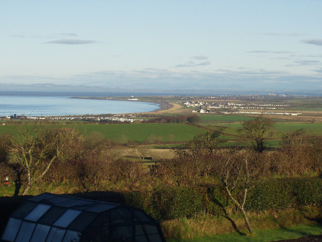
The scattering of farms and rural homesteads that existed at this spot prior to the 19th century turned into a full-blown village with the arrival of the railway in the early 19th century.  Seascale had aspirations to become a major resort, in fact it aimed to be the "Eastbourne of the north", but this ambition did not quite go according to plan, although the railway access ensured its popularity as a destination for day trippers.  It was after the Second World War that the area was transformed forever, with the decision to build a nuclear power station, originally called the Windscale Reactor and Calder Hall, and now known as the Sellafield nuclear reprocessing site.  The attendant influx of technicians and scientists who were brought into the area earned Seascale the nickname of "the brainiest village in Britain".  Today Sellafield is the largest employer in West Cumbria, so whether you consider Sellafield to be a blot on the landscape or a necessary evil there is no denying its effect on the local economy.  The British Pathe website has footage from 17th October 1956 with the description "The world's first commercial nuclear power station is opened at Sellafield". 

Map of the area. 

File:Seascale Jetty - geograph.org.uk - 286187.jpg
Seascale Jetty - geograph.org.uk - 286187. Photo by Peter Eckersley, via Wikimedia Commons

Thursday, 26 September 2013

ST BEES


On 18th September 2011 I blogged about Robin Hood's Bay in North Yorkshire, the eastern end of the 182-mile Coast To Coast walking route dreamt up by Alfred Wainwright.  Now, just over two years later, here we are at the western end of the route, St Bees.  Walkers generally start at St Bees and end in Robin Hood's Bay, although there is nothing to stop you doing it the other way around if you feel so inclined.  It is customary to pick up a pebble at St Bees and keep it safe during the walk, then throw it in the sea at Robin Hood's Bay, and Wainwright also dictated that walkers should dip their boots in the Irish Sea before setting off.  There is a stone pillar behind the beach that marks the start of the walk with a map and a photograph of Wainwright, and the boat ramp is the place where the boot dipping takes place.  This scene is overlooked by South Head, which is the first of many uphill stretches along the walk. 

The name St Bees derives from the Irish princess, St Bega, who founded a nunnery here in the 7th century AD.  The nunnery was destroyed by incoming Vikings, but in 1120 it was resurrected as a Benedictine priory by the Lord of Egremont William Meschin.  The Priory was dissolved in 1539, but the priory church still stands today and is used as the parish church of St Bees.  Across the way from the priory church is the venerable old St Bees School, which was founded in 1583.  The railway arrived at St Bees in the mid-19th century, and it facilitated the exploitation of the local sandstone, which was transported to Barrow-in-Furness for use as a building material.  The railway also brought the first tourists, who continue to flock to the village today, no doubt attracted as much by its proximity to the wonders of the Lake District as by the charms of the village itself.  Meanwhile, back to that beach, a long sweep of a beach which at low tide exposes an expanse of red sand and rock pools, while at high tide only the shingle part, with a huge variety of rock types, is accessible.  The beach was last year declared one of the two cleanest beaches in Cumbria, and this year received a Quality Coast Award.

Map of the area.  

File:St Bees seacote beach promenade.jpg
St Bees seacote beach promenade. Photo by Doug Sim, via Wikimedia Commons

Monday, 23 September 2013

WHITEHAVEN


Sadly, many people will associate the name Whitehaven with the tragic events that took place on 2 June 2010 when a local taxi driver went on the rampage with a gun leaving 12 people plus the perpetrator dead and an entire community traumatised.  However, this awful event should in no way put people off visiting the town, which retains the elegant appearance bestowed on it when it was laid out in the 17th century as Britain's first post-medieval planned town, largely thanks to the Lowther family of the local Lowther Baronetcy.  In fact, the town's Georgian architecture is one of the reasons it has been voted as one of the top ten seaside resorts in the UK.  

Whitehaven has had an interesting and eventful past, most notably in 1778 during the American War of Independence when John Paul Jones led a naval attack against the town, which is considered by some to have been the last invasion of England.  The economic mainstays used to be mining and shipping,  but these industries have since declined.  The docks and harbour were built in the 18th and 19th centuries and today are mostly used by fishing boats and leisure craft.  The harbour features include a disused lighthouse built in 1730.  There is a museum by the harbourside called The Beacon which tells the story of the town's maritime history.  Pride of place in the museum goes to a goblet made in 1763.  Another interesting little museum is The Rum Story, which promises to transport visitors to an exotic Caribbean island, and manages to combine displays on an African village, a slave ship and Cumbrian cottages all in one place.  . For those interested in the town's industrial heritage there is the Haig Pit Mining and Colliery Museum which is located on the cliffs above Whitehaven, with magnificent views to the Isle Of Man and the south of Scotland.

Events in the town include a number of sailing events each year courtesy of the Marina.   Whitehaven is at the western end of the C2C cycle route as well as being on the Cumbrian Coastal Way.  A short distance south of the town is St Bees head, which is looked after by the RSPBRSPB.  The bird colonies that can be viewed from the clifftop paths include the only nesting black guillemots in England.

Map of the area. 

File:I see no ships ... - geograph.org.uk - 126669.jpg
I see no ships … - geograph.org.uk - 126669. Photo by Phil Williams, via Wikimedia Commons


Friday, 20 September 2013

WORKINGTON


Almost every place in the country seems to have at least one claim to fame: the biggest, the smallest, the earliest, youngest, the oldest.  In the case of Workington, the town was until recently home to Britain's oldest barmaid.  Minnie Johnston, who sadly died last month aged 97, spent 80 years of her life pulling pints at the George IV pub where she lived.  Ironically, she was a teetotaller; maybe it was all those years being exposed to beer fumes that did it.  Minnie went out in style in a horse-drawn funeral carriage with hundreds of people attending the funeral.  So let's raise a glass to Minnie, who I am sure is much missed.

Workington has a proud industrial past, but as is so often the case the present is somewhat different.  Coal from the collieries that once surrounded the town used to be shipped from the harbour, but this has now ceased.  The other major industry which has since gone is steel manufacture.  One of the most successful exports arising from the latter was the steel rails which were made in the town and which were sent all over the world.  Present-day economic activity includes chemicals, recycling computers and the continued use of the docks which were built during the steelmaking days.  Workington stands at the mouth of the River Derwent, and although much of it is industrial in appearance Portland Square with its 18th-century houses surrounding a cobbled area with trees is one of the more picturesque spots.  Workington has two theatres: the Carnegie Theatre, and the Theatre Royal.  There used to be an Opera House, but this is now disused.  

On the outskirts of town is Curwen Park with the ruined Workington Hall.  This was the last refuge of Mary Queen of Scots, who spent some time here during May 1568 after fleeing from Scotland, just before the imprisonment which led up to her execution.  Opposite the Hall is a Georgian building housing the Helena Thompson Museum, which tells the story of Workington's past.  Nature lovers should head a mile to the north, where the nature reserve  Siddick PondsSiddick Ponds provides a wetland habitat for wildfowl and other species and a chance for twitchers to watch the wildlife from a lakeside hide.  There is another nature reserve south of the town at Harrington, with woodland walks and rare meadows.

Map of the area. 

File:Workington Harbour - geograph.org.uk - 93670.jpg
Workington Harbour - geograph.org.uk - 93670. Photo by Pat Pierpoint, via Wikimedia Commons

Monday, 16 September 2013

MARYPORT


In AD 122 the Emperor Hadrian ordered the building of the wall which came to be known as Hadrian's Wall, the western terminus of which was at Bowness-On-Solway (see 3 September).  As a complement to the wall, a series of forts were established on the coast of what is now Cumbria.  One of these was located in the vicinity of the present-day Maryport and was commanded by Marcus Maenius Agrippa, a personal friend of the Emperor.  The fort remained in use until 410AD, when it was abandoned as the soldiers were recalled to Rome.  After the Romans had gone it was the turn of the Vikings to settle in the area.  The Maryport of today was founded by the prominent local Senhouse family, the town being named after the wife of one of the Senhouses.  In the 18th century industries such as furnaces, forges and shipbuilding were established, then in the 19th century the railway arrived and the docks were built, largely for the purpose of exporting coal to Ireland.  Charles Dickens visited the town in 1857 with his travelling companion and fellow writer Wilkie Collins, and they stayed at the Golden Lion Hotel.  Another distinguished guest at the hotel was engineer George Stephenson, who stayed there during the planning of the Maryport and Carlisle Railway.  Maryport can claim a link to the Titanic, which it capitalised on with an exhibition last year: the founder of the White Star Line, Thomas Ismay, was born in the town.  There are a couple of museums showcasing the town's distant and more recent pasts: the Senhouse Roman Museum and the Maritime Museum.  Meanwhile, bringing things bang up to date, the new Wave Centre offers arts and entertainment plus conference facilities.  On the Harbourside is the Lake District Coast Aquarium, where the delights on offer include fish feeding and human feeding in the form of a harbourside café.

Map of the area. 

File:View across the harbour, Maryport - geograph.org.uk - 1269593.jpg
View across the harbour, Maryport - geograph.org.uk - 1269593. Photo by John Lord, via Wikimedia Commons

Saturday, 14 September 2013

ALLONBY


In the 10th century the Vikings were expelled from Ireland and they set sail in search of a new homeland.  Rumour has it that it was at Allonby that they landed, and here they set up a relatively peaceful community.  Later in its history, Allonby became an important centre for herring fishing, and other economic activities included salt making, weaving and shipbreaking.  There was also a thriving smuggling business during the 17th and 18th centuries, with spirits, tobacco and textiles being sneaked in from Scotland, Ireland and the Isle of Man.  During the 19th century the village of Allonby became a popular resort.  The Old Baths, built in 1835 by a group of rich Quakers, offered a variety of hot and cold sea water baths, while on a separate floor there was a ballroom.  The grand, colonnaded building still stands proud in the centre of the village, although its days as a bath house are long gone.  Another prominent building in the village is North Lodge with its adjoining former Quaker almshouses.  The Quakers were big in Allonby during the 18th and 19th centuries and aside from the baths and the almshouses, other reminders of their presence in the village include a 17th century cottage turned into a Quaker Meeting House in 1703 and a Reading Room built in 1862 on the site of the weaving sheds.  At the height of Allonby's popularity as a resort  there were 10 inns in the villlage, which were frequented by Cumberland's elite.  Charles Dickens visited in 1857 with fellow writer Wilkie Collins during a walking tour. Today, the main draw is the extensive sandy beach of Allonby Bay, with views across the Solway Firth to the Galloway Hills of Scotland, and inland to the mountains of the Lake District.  Flocks of oystercatchers can sometimes be seen wheeling around in the sky above the sea.  On a clear day the Isle Of Man can be discerned on the horizon.  The village website has a collection of photographs, including some fascinating old black and white images.

Map of the area. 

File:Allonby and Allonby Bay from the south - geograph.org.uk - 98449.jpg
Allonby and Allonby Bay from the south - geograph.org.uk - 98449. Photo by Ally McGurk, via Wikimedia Commons


Thursday, 12 September 2013

SILLOTH


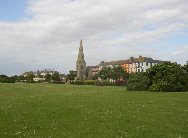
Silloth started out as an agricultural settlement, with activities such as salt production and crop cultivation overseen by the monks of nearby Holme Cultram Abbey.  The name derives from the term 'sea lathes', the lathes being a type of barn used to store grain.  Then in the 19th century the railway arrived in town and this, together with the building of a number of grand hotels, transformed the town into a Victorian seaside resort.  In those days the building now occupied by the amusement arcade was the Bathing Establishment, offering a variety of hot and cold baths.  Those who preferred to bathe in the sea had bathing machines at their disposal, wooden huts pulled down to the sea by horses, in which the bathers could protect their modesty while changing into their bathing gear before taking the plunge.  The branch line that brought about the popularity of the resort is now disused, but the resort remains popular, with its wide, tree-lined streets, the flower-filled expanse called The Green facing across the Solway Firth where numerous events are held, and the sand and shingle beach.  Aside from the railway, steamers bound for Liverpool and Dublin used to leave from the 19th century harbour, but these have also since disappeared, leaving the harbour to the pleasure craft that make use of it.  Silloth's 18-hole golf course is one of the best in the North, and has hosted two ladies' open championships.  The Solway Coast Discovery Centre in Silloth showcases the wildlife, heritage and landscapes of the stretch of coast.

Map of the area. 

File:Silloth Green - geograph.org.uk - 87864.jpg
Silloth Green - geograph.org.uk - 87864. Photo by Humphrey Bolton, via Wikimedia Commons


Monday, 9 September 2013

SKINBURNESS


Looking at the sleepy village of Skinburness on the Solway coast today, it is hard to believe that during King Edward I's campaign against the Scots it was a key naval port.  During the 13th century the King had granted a charter to establish a market town there, which was to provide the army with supplies for its Scottish expeditions.  At the end of the century Edward gathered together a fleet of around 50 ships from all over the country as well as from Ireland.  The fleet lay in wait at Skinburness until an opportunity arose for a confrontation with the Scots, led by William Wallace, with the purpose of seizing the land around the Solway for England.  However, the town's prominence was soon to come to an abrupt end when much of it was destroyed by a storm.  The monks of Holm Cultran Abbey, who owned the land, moved the population away and built Newton Arlosh as a replacement for Skinburness.  The monks are also thought to have been responsible for the building of a sea dyke which still protects the village from high tides today.  After all this upheaval Skinburness reverted to a quiet fishing village. 

There used to be a ferry service from Skinburness to Scotland operating from a building known as The Longhouse.  The service was advertised in the Cumberland Pacquet in 1787 as a "large and commodious ferry boat", with the promise that it would "ply constantly and on reasonable terms".  The ferry carried people, cattle and goods across the Solway.  The Longhouse is believed to have been the model for Joe Crakenthorpe's tavern in Redgauntlet by Sir Walter Scott, from where Bonnie Prince Charlie bade farewell to his supporters before going into exile.  The Longhouse was a pub called The Greyhound in the late 1700s, and Scott is reputed to have stayed there while writing Redgauntlet.  It later became a hotel and has now been converted into private residences.  Skinburness Marsh is of interest to birdwatchers, being a magnet for large numbers of geese in the winter.  There are also wading birds, and peregrines can sometimes be seen hunting them.  To the northeast of Skinburness is Grune Point, which offers wide views of the estuary.

Map of the area. 

File:Sea Dyke at Skinburnness - geograph.org.uk - 126335.jpg
Sea Dyke at Skinburness - geograph.org.uk - 126335. Photo by Phil Williams, via Wikimedia Commons.

Tuesday, 3 September 2013

DRUMBURGH AND BOWNESS-ON-SOLWAY


In the year 122 the Roman Emperor Hadrian, as part of his bid to secure his empire with fortifications, ordered the building of a wall across northern Britain with forts dotted at intervals along its length.  Much of the wall, which came to be known as Hadrian's Wall, remains today, and it is the most visible reminder of Roman Britain.  In 2003 a National Trail was unveiled which follows the route of the wall, starting from Wallsend in the east and ending at Bowness-On-Solway in the west.  Those who have toiled along the trail, braving the windswept northern uplands that the route passes through, will no doubt feel a growing sense of achievement on reaching the shores of the Solway Firth at Drumburgh, from where it is only around four miles to journey's end.  Drumburgh was the location of Concavata, the penultimate fort on the wall.  Hardly anything remains of the fort today, although the sharp turn taken by the Carlisle to Bowness road in the centre of the village follows the outline of one corner of the fort.

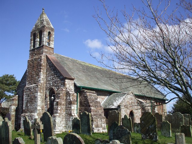
Bowness-On-Solway, which marks the end of the National Trail, was the site of a fort called Maia.  This fort was particularly significant for its role in guarding the entrance to the Solway Firth.  The site was originally occupied by a milecastle made of turf and timber; Hadrian's Wall had a series of numbered milecastles along its length, and the one here was number 80.  The fort which replaced it was first built of timber, then it was rebuilt in stone, and it was the second largest fort on the whole wall. Some of the local buildings have Roman stones in their structures, for example the Norman church of St Michael, which is believed to lie on the site formerly occupied by the fort's granary.  More details about the fort can be found on this website about Roman Britain.  Aside from the wall, the other big draw in Bowness is its extensive sandy beach and its birdlife, which can be found in the dunes, salt marshes, shingle beds and peat mosses of the area, which is part of the Solway Coast Area of Outstanding Natural Beauty.  Species include oystercatchers, plover, dunlin, godwit and redshank among others.

Map of the area. 

File:St Michael's Church, Bowness-on-Solway.jpeg
St Michael's Church, Bowness-on-Solway. Photo by John Lord, via Wikimedia Commons