Hemmed in by the mighty Penmaenmawr headland at one end and the smaller Penmaenbach at the other end, the quiet seaside town of Penmaenmawr became a resort in the 19th century when well-to-do tourists started visiting, perhaps encouraged by the praise lavished on the resort by the 19th century British Prime Minister William Ewart Gladstone, who visited no less than 11 times and who affectionately referred to the town as "dear old Penmaenmawr". There is a memorial to the politician which was made in 1991 to replace an earlier one which was stolen in the 1970s. The Penmaenmawr headland, in reality a mountain reaching directly down to the sea, is 1,300 feet high, while Penmaenbach marks the northern end of the Snowdonia range. The summit of Penmaenmawr has been quarried away, a reminder of the time when quarrying was big business here. There was a hill-fort on the top called Braich-y-Dinas, one of the largest hill-forts in Europe, but barely any trace of it remains now. Prehistoric remains have been found on the mountain, including signs of the manufacture of stone axes which are believed to have been exported as far afield as Cornwall and South East England. Also on Penmaenmawr is the Druid's Circle, or Meini Hirion, consisting of some 30 standing stones, regarded as one of the best such sites in Wales.
When the railway arrived in the area tunnels had to be built through the mountains. The main A5 road which follows roughly the same route used to follow a precarious route around the mountains but as the number of cars increased further tunnels were constructed to accommodate the road traffic. Just off the coast of Penmaenmawr is a rocky formation called Llys Helig which is believed to have been used by fishermen as far back as the 6th century. Legend has it that there is a sunken kingdom under this spot. The gently sloping beach is separated from the village by the railway line and has a promenade running along it with views taking in Anglesey, Puffin Island and the Great Orme, as well as breathtaking sunsets. Activities on offer besides lounging around on the beach include bowling, golf and a Sailing Club. For keen cyclists, there is a cycle path from Conwy to Llanfairfechan which passes through here, and walkers can enjoy wonderful mountain and coastal walks. The Penmaenmawr Historical Society and Museum has a collection of local objects and archive photographs.
Map of the area.
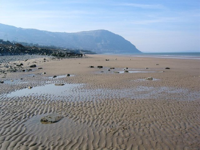 | |
| Penmaenmawr Sands - geograph.org.uk - 68820. Photo by David Crocker, via Wikimedia Commons. |
Thank you, glad you enjoyed it.
ReplyDelete