Labels

Aberdeenshire (21) Angus (4) antiquities (87) Argyll and Bute (35) Arran (7) art (37) birds (231) bridge (9) Caithness (12) Carmarthenshire (5) castle (165) Ceredigion (9) Channel Islands (13) Cheshire West and Cheshire (1) City and County of Swansea (1) City of Bristol (2) City of Edinburgh (4) Conwy (8) Cornwall (74) County Antrim (19) County Down (23) County Durham (3) County Londonderry (4) Cumbria (19) Denbighshire (2) Devon (48) diving (9) Dorset (18) Dumfries and Galloway (22) Dundee City (2) East Lothian (6) East Sussex (16) East Yorkshire (6) English Riviera (3) Essex (17) Fife (19) Flintshire (1) food (13) fossils (14) gardens (28) Ghosts (35) Glamorgan (1) Gower (7) Guernsey (4) Gwent (1) Gwynedd (19) Hampshire (13) Highland (72) Inner Hebrides (42) Inverclyde (5) Islay (8) Isle of Anglesey (14) Isle Of Man (7) Isle Of Wight (10) Isles of Scilly (3) Jersey (7) Kent (22) Lancashire (8) Lewis and Harris (7) lighthouse (62) Lincolnshire (8) Merseyside (8) Mid Glamorgan (1) mining (23) Moray (10) Mull (8) Norfolk (21) North Ayrshire (13) North Yorkshire (12) Northern Ireland (45) Northumberland (17) Orkney (10) Outer Hebrides (14) Pembrokeshire (27) pubs (47) Ross and Cromarty (20) Scotland (300) Scottish Borders (3) Shetland (14) shipwrecks (42) Skye (12) smuggling (48) Somerset (9) South Ayrshire (6) South Glamorgan (5) South Gloucestershire (1) Suffolk (18) surfing (84) Sutherland (16) Tyne and Wear (8) Wales (93) wartime (75) webcams (232) West Dunbartonshire (3) West Glamorgan (9) West Sussex (9)

Wednesday, 26 January 2011

PORTHOUSTOCK/HELFORD

Many of the divers heading across to explore the wrecks off the Manacles set off from the tiny beach at Porthoustock, a coastal hamlet near St Keverne. A lifeboat station was established here in 1869 in response to the alarming number of wrecks caused by these treacherous rocks (see Coverack post) but it was closed in 1942, and has since become the village hall. The main economic activity in this place is quarrying, and during the war the stone quarried here was used to build the airfields in Cornwall. Not even this tiny, tranquil spot escaped the German bombing raids of the Second World War. During the night of November 8th 1940 18 bombs fell in the Porthoustock and St Keverne district, but mercifully they were spared both damage and casualties.

Following the coast around from Porthoustock, you will notice a change in the nature of the coastline, because this stretch of the South Cornwall coast is characterised by the ‘rias’, or drowned river valleys, each with a subset of smaller creeks and inlets. If I were to make a list of my top five most idyllic spots in Cornwall, Helford would be in that list. Nestling on the south bank of the Helford River, this beautiful, peaceful village was, believe it or not, once a major port, receiving goods by ship from the continent. It even had its own customs house. Needless to say there was no shortage of pirates and smugglers wanting to get in on the act. One of the nearby creeks is Frenchman’s Creek, immortalised by Daphne du Maurier in her book of the same name.

Map of the area.
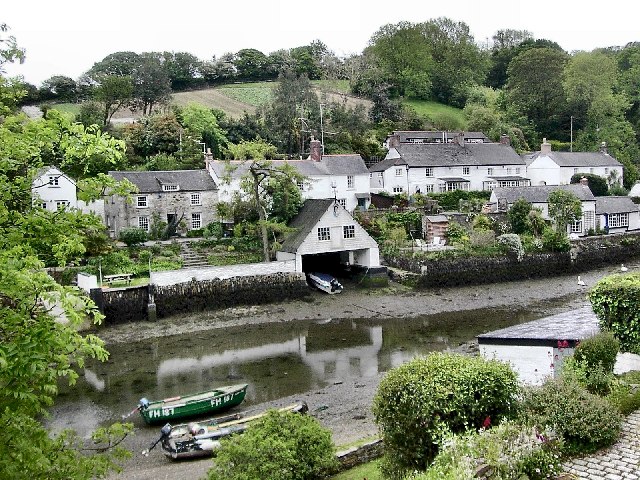

File:Helford Village - geograph.org.uk - 9853.jpg
Helford Village - geograph.org.uk - 9853. Photo by Richard Johns, via Wikimedia Commons.


No comments:

Post a Comment